Tropical Storm Fred Has Made Landfall Near Cape San Blas
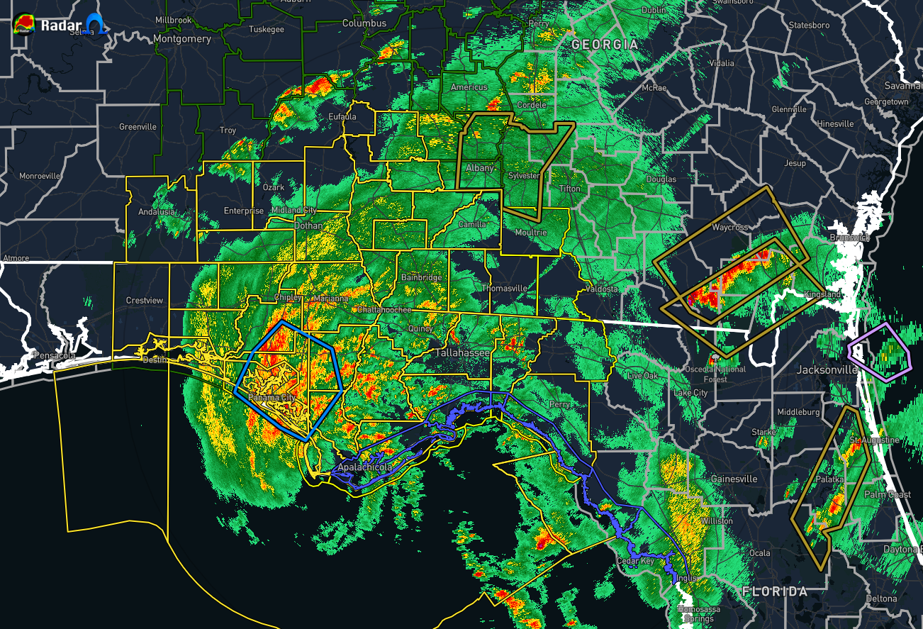
As of 2:15 pm CDT, the center of Fred has made landfall very close to Cape San Blas, Florida, as a very strong tropical storm with maximum sustained winds at 65 mph. The minimum central pressure was at 994 mb. The trend will be for Fred to slowly begin a weakening process as it moves northward and eventually northeastward throughout the next 24 hours. Fred is expected to become a depression by early Tuesday morning as the center ends its brief trek through the southeastern parts of Central Alabama and moves into western Georgia.
Here are more raw wind reports from NWS Tallahassee:
3 SSW Eastpoint [Gmz755 Co, FL] mesonet reports NON-TSTM WND GST of M65 MPH at 03:10 PM EDT — mesonet station 0569w 2.9 s eastpoint (weatherstem) reported a wind gust of 65 mph.
4 SE Panacea-Wakulla Ai [Franklin Co, FL] mesonet reports NON-TSTM WND GST of E64 MPH at 03:28 PM EDT — bald point reported a wind gust of 64 mph.
1 NNW Apalachicola Airp [Franklin Co, FL] asos reports NON-TSTM WND GST of M60 MPH at 03:13 PM EDT — asos station kaaf apalachicola reported a wind gust of 60 mph.
1 E Saint Andrews State [Gmz750 Co, FL] mesonet reports NON-TSTM WND GST of M57 MPH at 02:55 PM EDT — mesonet station xsta st. andrew bay reported a wind gust of 57 mph.
3 SSW Eastpoint [Gmz755 Co, FL] mesonet reports NON-TSTM WND GST of M63 MPH at 02:50 PM EDT — mesonet station 0569w 2.9 s eastpoint (weatherstem) reported a wind gust of 63 mph.
4 N High Bluff [Franklin Co, FL] mesonet reports NON-TSTM WND GST of E64 MPH at 02:57 PM EDT — franklin county eoc reported a wind gust of 64 mph.
1 NNW Apalachicola Airp [Franklin Co, FL] asos reports NON-TSTM WND GST of M53 MPH at 02:39 PM EDT — asos station kaaf apalachicola reported a wind gust of 53 mph.
Category: ALL POSTS, Severe Weather, Tropical
About the Author (Author Profile)
Scott Martin is an operational meteorologist, professional graphic artist, musician, husband, and father. Not only is Scott a member of the National Weather Association, but he is also the Central Alabama Chapter of the NWA president. Scott is also the co-founder of Racecast Weather, which provides forecasts for many racing series across the USA. He also supplies forecasts for the BassMaster Elite Series events including the BassMaster Classic.Subscribe
If you enjoyed this article, subscribe to receive more just like it.


