Rain At Times Mainly Over East Alabama Tonight/Tomorrow
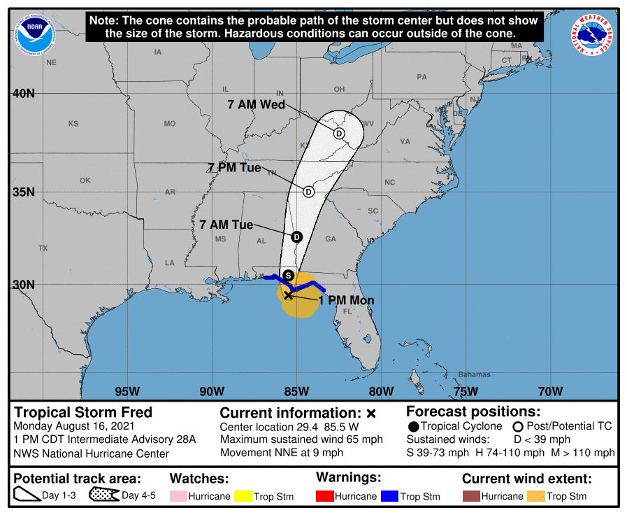
FRED MAKES LANDFALL: Tropical Storm Fred made landfall around 2:15 this afternoon at Cape San Blas with sustained winds of 65 mph. The system will weaken quickly as it moves northeast tonight. However, it will still bring significant weather issues to parts of the Southeast U.S. The remnant circulation will move into northern Georgia tomorrow.
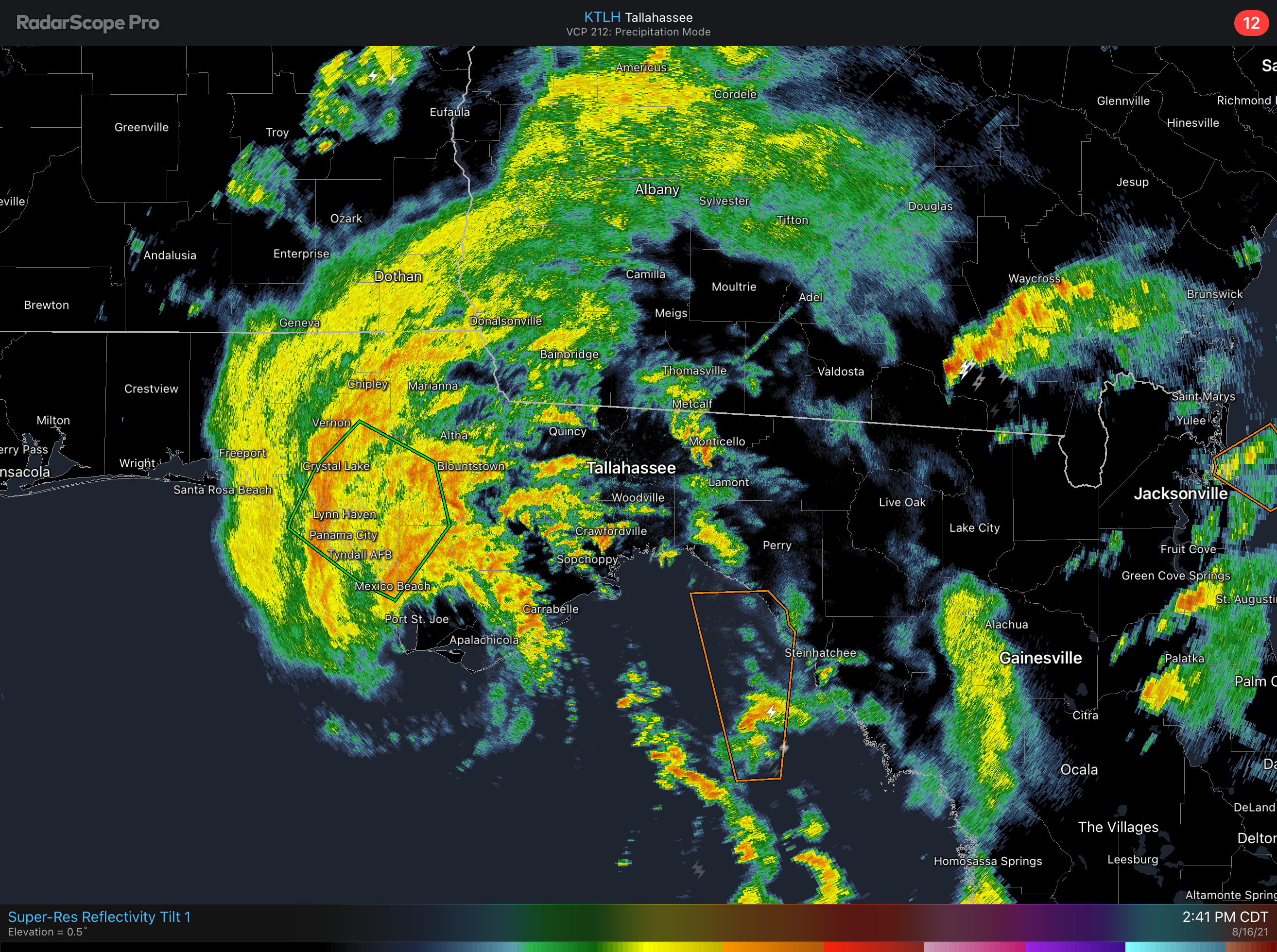
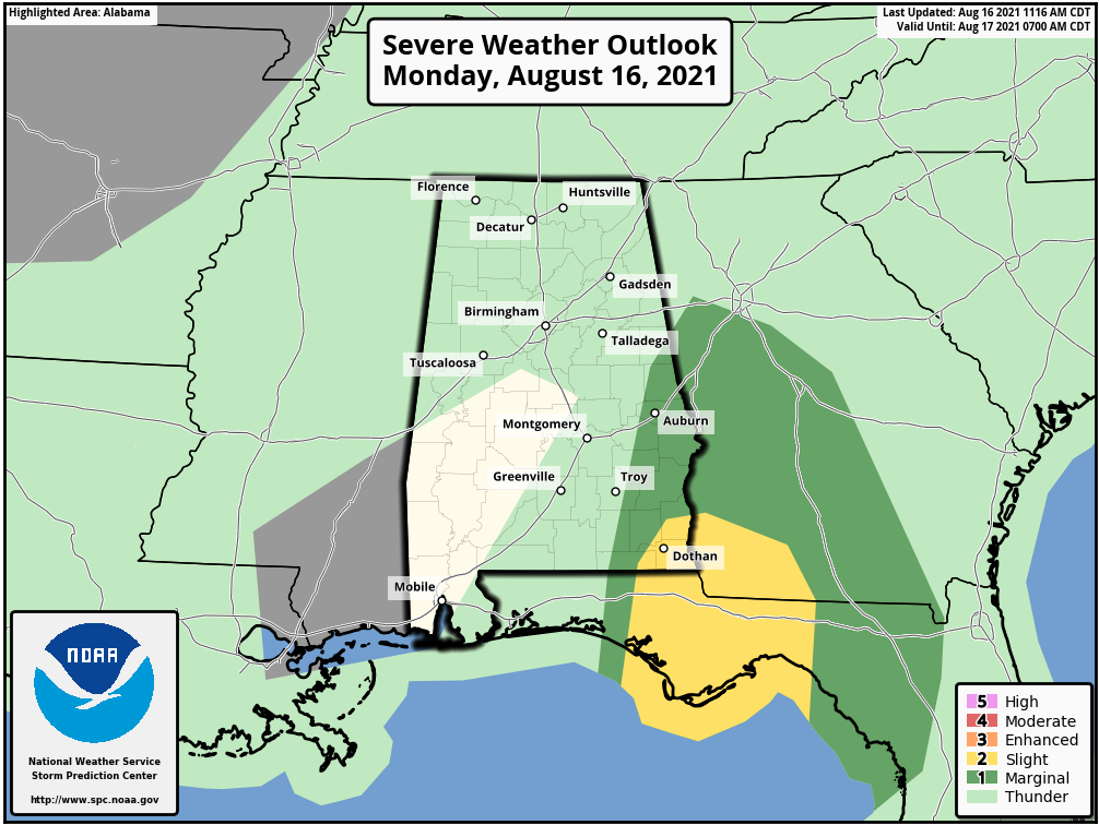
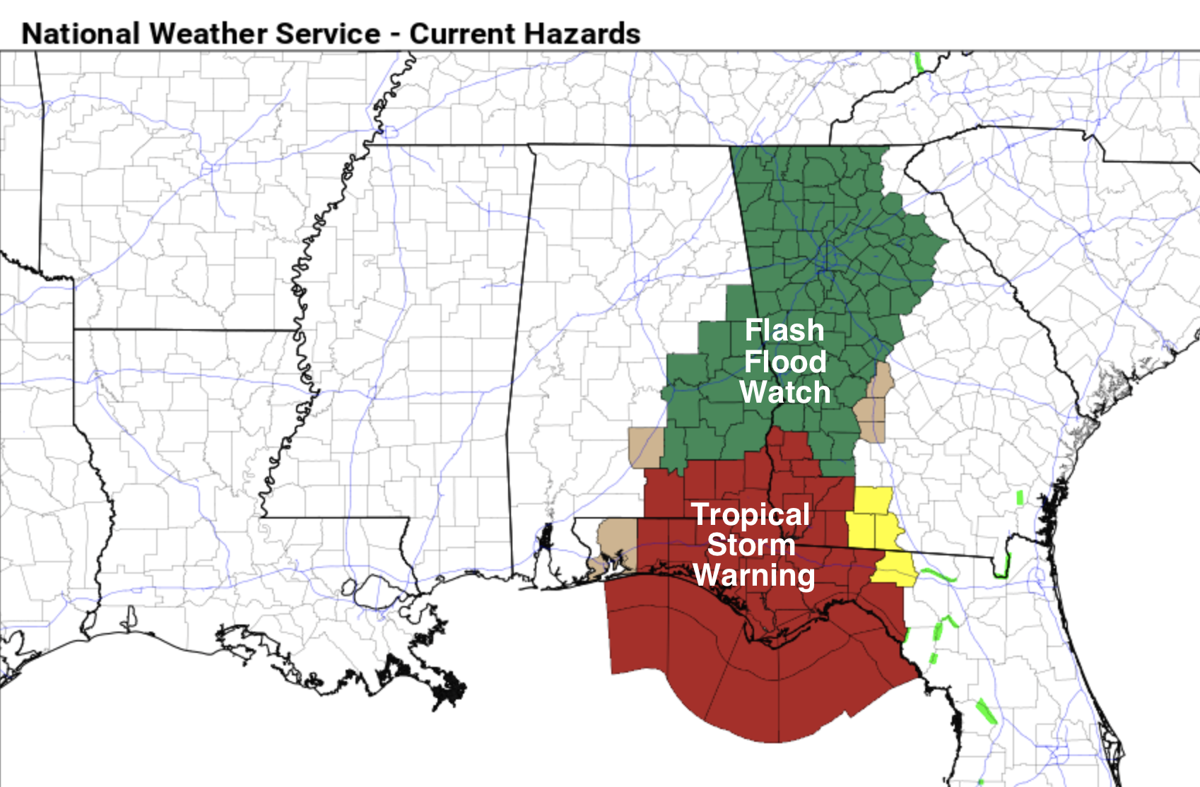
In Alabama, a flash flood watch is in effect for the far eastern part of the state from Randolph and Chambers counties south to near Dothan and Geneva through tonight. Rain amounts here in the 2-4 inch range are possible, with isolated heavier amounts near the southeast corner of the state. There is also the risk of a few brief, isolated tornadoes tonight across the southeast part of the state; Houston County is under a tornado watch until 7p CT. A low end “marginal risk” extends as far north as Chambers and southern Randolph counties.
Showers will be much more scattered in nature over the western 2/3 of Alabama tonight and tomorrow. The sky will be mostly cloudy tomorrow with highs in the low to mid 80s.
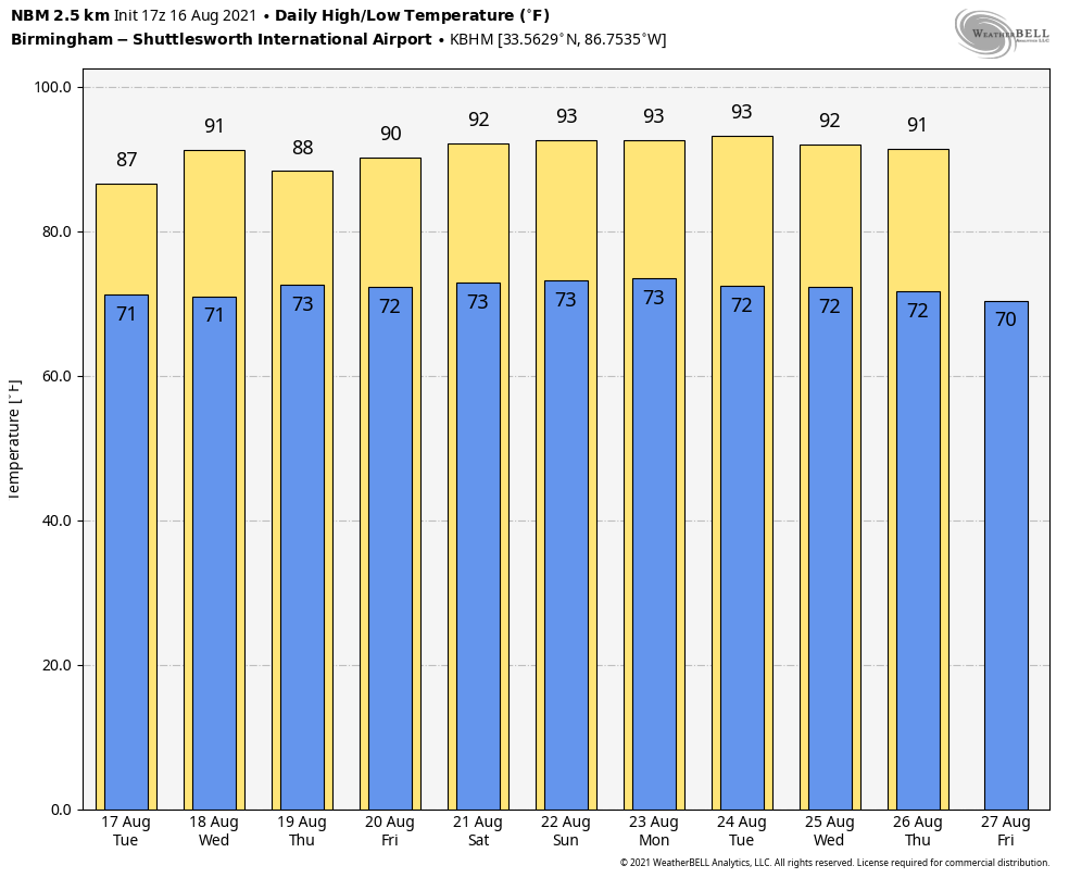
WEDNESDAY THROUGH THE WEEKEND: Look for routine summer weather Wednesday through Sunday. A mix of sun and clouds each day with scattered showers and thunderstorms, especially from noon to midnight. Odds of any one spot getting wet Wednesday through Friday are in the 50-60 percent range, dropping to 30-40 percent over the weekend. Highs will be mostly in the upper 80s through Friday, then rising into the low 90s Saturday and Sunday.
The overall pattern won’t change much through next week; partly sunny days with a few scattered showers and thunderstorms around during the afternoon and evening hours. Highs will be generally in the low 90s; See the Weather Xtreme video for maps, graphics, and more details.
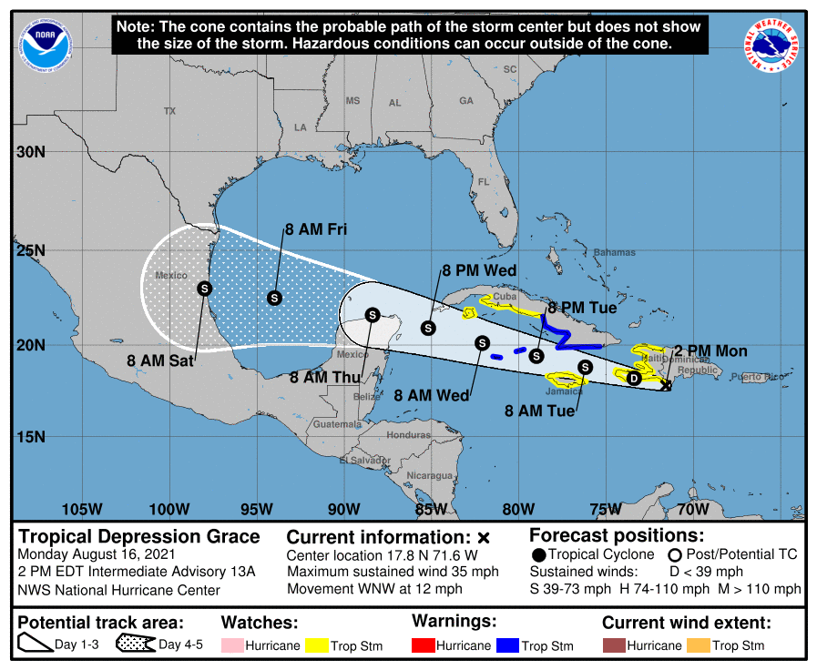
GRACE: Tropical Depression Grace is moving away from Hispaniola this afternoon, and is forecast to regain tropical storm strength over the next few days as it passes south of Cuba. Grace will likely move into Mexico, well south of Brownsville, Texas, Saturday, perhaps as a hurricane. It will remain south of the U.S.
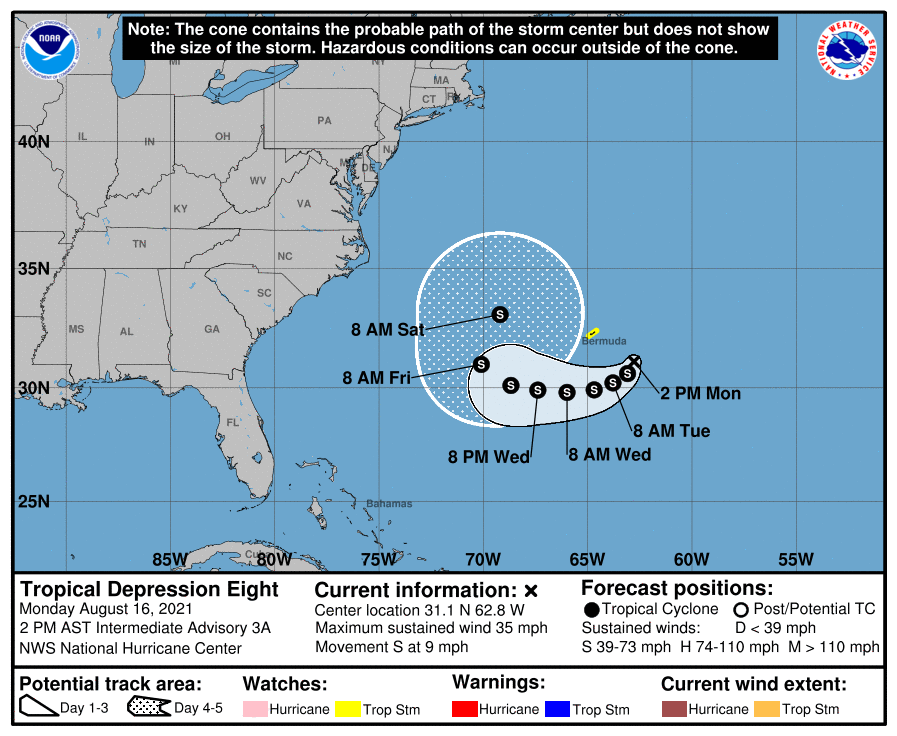
TD 8: Tropical Depression 8, southeast of Bermuda in the Atlantic, is forecast to become Tropical Storm Henri tonight. It will loop around Bermuda, and ultimately move out into the open North Atlantic… no threat to the U.S.
ON THIS DATE IN 1992: One of the most destructive United States hurricanes of record started modestly as a tropical wave that emerged from the west coast of Africa on August 14. The wave spawned a tropical depression on August 16, which became Tropical Storm Andrew the next day.
BEACH FORECAST: Click here to see the AlabamaWx Beach Forecast Center page.
WEATHER BRAINS: Don’t forget you can listen to our weekly 90 minute show anytime on your favorite podcast app. This is the show all about weather featuring many familiar voices, including our meteorologists here at ABC 33/40.
CONNECT: You can find me on all of the major social networks…
Look for the next Weather Xtreme video here by 6:00 a.m. tomorrow…
Category: Alabama's Weather, ALL POSTS, Weather Xtreme Videos
About the Author (Author Profile)
James Spann is one of the most recognized and trusted television meteorologists in the industry. He holds the AMS CCM designation and television seals from the AMS and NWA. He is a past winner of the Broadcast Meteorologist of the Year from both professional organizations.Subscribe
If you enjoyed this article, subscribe to receive more just like it.


