4:30 PM Local Statement on Fred for the Eastern Florida Panhandle, the Big Bend, Southeast Alabama, & Southwest Georgia
NEW INFORMATION AS OF 4:30 PM CDT
CURRENT WATCHES AND WARNINGS:
• A Storm Surge Warning is in effect for Coastal Dixie County
• A Tropical Storm Warning is in effect for Baker, Calhoun, Calhoun, Central Walton, Clay, Coastal Bay, Coastal Gulf, Coffee, Dale, Decatur, Early, Gadsden, Geneva, Grady, Henry, Holmes, Houston, Inland Bay, Inland Franklin, Inland Gulf, Inland Jefferson, Inland Taylor, Inland Wakulla, Jackson, Leon, Liberty, Miller, Mitchell, North Walton, Quitman, Randolph, Seminole, South Walton, and Washington counties.
• A Storm Surge Warning and a Tropical Storm Warning are in effect for Coastal Franklin, Coastal Jefferson, Coastal Taylor, and Coastal Wakulla counties.
STORM INFORMATION:
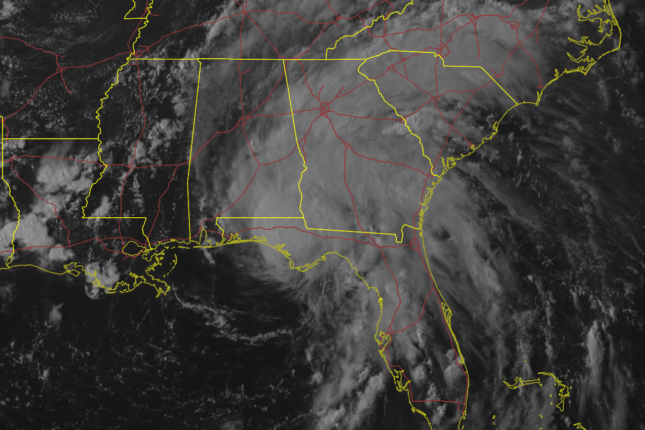
• About 30 miles east-southeast of Panama City, Florida, or about 20 miles west-northwest of Apalachicola, Florida.
• 29.9N, 85.3W
• Storm intensity at 60 mph.
• Movement north-northeast or 20 degrees at 9 mph.
SITUATION OVERVIEW
Tropical storm Fred made landfall near Cape San Blas this afternoon and continues a slow north movement into the Apalachicola national forest. Weakening of Fred will continue as it moves further inland. Wind gusts into the mid 60 miles per hour range were noted along the western Florida big bend coastline from Apalachicola northward into Franklin County. As well, strong winds continue on the west side of the center of circulation, with near 60 miles an hour wind gusts in Bay County, Florida. These strong winds will shift slowly north and east with time this evening.
Heavy rainfall and flooding continue to be a major hazard with tropical storm Fred. Widespread rainfall amounts of 4 to 8 inches with isolated amounts near 12 inches will be possible across the Florida panhandle, with a widespread 3 to 5 inches, isolated 9 inches possible for southeast Alabama, portions of southwest Georgia, and the western Florida big bend. These amounts would likely result in flash flooding and river flooding across the area. A flash flood watch remains in effect from Tallahassee to Albany and areas westward.
The storm surge threat remains unchanged across the area today and tonight. A storm surge warning remains in effect for all of Apalachee bay. Three to five feet of inundation will be possible from Franklin to Taylor County, with 2-4 feet of inundation possible along the Dixie County coast. Minor coastal flooding of 1 to 3 feet will be possible along the panhandle coast, where a coastal flood advisory is in effect.
Tropical storm force winds will be possible across the region, and this may result in downed trees and power lines that could cause a few power outages. In addition, a few tornadoes will be possible.
Additional hazards will include dangerous marine conditions, deadly rip currents, high surf, and beach erosion.
POTENTIAL IMPACTS
FLOODING RAIN: Protect against life-threatening rainfall flooding having possible extensive impacts across the Florida panhandle, western big bend, and SE Alabama. Potential impacts include:
• Major rainfall flooding may prompt many evacuations and rescues.
• Rivers and tributaries may rapidly overflow their banks in multiple places. Small streams, creeks, and ditches may become dangerous rivers. Flood control systems and barriers may become stressed.
• Flood waters can enter many structures within multiple communities, some structures becoming uninhabitable or washed away. Many places where flood waters may cover escape routes. Streets and parking lots become rivers of moving water, with underpasses submerged. Driving conditions become dangerous. Many road and bridge closures, with some weakened or washed out.
Protect against dangerous rainfall flooding, having possible limited to significant impacts across the eastern Florida big bend and SW Georgia.
WIND: Potential impacts from the main wind event are now unfolding across coastal areas of the eastern Florida panhandle and western big bend. Remain well sheltered from dangerous wind having additional significant impacts. If realized, these impacts include:
• Some damage to roofing and siding materials, along with damage to porches, awnings, carports, and sheds. A few buildings experiencing window, door, and garage door failures. Mobile homes damaged, especially if unanchored. Unsecured lightweight objects become dangerous projectiles.
• Several large trees snapped or uprooted, but with greater numbers in places where trees are shallow rooted. Several fences and roadway signs blown over.
• Some roads impassable from large debris, and more within urban or heavily wooded places. A few bridges, causeways, and access routes impassable.
• Scattered power and communications outages, but more prevalent in areas with above ground lines.
SURGE: Protect against life-threatening surge having possible significant impacts across Apalachee bay. Potential impacts in this area include:
• Areas of inundation with storm surge flooding accentuated by waves. Damage to several buildings, mainly near the coast.
• Sections of near-shore escape routes and secondary roads become weakened or washed out, especially in usually vulnerable low spots.
• Major beach erosion with heavy surf breaching dunes. Strong and numerous rip currents.
• Moderate damage to marinas, docks, boardwalks, and piers. Several small craft broken away from moorings, especially in unprotected anchorages.
Also, protect against locally hazardous surge having possible limited
impacts across the Florida panhandle.
TORNADOES: Protect against a tornado event having possible limited impacts across eastern Florida panhandle, Florida big bend, southeastern Alabama and southwestern Georgia. Potential impacts include:
• The occurrence of isolated tornadoes can hinder the execution of emergency plans during tropical events.
• A few places may experience tornado damage, along with power and communications disruptions.
• Locations could realize roofs peeled off buildings, chimneys toppled, mobile homes pushed off foundations or overturned, large tree tops and branches snapped off, shallow-rooted trees knocked over, moving vehicles blown off roads, and small boats pulled from moorings.
Category: Alabama's Weather, ALL POSTS, Severe Weather, Tropical
About the Author (Author Profile)
Scott Martin is an operational meteorologist, professional graphic artist, musician, husband, and father. Not only is Scott a member of the National Weather Association, but he is also the Central Alabama Chapter of the NWA president. Scott is also the co-founder of Racecast Weather, which provides forecasts for many racing series across the USA. He also supplies forecasts for the BassMaster Elite Series events including the BassMaster Classic.Subscribe
If you enjoyed this article, subscribe to receive more just like it.


