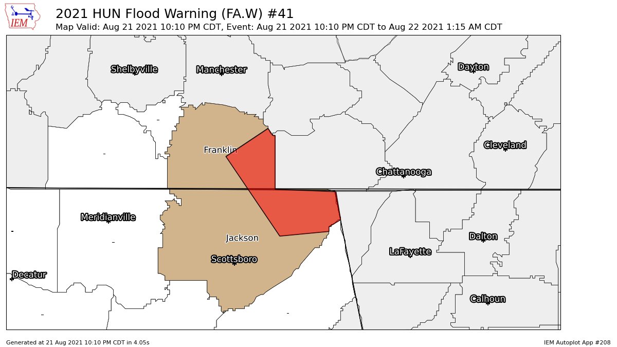
Flood Warning for Parts of Jackson Co. Until 1:15 am
The National Weather Service in Huntsville has issued a
* Flood Warning for…
Northeastern Jackson County in northeastern Alabama…
Southeastern Franklin TN County in middle Tennessee…
* Until 115 AM CDT.
* At 1010 PM CDT, Doppler radar indicated heavy rain due to
thunderstorms. Flooding is ongoing or expected to begin shortly in
the warned area. Between 1 and 3 inches of rain have fallen.
* Some locations that will experience flooding include…
Bridgeport, Stevenson, Cowan, Sewanee, Anderson, Russell Cave
National Monument, Bass, Sherwood, Long Island, Fabius, St.
Andrews and Higdon.
Additional rainfall amounts up to 1 inch are possible in the warned
area.
PRECAUTIONARY/PREPAREDNESS ACTIONS…
Turn around, don’t drown when encountering flooded roads. Most flood
deaths occur in vehicles.
Be especially cautious at night when it is harder to recognize the
dangers of flooding.
Category: Alabama's Weather, ALL POSTS
About the Author (Author Profile)
Scott Martin is an operational meteorologist, professional graphic artist, musician, husband, and father. Not only is Scott a member of the National Weather Association, but he is also the Central Alabama Chapter of the NWA president. Scott is also the co-founder of Racecast Weather, which provides forecasts for many racing series across the USA. He also supplies forecasts for the BassMaster Elite Series events including the BassMaster Classic.Subscribe
If you enjoyed this article, subscribe to receive more just like it.


