Midday Nowcast: Continued Hot and Soon To Be Ida
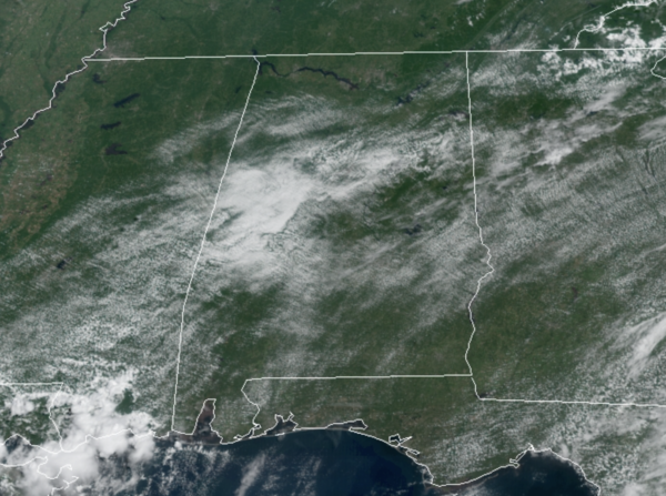
TODAY THROUGH SUNDAY: The upper ridge weakens some in the coming days, but temperatures will remain hot with highs in the 88-93 range for much of North/Central Alabama. Each day we will continue to see some afternoon and evening showers and thunderstorms. Again, many locations will stay dry, while many others will see rain. It comes down to watching radar trends during the afternoon and evening hours. Also, as we see each day, any storm activity will pack a punch with lots of lightning, gusty winds, and torrential rainfall; isolated areas of wind damage and flash flooding are possible. For the weekend, not much change as the days will be hot and humid, with a mix of sun and clouds and feature those randomly, scattered storms.
NEXT WEEK: There remains a lot of uncertainty with next week’s forecast as we wait and see what happens in the tropics. For now, early in the week, due to the likely tropical system making landfall west of Alabama, our rain chances will be much higher, especially Monday and Tuesday as Alabama will be on the east side, “wet side” of the system. We should also mention Alabama will be in favorable position for some tornado potential Monday and Tuesday, but once again it is simply to early to know the magnitude of the threat. Rain becomes more scattered over the latter half of the week as the tropical system lifts out; highs during the week will be in the 80s.
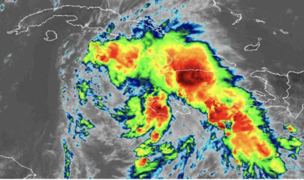
SOON TO BE IDA: The center of Tropical Depression Nine was located near latitude 16.9 North, longitude 79.2 West. The depression is moving toward the northwest near 13 mph, and this general motion should continue over the next few days. On the forecast track, the center of the depression will pass near or over the Cayman Islands tonight, the Isle of Youth and Western Cuba Friday, and move over the southeastern and central Gulf of Mexico Friday night and Saturday. The system is forecast to approach the U.S. northern Gulf Coast on Sunday.
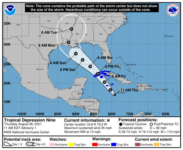
Maximum sustained winds are near 35 mph with higher gusts. Steady strengthening is forecast during the next few days. The depression is expected to become a tropical storm tonight, and become a hurricane when it is near western Cuba or over the southeastern Gulf of Mexico. Once the system moves into the Gulf of Mexico, conditions are expected to be conducive for additional strengthening, and rapid intensification is explicitly shown in the NHC forecast between 48 and 72 hours. The NHC intensity forecast brings the system near major hurricane strength when it approaches the northern Gulf coast on Sunday. The estimated minimum central pressure is 1005 mb (29.68 inches).
ELSEWHERE IN THE TROPICS: Two other areas of concern that could become Julian and Kate.
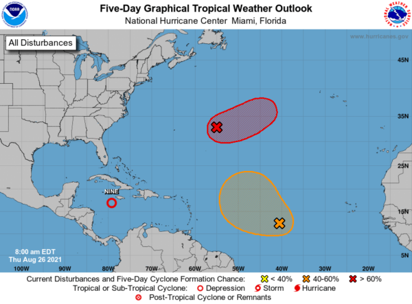
1. A trough of low pressure located over the central Atlantic about 600 miles east of Bermuda continues to produce disorganized showers and thunderstorms. Environmental conditions are forecast to be generally conducive for development, and a tropical depression is likely to form late this week or this weekend while the system moves slowly eastward at 5 to 10 mph. Formation chance through 5 days…high…70 percent.
2. A tropical wave located over the central tropical Atlantic about 1000 miles west-southwest of the Cabo Verde Islands is producing disorganized showers and thunderstorms. Environmental conditions appear a little more conducive for development during the next few days, and a tropical depression could form by the weekend while the system moves toward the west-northwest or northwest at 10 to 15 mph. Upper-level winds could become less conducive for development by early next week. Formation chance through 5 days…medium…50 percent.
BEACH FORECAST CENTER: Get the latest weather and rip current forecasts for the beaches from Fort Morgan to Panama City on our Beach Forecast Center page. There, you can select the forecast of the region that you are interested in visiting.
WORLD TEMPERATURE EXTREMES: Over the last 24 hours, the highest observation outside the U.S. was 122.0F at Al-ashraf, Iraq. The lowest observation was -95.3F at Amundsen-Scott South Pole Station, Antarctica.
CONTIGUOUS TEMPERATURE EXTREMES: Over the last 24 hours, the highest observation was 116F at Death Valley, CA. The lowest observation was 22F at Choteau, MT.
WEATHER ON THIS DATE IN 1883: Krakatoa Volcano exploded in the East Indies. The explosion was heard more than 2500 miles away, and every barograph around the world recorded the passage of the air wave, up to seven times. Giant waves, 125 feet high and traveling 300 mph, devastated everything in their path, hurling ashore coral blocks weighing up to 900 tons, and killing more than 36,000 persons. Volcanic ash was carried around the globe in thirteen days producing blue and green suns in the tropics, and then vivid red sunsets in higher latitudes. The temperature of the earth was lowered one degree for the next two years, finally recovering to normal by 1888.
Category: Alabama's Weather, ALL POSTS
About the Author (Author Profile)
Macon, Georgia Television Chief Meteorologist, Birmingham native, and long time Contributor on AlabamaWX. Stormchaser. I did not choose Weather, it chose Me. College Football Fanatic. @Ryan_StinnetSubscribe
If you enjoyed this article, subscribe to receive more just like it.


