Ida Becoming Better Organized
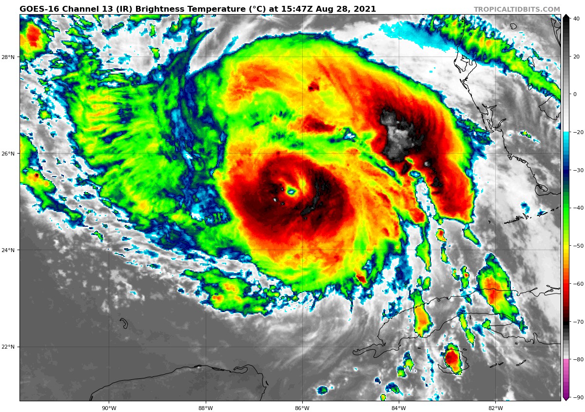
Hurricane Ida continues to become more organized this morning over the southeastern Gulf, about 430 miles south southeast of New Orleans, or the same distance southeast of Houma LA. The storm is moving northwest at a pretty fast clip, around 16 mph.
The system appears to be developing a large Central Dense Overcast, which is a large, round mass of thunderstorms at the core of a strong hurricane. An eye appears to have developed on infrared satellite imagery. A good inner core has been visible all morning on microwave satellite imagery, which can “see” through the clouds.
The Hurricane Hunters found the pressure had dropped slightly, and we would expect that a more rapid drop in pressure will occur soon. Both planes that have been sampling the atmosphere in and around the storm this morning have departed for their homes. Two more flights will leave this afternoon between 3-4 p.m. to gather data that will be fed into the evening global model runs.
How strong Ida will be is of course a main concern. The intensity models have backed off a bit this morning, but the HWRF Hurricane Model still takes it to 135 mph, which is a low end Cat 4. The official NHC forecast carries it to 140 mph. The key takeaway though is preparing for a Cat 4 is essentially the same as preparing for a Cat 3.
We will have more details throughout the storm.
Category: Alabama's Weather, ALL POSTS, Tropical
About the Author (Author Profile)
Bill Murray is the President of The Weather Factory. He is the site's official weather historian and a weekend forecaster. He also anchors the site's severe weather coverage. Bill Murray is the proud holder of National Weather Association Digital Seal #0001 @wxhistorianSubscribe
If you enjoyed this article, subscribe to receive more just like it.


