Bad Situation is Unfolding for New Orleans/Baton Rouge and Parishes to the South
The center of Hurricane Ida has been edging east over the past 12 hours or so and it does appear that the center of the storm will pass near or just west of the Metro New Orleans. New Orleans could even see the eyewall and eye.
The center of Hurricane Ida is 120 miles south southeast of Grand Isle at 2:30 a.m. With a movement of about 15 mph to the north northwest, the center will move onshore near Grand Isle between 10 a.m. and noon, perhaps a little later than that.
Tropical storm force winds will reach New Orleans early this morning, by 8-9 a.m.
Here is a prediction of the sustained winds over Southeast Louisiana at 1 p.m. CDT today:
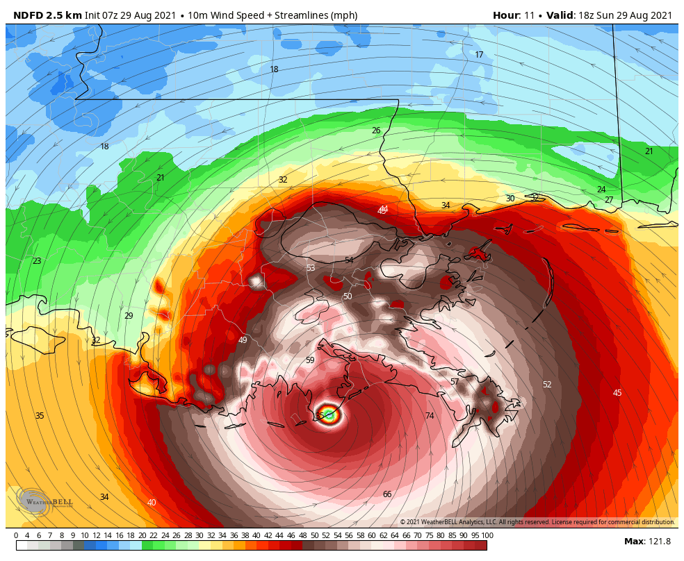
Sustained winds over 100 mph will impact Lafourche and Terrebonne Parishes as the hurricane moves NNW. Hurricane force gusts will be moving into New Orleans early afternoon.
Winds will be gusting to 130-145 mph in the eyewall east of the center. In New Orleans, winds will be gusting to 90-95 mph.
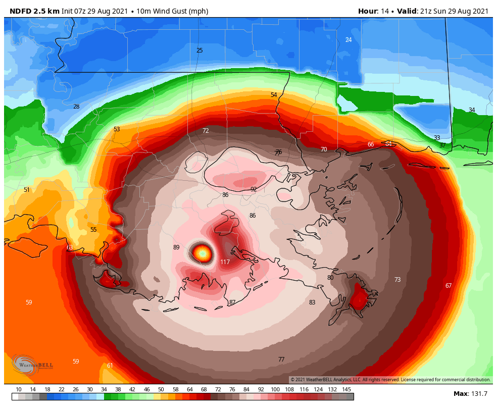
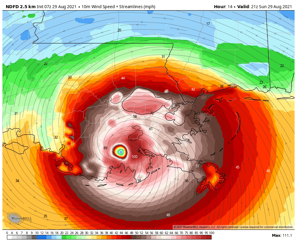
By 7 p.m., the center will be passing just west of New Orleans. Sustained winds will be around 50-70 mph and will be gusting to over 100-105 mph just east of the center. New Orleans will be feeling those 90-105 mph gusts. Areas from Baton Rouge to along the NorthShore, including Hammond, Covington, and Mandeville will start seeing hurricane force gusts. Those gusts will increase to around 90-100 mph through midnight. Hurricane force gusts will continue through 2-3 a.m. Tropical storm force gusts will persist until late Monday afternoon.
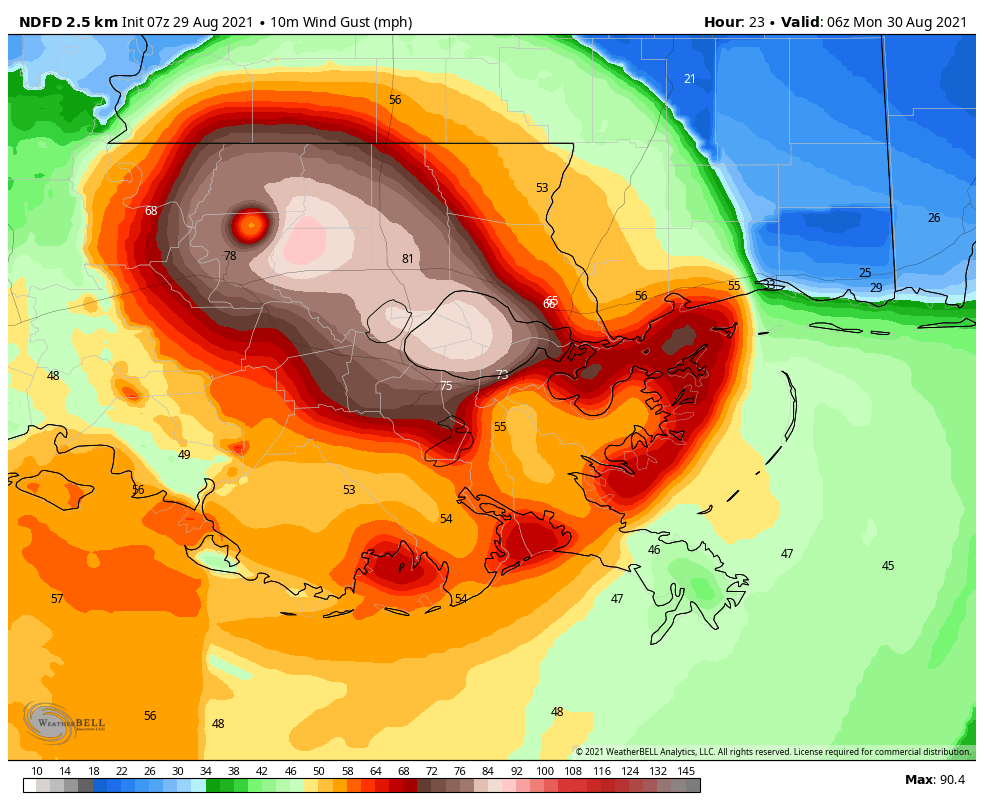
The eye may pass very near Baton Rouge around 3-4 a.m. Winds will begin to diminish in Baton Rouge and along the NorthShore through the early morning hours, but tropical storm force gusts will persist into Monday afternoon.
THIS FORECAST BASED ON SPECIFIC TRACK
If the track edges a little further east, New Orleans could see slightly higher winds. We will be tracking the center continuously on radar from now on.
Category: Alabama's Weather, ALL POSTS, Tropical
About the Author (Author Profile)
Bill Murray is the President of The Weather Factory. He is the site's official weather historian and a weekend forecaster. He also anchors the site's severe weather coverage. Bill Murray is the proud holder of National Weather Association Digital Seal #0001 @wxhistorianSubscribe
If you enjoyed this article, subscribe to receive more just like it.


