Flash Flood Watch Issued for Parts of Central Alabama; Severe Weather Threat As Well
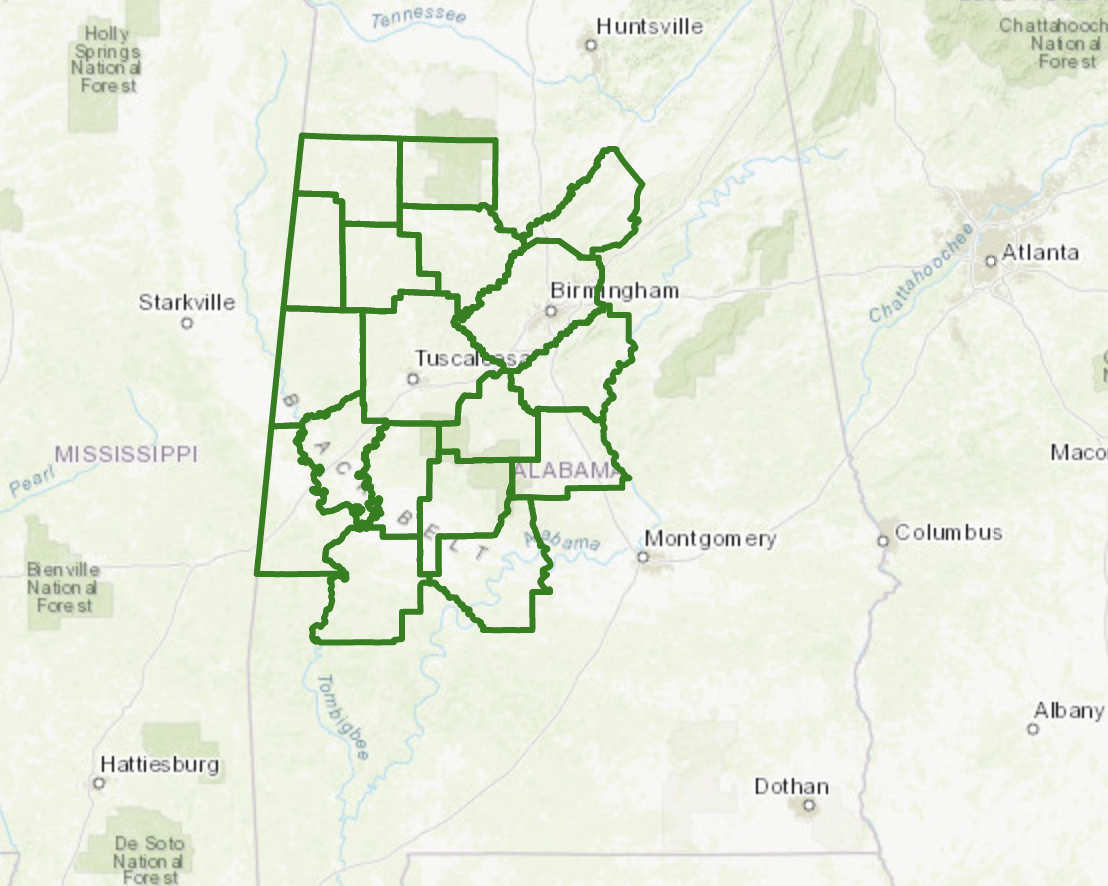
The NWS in Birmingham has issued a Flash Flood Watch that starts at 7 a.m. Monday and goes until 7 p.m. Tuesday for Bibb, Blount, Chilton, Dallas, Fayette, Greene, Hale, Jefferson, Lamar, Marengo, Marion, Perry, Pickens, Shelby, Sumter, Tuscaloosa, Walker, and Winston Counties.
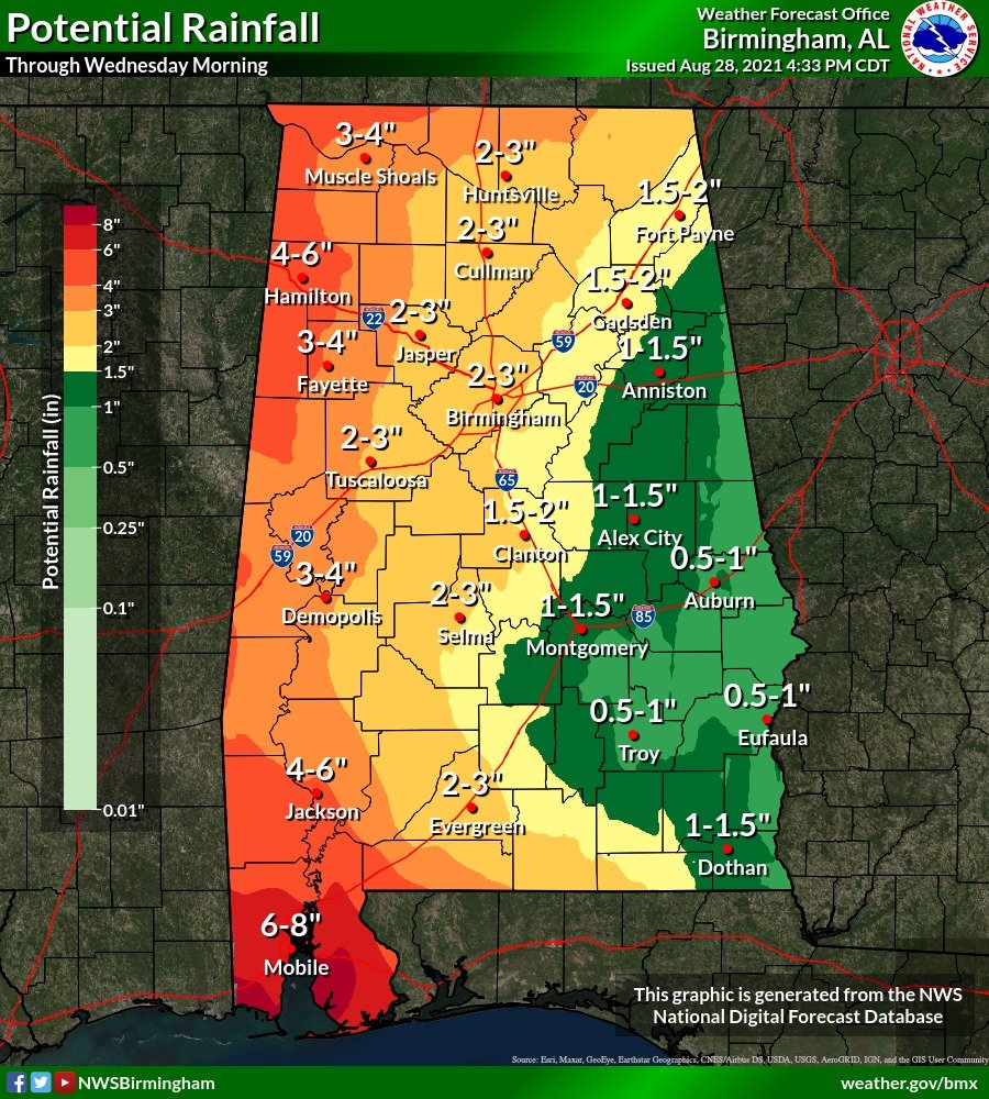
2-5 inches of rain will fall starting early tomorrow through early Tuesday across Alabama as the center of Hurricane Ida makes landfall and turns north and northeast over the next two days. Here are expected rainfall amounts:
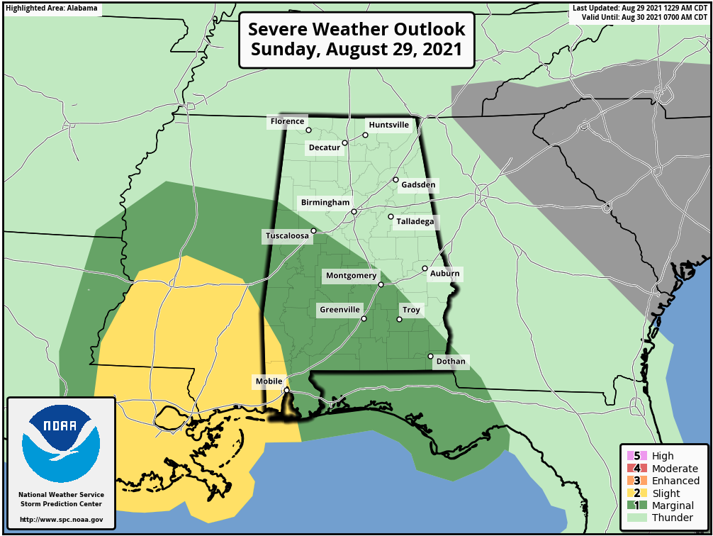
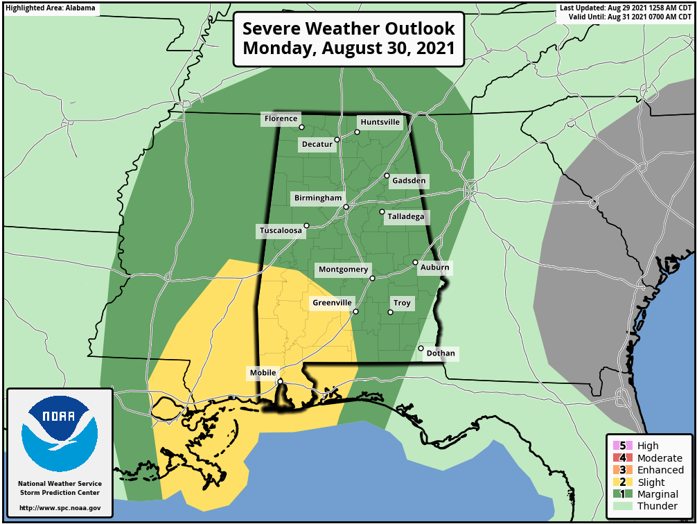
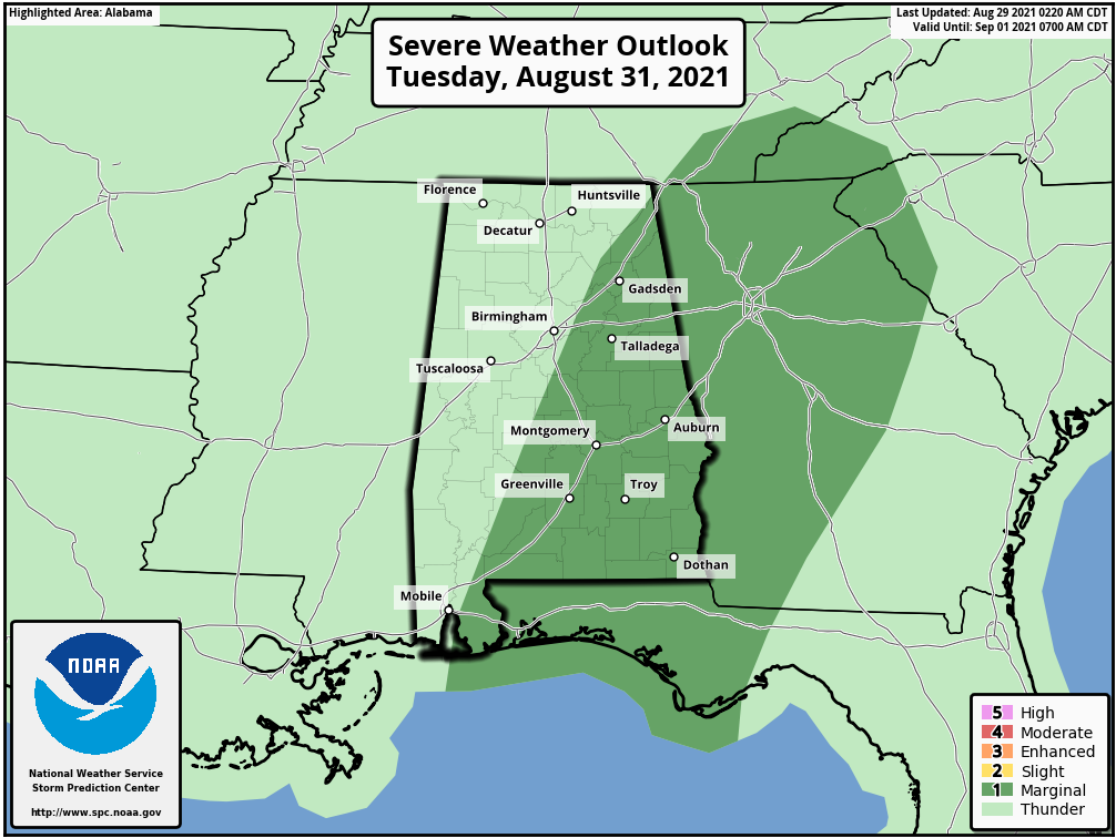
Severe weather is possible today, tomorrow, and Tuesday across Alabama. The threat will come in the form of tornadoes in the feeder bands around Hurricane Ida.
Here are the SPC outlooks:
Day One – Today
Day Two – Monday
Day Three – Tuesday
Category: Alabama's Weather, ALL POSTS, Severe Weather
About the Author (Author Profile)
Bill Murray is the President of The Weather Factory. He is the site's official weather historian and a weekend forecaster. He also anchors the site's severe weather coverage. Bill Murray is the proud holder of National Weather Association Digital Seal #0001 @wxhistorianSubscribe
If you enjoyed this article, subscribe to receive more just like it.


