Dauphin Island & Parts of Mobile County Under a Tornado Warning
BULLETIN – EAS ACTIVATION REQUESTED
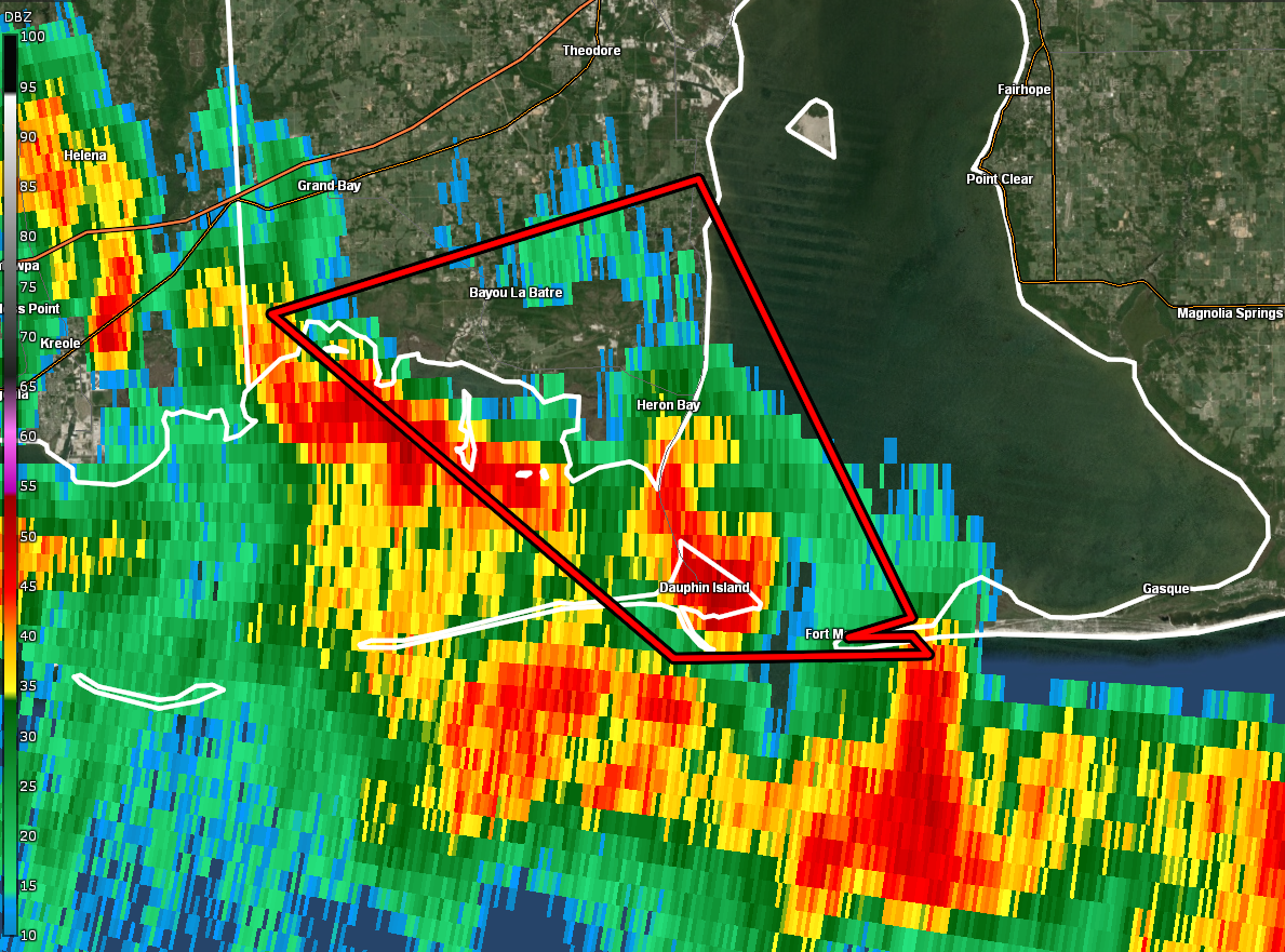
Tornado Warning
National Weather Service Mobile AL
730 AM CDT Sun Aug 29 2021
The National Weather Service in Mobile has issued a
* Tornado Warning for…
Southwestern Mobile County in southwestern Alabama…
* Until 800 AM CDT.
* At 730 AM CDT, a severe thunderstorm capable of producing a tornado
was located over Fort Morgan, or near Dauphin Island, moving
northwest at 40 mph.
HAZARD…Tornado.
SOURCE…Radar indicated rotation.
IMPACT…Flying debris will be dangerous to those caught without
shelter. Mobile homes will be damaged or destroyed.
Damage to roofs, windows, and vehicles will occur. Tree
damage is likely.
* This dangerous storm will be near…
Dauphin Island around 735 AM CDT.
Alabama Port around 745 AM CDT.
Bayou La Batre and Coden around 755 AM CDT.
PRECAUTIONARY/PREPAREDNESS ACTIONS…
TAKE COVER NOW! Move to a basement or an interior room on the lowest
floor of a sturdy building. Avoid windows. If you are outdoors, in a
mobile home, or in a vehicle, move to the closest substantial shelter
and protect yourself from flying debris.
Heavy rainfall may hide this tornado. Do not wait to see or hear the
tornado. TAKE COVER NOW!
Category: Alabama's Weather, ALL POSTS, Severe Weather, Tropical
About the Author (Author Profile)
Scott Martin is an operational meteorologist, professional graphic artist, musician, husband, and father. Not only is Scott a member of the National Weather Association, but he is also the Central Alabama Chapter of the NWA president. Scott is also the co-founder of Racecast Weather, which provides forecasts for many racing series across the USA. He also supplies forecasts for the BassMaster Elite Series events including the BassMaster Classic.Subscribe
If you enjoyed this article, subscribe to receive more just like it.


