Flash Flood Watches Issued for Portions of North/Central Alabama Ahead of Ida
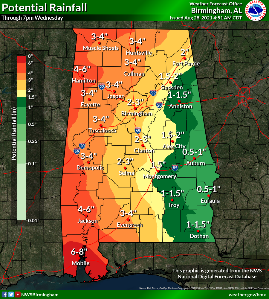
We are expecting to see plenty of rain across North/Central Alabama over the next few days as the eastern side of Hurricane Ida will move through the area after making landfall later today on the Louisiana Gulf Coast. Potential rainfall totals (from now through 7 pm Wednesday) range from as little as 1/2 to 1 inch over the extreme eastern and southeastern portions of the area, to as high as 4 to 6 inches for the extreme western parts of the area. Some localized amount may be even higher. For that reason, both NWS offices in Huntsville and Birmingham have issued flash flood watches for portions of their county warning areas.
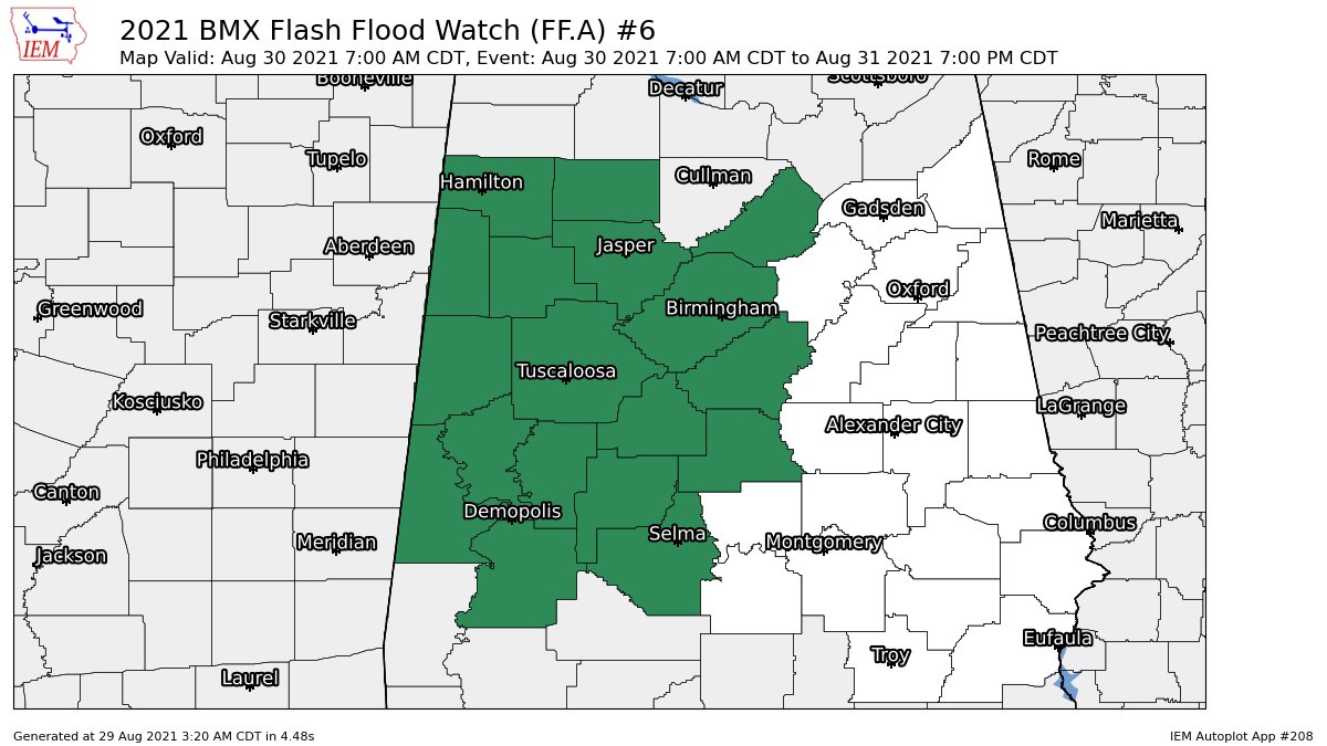
NWS Birmingham has issued a FLASH FLOOD WATCH that will go into effect at 7 am Monday for the following counties in Central Alabama: Bibb, Blount, Chilton, Dallas, Fayette, Greene, Hale, Jefferson, Lamar, Marengo, Marion, Perry, Pickens, Shelby, Sumter, Tuscaloosa, Walker, and Winston. The watch is set to expire at 7 pm Tuesday.
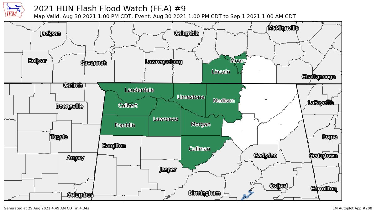
NWS Huntsville has issued a FLASH FLOOD WATCH that will go into effect at 1 pm Monday for the following counties in North Alabama: Colbert, Cullman, Franklin, Lauderdale, Lawrence, Limestone, Madison, and Morgan. The watch is set to expire at 1 am Wednesday.
Category: Alabama's Weather, ALL POSTS
About the Author (Author Profile)
Scott Martin is an operational meteorologist, professional graphic artist, musician, husband, and father. Not only is Scott a member of the National Weather Association, but he is also the Central Alabama Chapter of the NWA president. Scott is also the co-founder of Racecast Weather, which provides forecasts for many racing series across the USA. He also supplies forecasts for the BassMaster Elite Series events including the BassMaster Classic.Subscribe
If you enjoyed this article, subscribe to receive more just like it.


