What’s Happening Now & What Can We Expect in Central Alabama from Hurricane Ida
CENTRAL ALABAMA IMPACTS
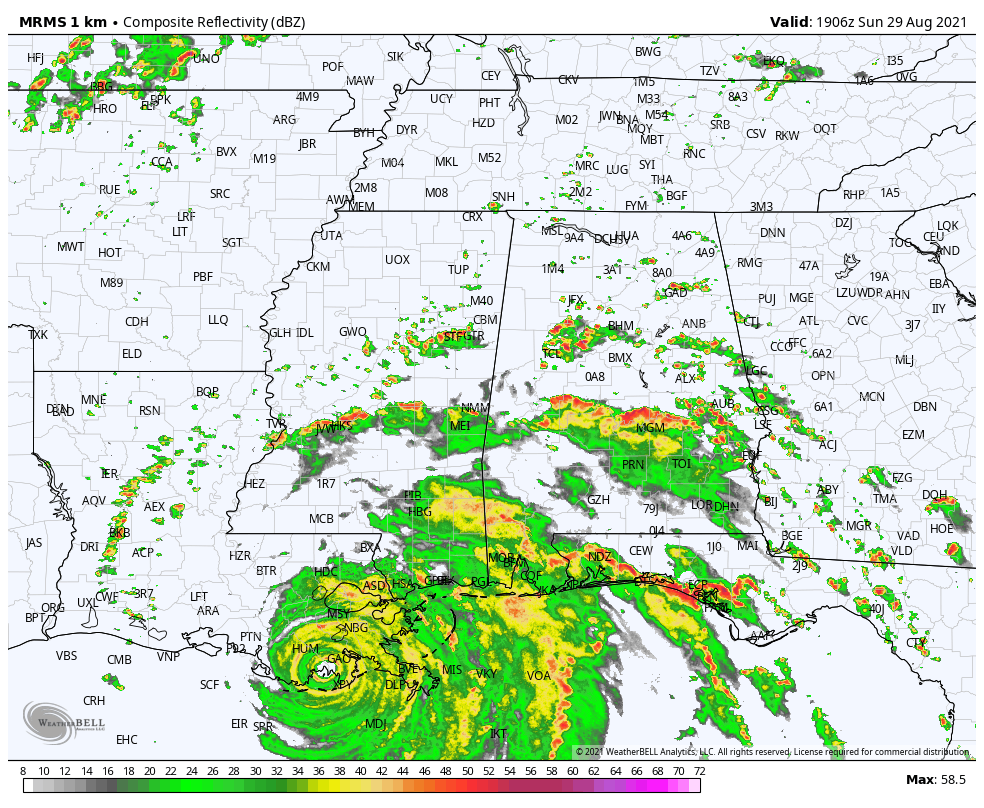
We are already starting to see the first rainband from Ida moving through the southern parts of Central Alabama this afternoon, and more impacts will move into the area later today through the entire day on Monday and much of the day on Tuesday as Ida’s center moves roughly up the Mississippi River before curving off to the northeast just north of the area.
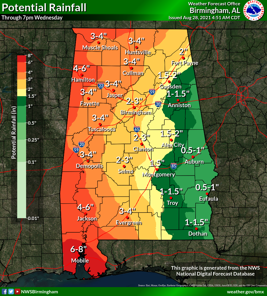
Rainfall totals will range from as small as around 1/2 to 1 inch for the extreme east and southeastern parts of the area, to as high as 4-6 inches over the extreme western parts of the area. Some localized amounts may be even higher. There will be the potential for flooding in those low-lying and poor drainage areas.
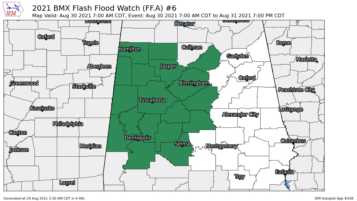
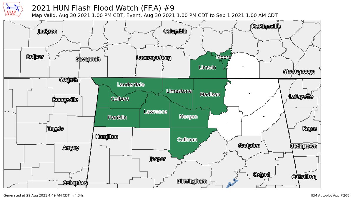
Flash flood watches have been issued for the western 2/3rds of the area and will go into effect on Monday morning.
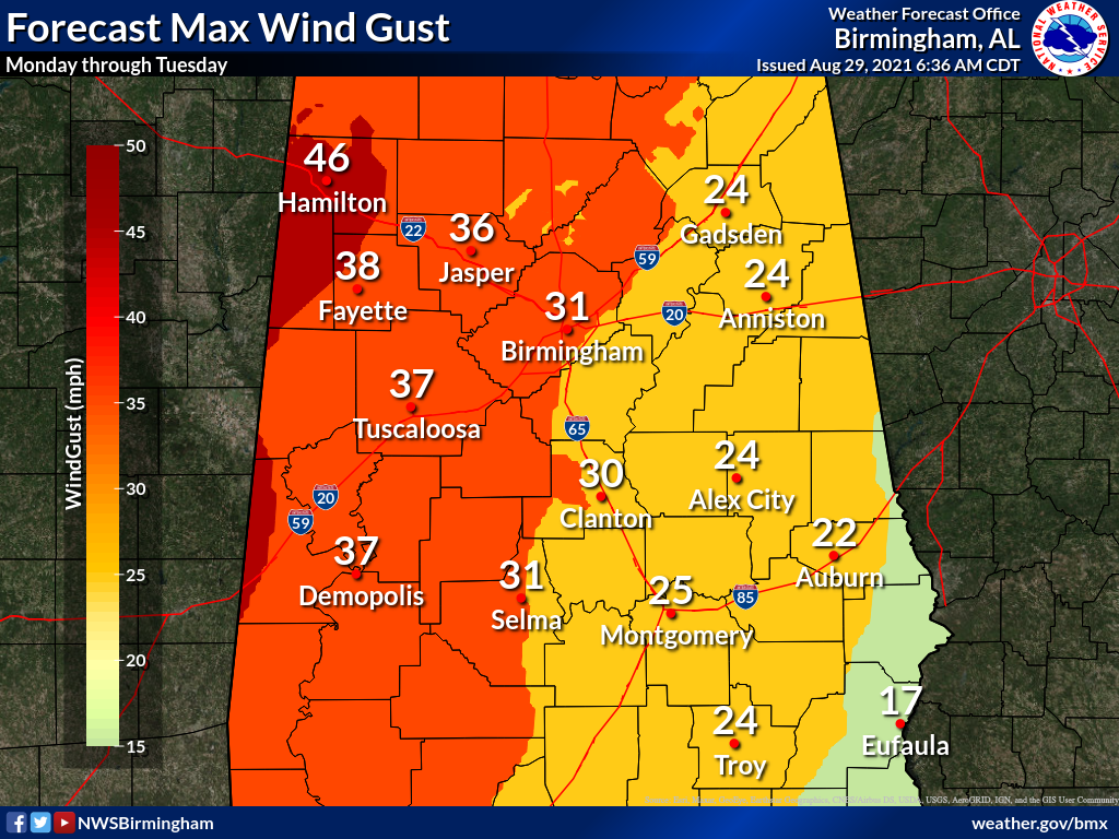
It will be breezy as sustained winds may reach as high as 15-30 mph from southeast to northwest, with wind gusts potentially reaching as high as 25-45 mph. The higher winds will be seen closer to where the center passes by the area.
A few tropical-type brief spin-up tornadoes will be possible starting later tonight through Tuesday afternoon across the area. Timing breakdown will be from approximately 4 am Monday to 7 am Tuesday for the southwestern corner of the area, from 10 am Monday to 10 am Tuesday for the rest of the western half of the area (west of I-65), and from 10 pm Monday to 4 pm Tuesday east of I-65.
Just remember that these projected impacts could change with each update to Ida’s forecast track. Any jog to the east with the track means impacts may be greater to Central Alabama, while any jog to the west may lessen those impacts. That is why it is very important that you have the latest information on Ida. Old information is likely to be bad information.
THE REST OF SUNDAY
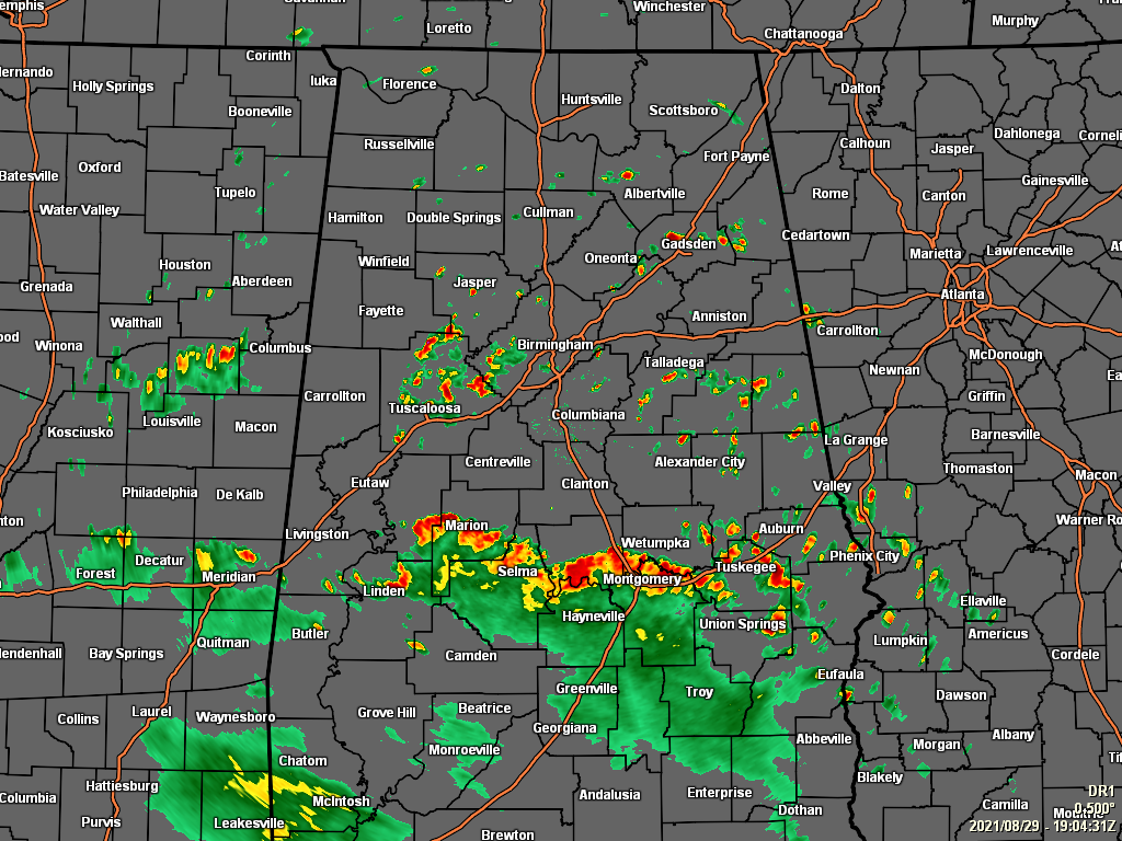
A few widely scattered showers have formed in the afternoon heating, but we also have a band of showers and storms that has spawned off of Ida and is moving through the southern parts of the area. Rain chances will continue to increase across the area from southwest to northeast as Ida continues to move farther inland. Afternoon highs will be in the upper 80s to the lower 90s.
For tonight, the scattered activity will mostly dissipate after sunset, but we’ll have to watch for more tropical rainbands moving up into the area from the south and southwest. A couple brief spin-up tornadoes may be possible during the pre-dawn hours, roughly along and south of a line from Aliceville (Sumter Co.) to Orrville (Dallas Co.).
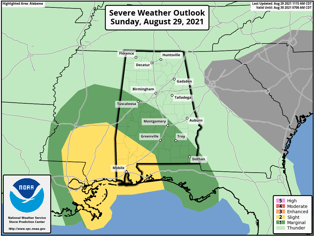
A level 1/5 Marginal Risk is up for locations south of a line from Millport (Lamar Co.) to Clanton (Chilton Co.) to Texasville (Barbour Co.). Lows will be in the lower to mid 70s.
MONDAY AND TUESDAY
Showers and storms will become likely across the area, as we’ll be on the wet and active side of Ida as her center moves northward through Mississippi. It will be breezy with the potential for wind gusts up to 25-45 mph across the area from southeast to northwest, and a few brief spin-up tornadoes are possible as well.
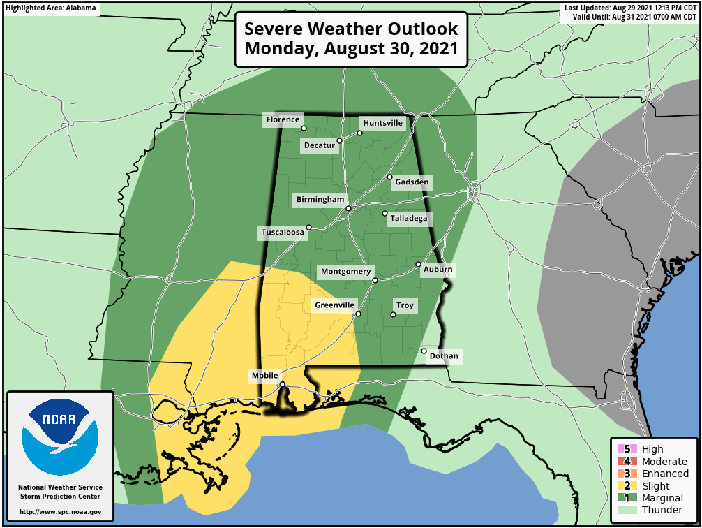
A Marginal Risk is up for nearly all of Central Alabama, except for the extreme southwestern portions, where a Slight Risk is up. Highs will be in the upper 70s to the upper 80s across the area.
The center of Ida will be approaching Nashville on Tuesday afternoon, and we’ll continue to see showers and thunderstorms across the area. A few tornadoes may be possible once again across the area until the late afternoon hours.
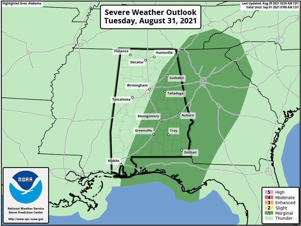
A Marginal Risk is up for much of the eastern half of the area east of a line from Altoona (Etowah Co.) to Calera (Shelby Co.) to Orrville (Dallas Co.). It will be breezy once again and highs will be in the mid 70s to the mid 80s.
Category: Alabama's Weather, ALL POSTS, Severe Weather, Tropical
About the Author (Author Profile)
Scott Martin is an operational meteorologist, professional graphic artist, musician, husband, and father. Not only is Scott a member of the National Weather Association, but he is also the Central Alabama Chapter of the NWA president. Scott is also the co-founder of Racecast Weather, which provides forecasts for many racing series across the USA. He also supplies forecasts for the BassMaster Elite Series events including the BassMaster Classic.Subscribe
If you enjoyed this article, subscribe to receive more just like it.


