Midday Nowcast: Sun Now, but Watching the Radar this Afternoon
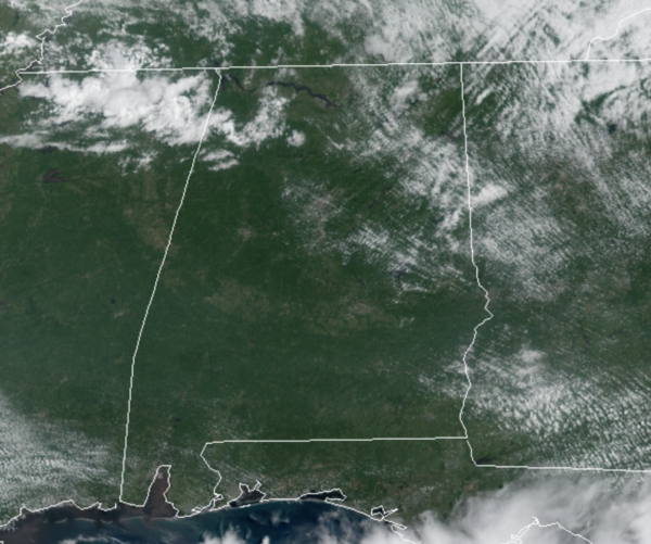
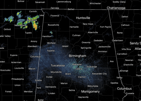
A surface boundary will be dropping into the state later today and will produce scattered showers and thunderstorms. These are already beginning to develop towards our northwest and will drop south into the state through the afternoon and evening hours. Some of these storms could pack a punch with gusty winds and lots of lightning, so we will be keeping on on eye on them. Temperatures this afternoon will be in the mid and upper 80s.
TOMORROW THROUGH SUNDAY: A very dry airmass flows into the state tonight behind the boundary, and will set the stage for very nice weather for Alabama and the Deep South tomorrow and through the weekend. Sunny days, fair pleasant nights, and lower humidity levels are in the forecast. Highs will be in the mid and upper 80s, with lows in the 60s, but cooler spots across North Alabama will dip into the 50s early Friday morning for a nice hint of fall in the air. By Sunday, a weak disturbance will ride the northwest flow aloft into the state and it will squeeze out some showers and thunderstorms as it moves through the state late in the day Sunday, but many locations will remain dry.
IN THE TROPICS: Ida is out of here with its remnants bringing tornadoes and flooding the Mid-Atlantic and Northeast today, Julian has come and gone, Kate is fading away, Larry formed this morning and will become a major hurricane in the coming days, but looks to remain out in the Atlantic.

IN THE CARIBBEAN: An area of low pressure continues to produce disorganized shower activity over the southwestern Caribbean Sea. Some slow development of this system remains possible over the next couple of days if it remains over open water while moving west-northwestward or northwestward at 5 to 10 mph near the coast of Central America. Thereafter, the system will have another opportunity for gradual development in the southwestern Gulf of Mexico. Regardless of development, heavy rains are possible across portions of Central America and the Yucatan Peninsula later this week into the weekend. Formation chance through 5 days…low…30 percent. If it does develop and is named, it would be Mindy.
BEACH FORECAST CENTER: Get the latest weather and rip current forecasts for the beaches from Fort Morgan to Panama City on our Beach Forecast Center page. There, you can select the forecast of the region that you are interested in visiting.
WORLD TEMPERATURE EXTREMES: Over the last 24 hours, the highest observation outside the U.S. was 121.1F at Khanaqin, Iraq. The lowest observation was -97.6F at Amundsen-Scott South Pole Station, Antarctica.
CONTIGUOUS TEMPERATURE EXTREMES: Over the last 24 hours, the highest observation was 112F at Stovepipe Wells, CA. The lowest observation was 22F at Sand Creek Station, OR.
WEATHER ON THIS DATE IN 1898: A forest fire driven by high winds burned down the town of Hinkley, MN, killing 418 persons.
Category: Alabama's Weather, ALL POSTS
About the Author (Author Profile)
Macon, Georgia Television Chief Meteorologist, Birmingham native, and long time Contributor on AlabamaWX. Stormchaser. I did not choose Weather, it chose Me. College Football Fanatic. @Ryan_StinnetSubscribe
If you enjoyed this article, subscribe to receive more just like it.


