

Midday Nowcast: Continued Cloudy with Scattered Showers
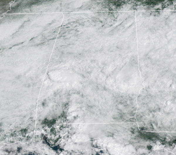
Another cloudy, wet day is underway across Alabama as the remnants of Nicholas continue to spread deep tropical moisture over the state.
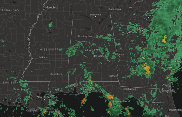
Due to the clouds and rain, temperatures will not make it out of the 70s for much of Alabama again today. This afternoon, we can’t rule out a few rumbles of thunder, but for the most part we are just dealing with areas of rain.
FRIDAY AND THE WEEKEND: The tropical air mass will remain in place, so it will remain mainly cloudy with scattered to numerous showers remaining in the forecast each day. Rain is possible at anytime, but the greatest coverage will occur during the afternoon and evening hours. Highs tomorrow through Sunday should be in the upper 70s to low 80s.
NEXT WEEK: The pattern doesn’t change much for next week, moist air remains in place and therefor we should continue to see more clouds than sun, with the continued chance of scattered showers and thunderstorms on a daily basis. Highs should be in the low to mid 80s, which is pretty close to where they should be this time of year. By late Wednesday and into Thursday, it looks like we will have a front finally sweep through the state, bringing a drier air mass back to the state.
IN THE TROPICS: Three features the NHC is monitoring, two of which will likely become Odette and Peter in the coming days.

1. Showers and thunderstorms have become slightly less organized in association with a tropical wave located a little more than 800 miles west-southwest of the Cabo Verde Islands. However, environmental conditions are expected to be conducive for development during the next few days, and a tropical depression is still likely to form late this week or this weekend. This system is expected to move westward to west-northwestward across the tropical Atlantic during the next several days. Formation chance through 5 days…high…80 percent.
2. Shower and thunderstorm activity has increased this morning over the eastern portion of a broad area of low pressure located about 250 miles south-southeast of the Outer Banks of North Carolina. Environmental conditions are expected to become more conducive for development, and a tropical depression is still likely to form during the next day or two while the system moves northward to north-northeastward off the southeast and mid-Atlantic U.S. coasts. Regardless of development, this system could bring high surf to portions of the southeast and mid-Atlantic U.S. coasts later this week and this weekend. An Air Force Reserve reconnaissance aircraft is scheduled to investigate the disturbance this afternoon. Formation chance through 5 days…high…70 percent.
3. Showers and thunderstorms over the far eastern tropical Atlantic are associated with a tropical wave that will move off the west coast of Africa today. Environmental conditions are forecast to be marginally conducive for some gradual development over the next few days while the system moves west-northwestward to northwestward over the far eastern Atlantic. Formation chance through 5 days…low…20 percent.
BEACH FORECAST CENTER: Get the latest weather and rip current forecasts for the beaches from Fort Morgan to Panama City on our Beach Forecast Center page. There, you can select the forecast of the region that you are interested in visiting.
WORLD TEMPERATURE EXTREMES: Over the last 24 hours, the highest observation outside the U.S. was 114.3F at Adrar, Algeria. The lowest observation was -90.8F at Amundsen-Scott South Pole Station, Antarctica.
CONTIGUOUS TEMPERATURE EXTREMES: Over the last 24 hours, the highest observation was 111F at Death Valley, CA. The lowest observation was 23F at Yellowstone National Park South Entrance, WY.
Category: Alabama's Weather, ALL POSTS
About the Author (Author Profile)
Macon, Georgia Television Chief Meteorologist, Birmingham native, and long time Contributor on AlabamaWX. Stormchaser. I did not choose Weather, it chose Me. College Football Fanatic. @Ryan_StinnetSubscribe
If you enjoyed this article, subscribe to receive more just like it.


