Tropical Storm Sam Forms Out in the Tropical Atlantic; Expected to Become a Hurricane on Friday
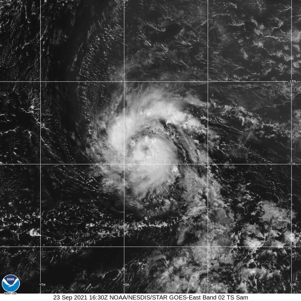
As of the 10 am update from the National Hurricane Center, TD-18 has strengthened into Tropical Storm Sam, with maximum sustained winds at 50 MPH. This is the 2nd earliest formation of the 18th named storm in the Atlantic basin, moving ahead of the 2005 hurricane season, and only trailing last year.
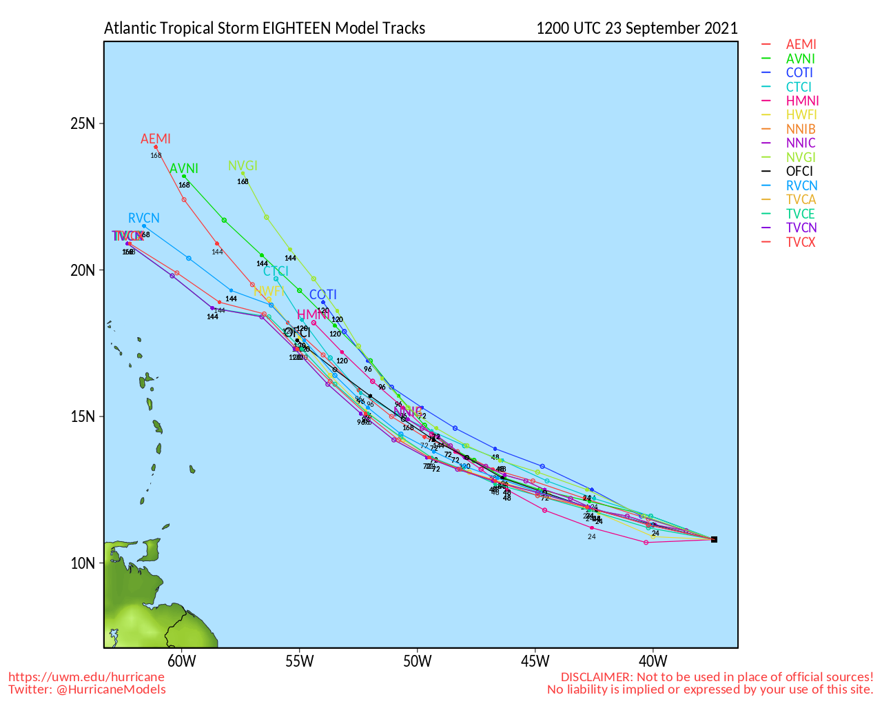
The latest hurricane models show that Sam will curve to the northwest before reaching the Leeward Islands. After that, most model members do have it continuing a curve that will keep it away from the US East Coast. As far as intensity, it will rapidly strengthen over the next several days. Intensity models have it potentially reaching a strong category 2 to a mid-category 3 strength storm over the next 72 hours. NHC is projecting max winds at 125 mph by Tuesday morning. Here is the latest from the National Hurricane Center:
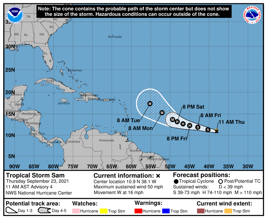
SUMMARY OF 1100 AM AST…1500 UTC…INFORMATION
———————————————–
LOCATION…10.9N 38.1W
ABOUT 1745 MI…2805 KM ESE OF THE NORTHERN LEEWARD ISLANDS
MAXIMUM SUSTAINED WINDS…50 MPH…85 KM/H
PRESENT MOVEMENT…W OR 280 DEGREES AT 16 MPH…26 KM/H
MINIMUM CENTRAL PRESSURE…1003 MB…29.62 INCHES
WATCHES AND WARNINGS
——————–
There are no coastal watches or warnings in effect.
DISCUSSION AND OUTLOOK
———————-
At 1100 AM AST (1500 UTC), the center of Tropical Storm Sam was located near latitude 10.9 North, longitude 38.1 West. Sam is moving toward the west near 16 mph (26 km/h) and this general motion is expected to continue over the next several days, but with a gradual slowdown in forward motion.
Recent satellite wind data indicates maximum sustained winds have increased to near 50 mph (85 km/h) with higher gusts. Additional strengthening is forecast over the next several days, and Sam is now forecast to become a hurricane tomorrow and be near major hurricane intensity by the end of the weekend. Tropical-storm-force winds extend outward up to 45 miles (75 km) from the center. The estimated minimum central pressure is 1003 mb (29.62 inches).
HAZARDS AFFECTING LAND
———————-
None.
All images, forecasts, and documents are courtesy of their respective publishers.
About the Author (Author Profile)
Scott Martin is an operational meteorologist, professional graphic artist, musician, husband, and father. Not only is Scott a member of the National Weather Association, but he is also the Central Alabama Chapter of the NWA president. Scott is also the co-founder of Racecast Weather, which provides forecasts for many racing series across the USA. He also supplies forecasts for the BassMaster Elite Series events including the BassMaster Classic.Subscribe
If you enjoyed this article, subscribe to receive more just like it.


