Peter & Rose Are Gone, But the Tropics Remain Very Active
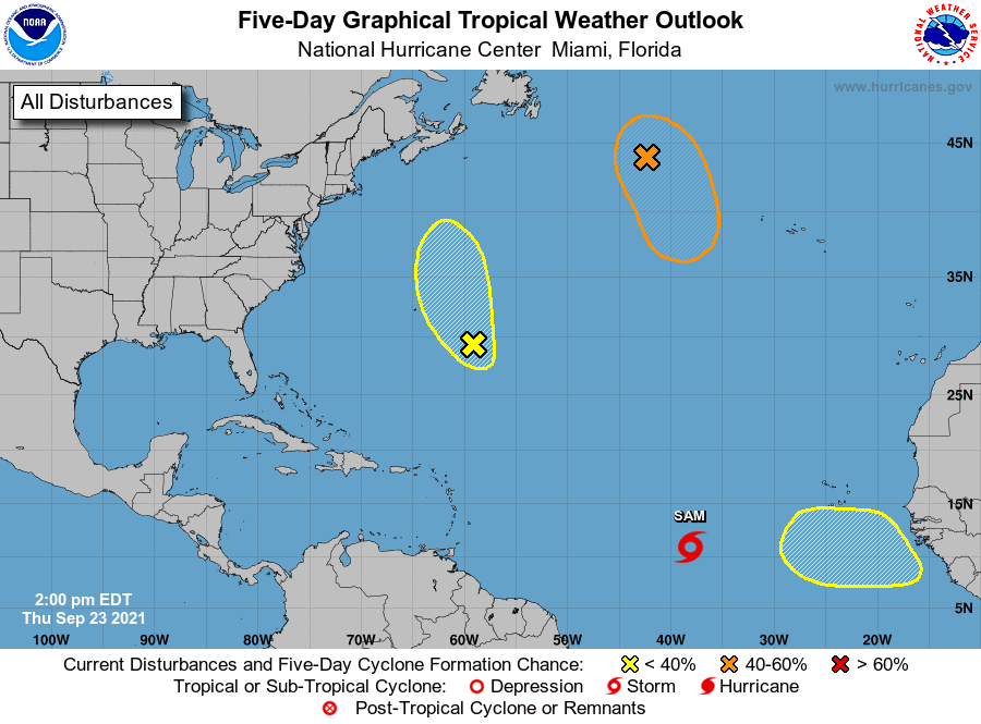
We know about the formation of Tropical Storm Sam from the post earlier this morning and from Ryan’s midday post, but we still have three other areas of interest even after Peter and Rose have been taken off of the board. The good news is that none of these are a threat to the US Mainland. Here is the latest Tropical Weather Outlook from the National Hurricane Center:
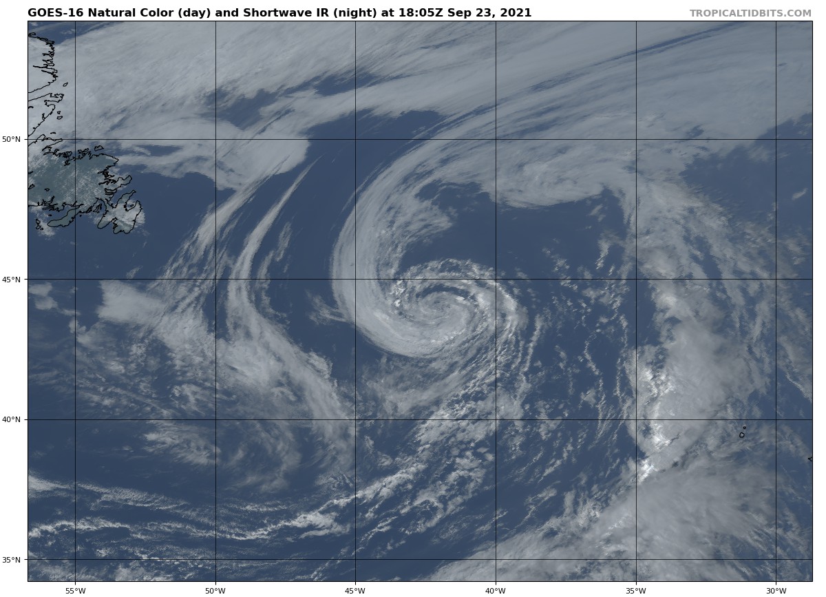
A gale-force, non-tropical low pressure system, the remnants of Odette, is located a little more than 600 miles west-northwest of the westernmost Azores. While showers and thunderstorms remain limited near the low, only a small increase in this activity could result in the formation of a subtropical or tropical cyclone while it moves generally southward over marginally warmer waters during the next day or so. Strong upper-level winds are expected to develop over the system beginning tomorrow, which should then limit further development.
* Formation chance through 48 hours… medium… 60 percent.
* Formation chance through 5 days… medium… 60 percent.
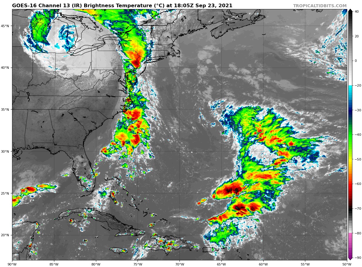
A surface trough of low pressure has developed in association with a large area of showers and thunderstorms located a few hundred miles southeast of Bermuda. This feature is interacting with an upper-level trough, and some tropical or subtropical development could occur in the next day or two as this feature moves generally north-northwestward. Strong upper-level winds should prohibit further development by this weekend.
* Formation chance through 48 hours… low… 10 percent.
* Formation chance through 5 days… low… 10 percent.
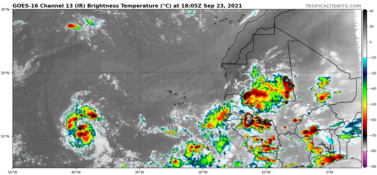
A tropical wave is expected to move off the west coast of Africa by the end of this weekend. Thereafter, environmental conditions are forecast to be conducive for gradual development of this system as it moves westward at 10 to 15 mph over the far east Atlantic.
* Formation chance through 48 hours… low… near 0 percent.
* Formation chance through 5 days… low… 30 percent.
All images, forecasts, and documents are courtesy of their respective publishers.
About the Author (Author Profile)
Scott Martin is an operational meteorologist, professional graphic artist, musician, husband, and father. Not only is Scott a member of the National Weather Association, but he is also the Central Alabama Chapter of the NWA president. Scott is also the co-founder of Racecast Weather, which provides forecasts for many racing series across the USA. He also supplies forecasts for the BassMaster Elite Series events including the BassMaster Classic.Subscribe
If you enjoyed this article, subscribe to receive more just like it.


