Saturday Weather Xtreme Video: Increasing Shower & Thunderstorm Chances Throughout the Weekend
THIS WEEKEND: We’ll start off with some clouds out there and a couple of places with some patchy fog this morning, but clouds will build with the heating of the day. We have enough moisture in place for the chance of a few isolated to scattered showers and storms, mainly across the western half of the area. Much of the eastern half will stay dry, with only a slight chance of an isolated shower for those north of I-20. Highs will be in the 80s. If you are headed to either Tuscaloosa or downtown Birmingham for the football games, you might want to carry a poncho just in case. Patchy fog may be an issue during the overnight hours in some spots, and lows will be in the mid to upper 60s.
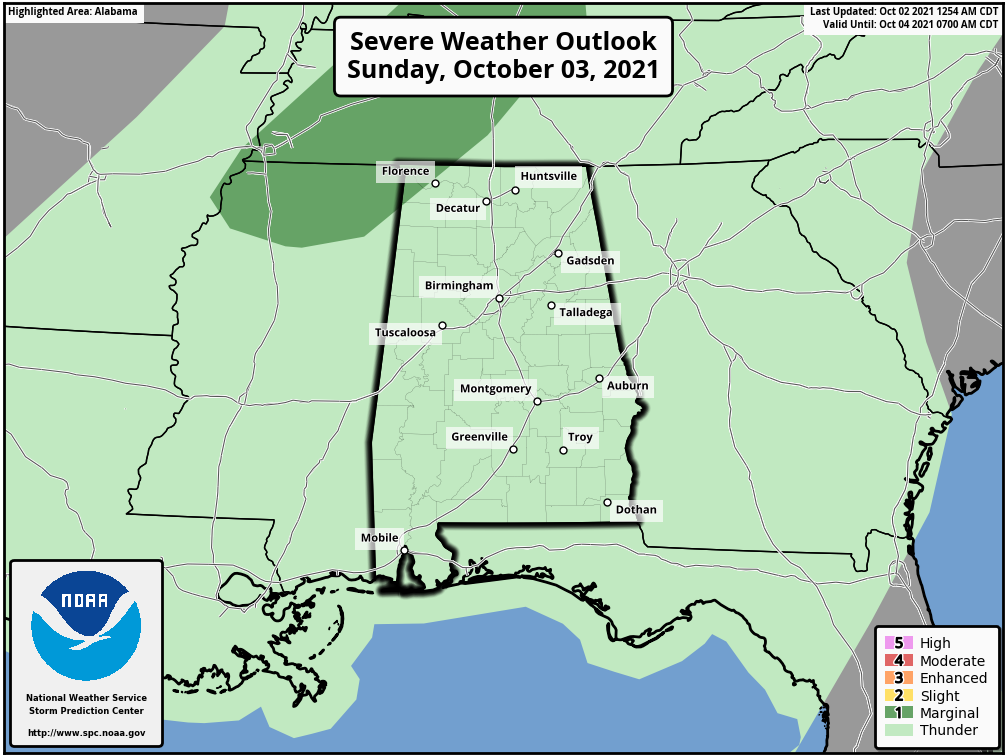
A cold front will be approaching the Mississippi River on Sunday that will put Central Alabama in the warm and humid sector. Scattered to numerous showers and storms will become likely by the afternoon hours. We can’t rule out a strong storm or two over the extreme northwestern corner of the state, and the Storm Prediction Center has a Marginal Risk up for those locations with the threat for gusty winds. Highs will be in the mid 70s to the mid 80s.
THE WORKWEEK AHEAD: That cold front will be knocking on our door on Monday, that will keep our chances for showers and storms likely mainly during the afternoon and evening hours. Highs will be in the upper 70s to the lower 80s. On Tuesday, the front will start off around the I-59 corridor and will eventually stall out just south of that. Showers and storms will continue to be likely throughout the day. Highs will be in the mid 70s to the lower 80s. The front will not have moved much for Wednesday, keeping showers and thunderstorms in the forecast. Highs will be in the lower 70s to the lower 80s.
The front finally moves out of the area, but moisture will stick around on both Thursday and Friday. We can expect scattered shower and thunderstorm activity mainly during the afternoon and evening hours, but a few showers may occur during the morning hours. Highs will be in the mid 70s to the lower 80s on both days.
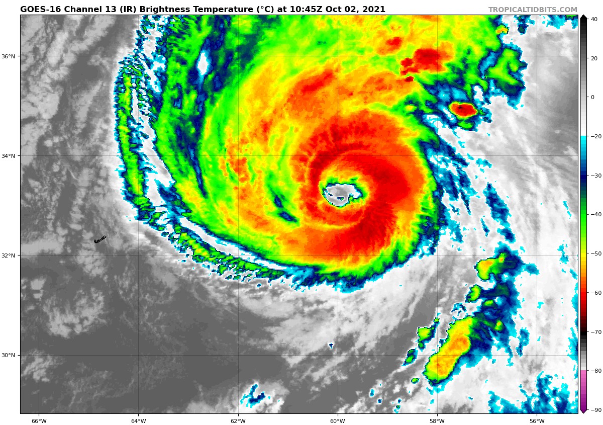
THE TROPICS: Hurricane Sam continues to be a category 4 hurricane with peak sustained winds at 130 mph, but the good news is that it is now moving away from Bermuda and is no threat to any land. However, large swells will be possible along the east coast starting today, which will potentially lead to dangerous rip currents.
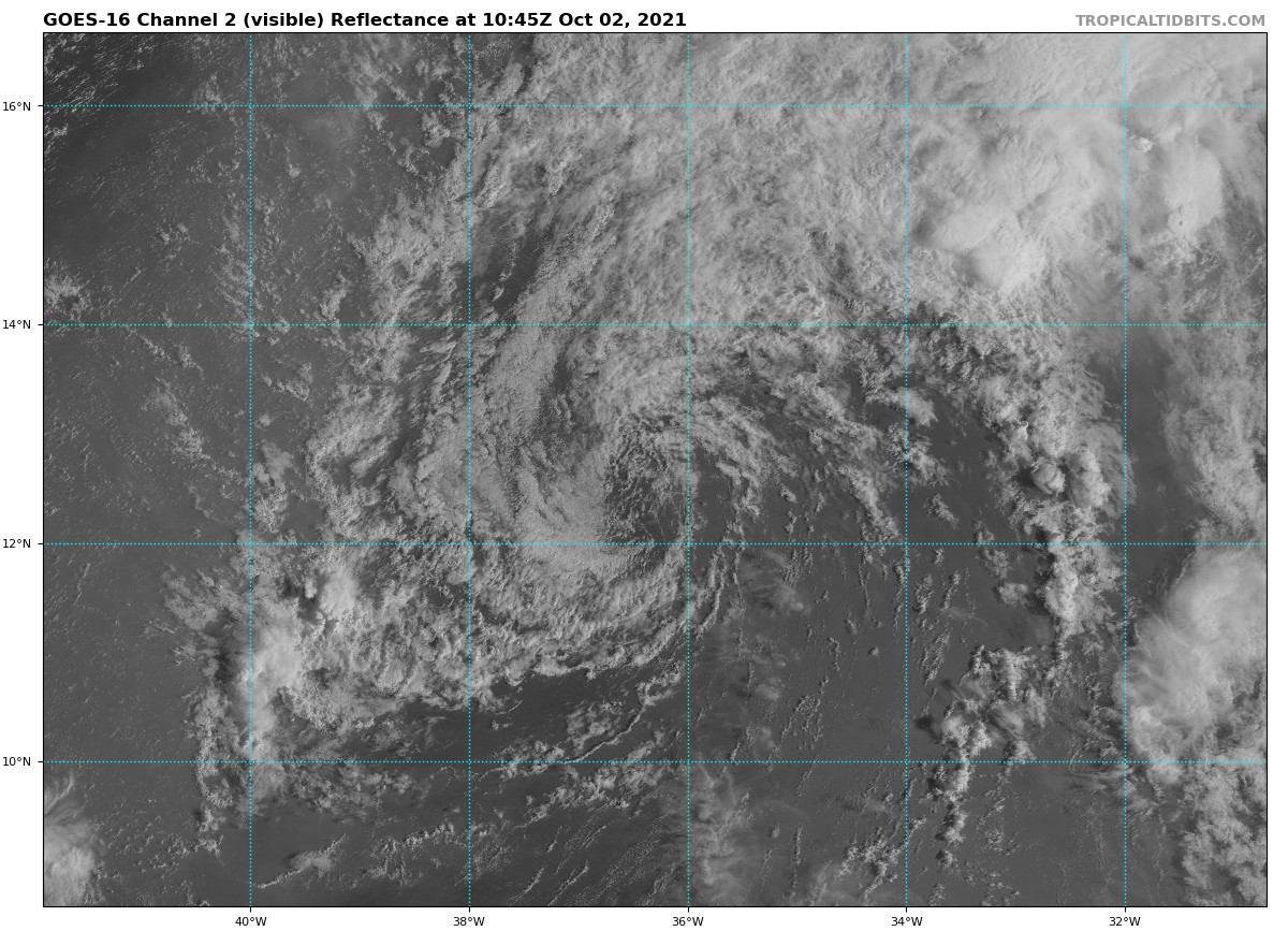
Tropical Storm Victor is barely hanging on to life, as there is literally no convection around the center. Peak winds were at 50 mph, and he will continue to weaken throughout the weekend and will become a remnant low on Monday. No threat to any land. The rest of the tropics are quiet.
Category: Alabama's Weather, ALL POSTS, Severe Weather, Tropical, Weather Xtreme Videos
About the Author (Author Profile)
Scott Martin is an operational meteorologist, professional graphic artist, musician, husband, and father. Not only is Scott a member of the National Weather Association, but he is also the Central Alabama Chapter of the NWA president. Scott is also the co-founder of Racecast Weather, which provides forecasts for many racing series across the USA. He also supplies forecasts for the BassMaster Elite Series events including the BassMaster Classic.Subscribe
If you enjoyed this article, subscribe to receive more just like it.


