Flash Flood Warning for Portions of Jackson County Until 10 pm
BULLETIN – EAS ACTIVATION REQUESTED
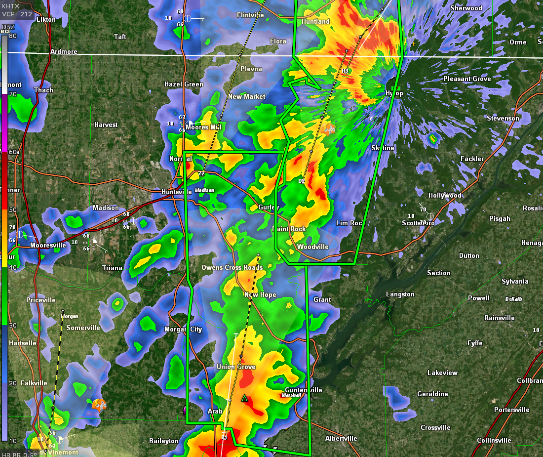
Flash Flood Warning
National Weather Service Huntsville AL
654 PM CDT Wed Oct 6 2021
The National Weather Service in Huntsville has issued a
* Flash Flood Warning for…
Northwestern Jackson County in northeastern Alabama…
Western Franklin TN County in middle Tennessee…
* Until 1000 PM CDT.
* At 654 PM CDT, Doppler radar indicated thunderstorms producing
heavy rain across Jackson, and Franklin counties. Between 1 and 2
inches of rain have fallen. Additional rainfall amounts of 2 to 3
inches are possible in the warned area as more heavy storms move
into the area from the south. Flash flooding is ongoing or
expected to begin shortly.
HAZARD…Flash flooding caused by thunderstorms.
SOURCE…Radar.
IMPACT…Flash flooding of small creeks and streams, highways,
streets and underpasses as well as other poor drainage
and low-lying areas.
* Some locations that will experience flash flooding include…
Winchester, Decherd, Estill Springs, Huntland, Skyline, Gurley,
Woodville, Tims Ford Lake, Pleasant Groves, Hytop, Paint Rock,
Francisco, Larkin, Estillfork, Beans Creek, Princeton, Maxwell,
Jericho, Belvidere and Hollytree.
PRECAUTIONARY/PREPAREDNESS ACTIONS…
Turn around, don’t drown when encountering flooded roads. Most flood
deaths occur in vehicles.
Category: Alabama's Weather, ALL POSTS, Severe Weather
About the Author (Author Profile)
Bill Murray is the President of The Weather Factory. He is the site's official weather historian and a weekend forecaster. He also anchors the site's severe weather coverage. Bill Murray is the proud holder of National Weather Association Digital Seal #0001 @wxhistorianSubscribe
If you enjoyed this article, subscribe to receive more just like it.


