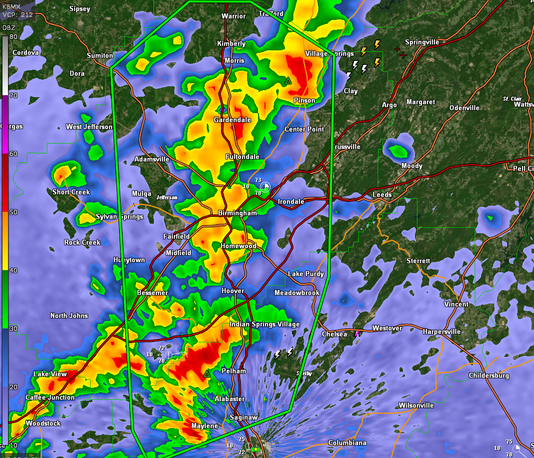
Flash Flood Warning for Portions of Jefferson and Shelby including the Birmingham Metro Area Until 1015 pm
The National Weather Service in Birmingham has issued a
* Flash Flood Warning for…
Jefferson County in central Alabama…
Northwestern Shelby County in central Alabama…
* Until 1015 PM CDT.
* At 717 PM CDT, Doppler radar indicated thunderstorms producing
heavy rain across the warned area. Between 2 and 3 inches of rain
have fallen. Additional rainfall amounts of 1 to 3 inches are
possible in the warned area. Flash flooding is ongoing or expected
to begin shortly.
HAZARD…Flash flooding caused by thunderstorms.
SOURCE…Radar.
IMPACT…Flash flooding of small creeks and streams, urban
areas, highways, streets and underpasses as well as
other poor drainage and low-lying areas.
* Some locations that will experience flash flooding include…
Birmingham, Hoover, Vestavia Hills, Alabaster, Bessemer, Homewood,
Pelham, Mountain Brook, Trussville, Helena, Hueytown, Gardendale,
Irondale, Fairfield, Chelsea, Fultondale, Sumiton, Center Point,
Pleasant Grove and Clay.
Category: Alabama's Weather, ALL POSTS, Severe Weather
About the Author (Author Profile)
Bill Murray is the President of The Weather Factory. He is the site's official weather historian and a weekend forecaster. He also anchors the site's severe weather coverage. Bill Murray is the proud holder of National Weather Association Digital Seal #0001 @wxhistorianSubscribe
If you enjoyed this article, subscribe to receive more just like it.


