Midday Nowcast: Cloudy with a Few Showers
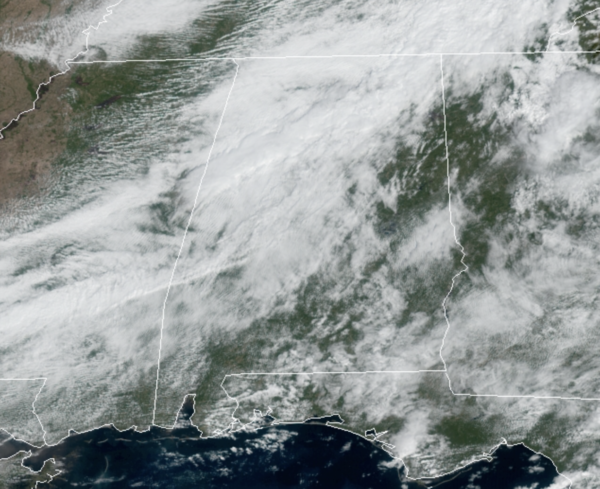
A cold front is moving through the state today and it the reason we are dealing with a few isolated showers across Alabama.
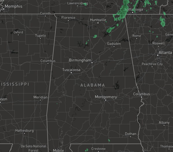
We are seeing more clouds than sun, and North/Central Alabama temperatures are in the mid 70s in most locations, while across South Alabama, 80s are more common.
As the front clears the area, a much cooler night is ahead with lows in the 40s for many locations by tomorrow morning.
TERRIFIC TUESDAY: Tomorrow will be a beautiful fall day across Alabama as we will be in-between systems. Expect a sunny day with temperatures ranging from the upper 60s to low 70s.
MIDWEEK STORM THREAT: Our next storm system begins to take shape late tomorrow to our west and moves eastward through the day Wednesday. Expect increasing clouds through the day, but it appears the rain and storms will not arrive until Wednesday night and through the early morning hours Thursday.
As the rain/storms move through, there could be some stronger storms. However, new model data shows basically no instability over the northern 2/3 of the state, and the severe weather threat will be limited to the southern counties of the state. The SPC has defined a “slight risk” (level 2/5) for much of Mobile County, and the eastern shore of Baldwin county, with a “marginal risk” (level 1/5) as far north as Butler, Monroeville, Evergreen, and Brewton.
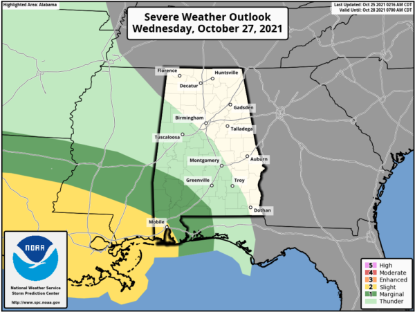
Down that way, there is the potential of damaging winds, hail, and a few isolated tornadoes. Just something, we will keep an eye on the next few days.
Wednesday will be mild with highs in the 70s, but behind the front on Thursday, temperatures hold in the 60s with clouds and scattered areas of light rain.
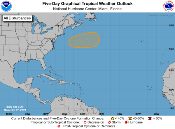
IN THE TROPICS: A non-tropical low pressure system is expected to form off the east coast of the United States during the next day or so. The frontal low will move generally north-northeastward through the middle of the week, and the system will likely bring rain and wind impacts to portions of the mid-Atlantic and northeast U.S. coast. By the end of the week, the low could acquire some tropical or subtropical characteristics while it moves eastward away from the northeast U.S. coast. Formation chance through 5 days…medium…40 percent.
BEACH FORECAST CENTER: Get the latest weather and rip current forecasts for the beaches from Fort Morgan to Panama City on our Beach Forecast Center page. There, you can select the forecast of the region that you are interested in visiting.
WORLD TEMPERATURE EXTREMES: Over the last 24 hours, the highest observation outside the U.S. was 113.9F at Kroonstad, South Africa. The lowest observation was -72.0F at Vostok, Antarctica.
CONTIGUOUS TEMPERATURE EXTREMES: Over the last 24 hours, the highest observation was 99F at Zapata, TX. The lowest observation was 19F at Crane Lake, MN.
WEATHER ON THIS DATE IN 1977: Dutch Harbor in Alaska reported a barometric pressure reading of 27.31 inches (925 millibars) to establish an all-time record for the state.
Category: Alabama's Weather, ALL POSTS
About the Author (Author Profile)
Macon, Georgia Television Chief Meteorologist, Birmingham native, and long time Contributor on AlabamaWX. Stormchaser. I did not choose Weather, it chose Me. College Football Fanatic. @Ryan_StinnetSubscribe
If you enjoyed this article, subscribe to receive more just like it.


