Midday Nowcast: Sunny and Very Nice
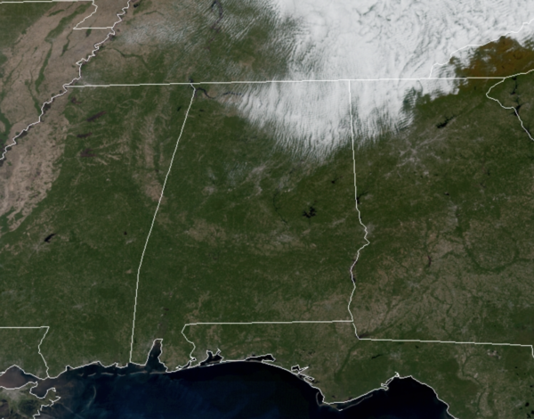
Today is a beautiful fall day across Alabama as are seeing sunshine in full supply with temperatures ranging from the upper 60s to low 70s across the state. The exception is in the Tennessee Valley of the state, where clouds linger late this morning, but these should clear out this afternoon. Tonight, expect temperatures to fall into the upper 40s and lower 50s again.
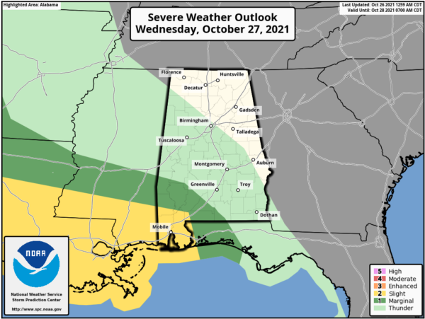
FOR TOMORROW: Tomorrow will be warmer day with highs in the 70s, but expect increasing clouds through the day. Rain and storms will move into Alabama after sunset tomorrow night and continue through the early morning hours Thursday as a dynamic storm system moves out of the Plains.
No threat of sever weather across the northern 2/3 of Alabama as there will be no instability in place, but there could be some strong to possibly severe storms across the southwestern counties of the state. The SPC has defined a “slight risk” (level 2/5) for much of Mobile and Baldwin Counties, with a “marginal risk” (level 1/5) as far north as Butler, Monroeville, and Andalusia through 7AM Thursday morning.
After 7AM Thursday, and through the midday hours Thursday, the SPC has a “marginal risk” (level 1/5) for areas of Southeast Alabama, including Troy and Dothan.
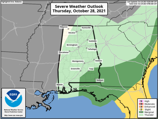
Within the risk areas, there is the potential of damaging winds and a few isolated tornadoes. Not a major threat, but certainly something to watch as the system moves through the state.
Behind the front Thursday, temperatures will hold in the 60s with clouds and scattered areas of light rain due to the upper level low spinning over the Mid-South.
RAW FRIDAY: The upper low will hold over the region Friday and our Friday will remain a cloudy, chilly, and blustery day with temperatures hold in the 50s all day. Add in gusty northwesterly winds of 15-30 mph, it will feel much chillier. Some light rain is likely at times over portions of Alabama through Friday night.
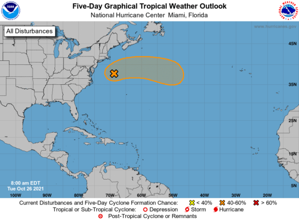
IN THE TROPICS: A deepening, non-tropical low pressure system with storm-force winds is located about 400 miles east-northeast of Cape Hatteras, North Carolina. This low is forecast to move north-northeastward today, and there is a brief chance of it acquiring some limited subtropical characteristics before it merges with another frontal system. The extratropical low is then expected to meander off the mid-Atlantic and northeast U.S. coasts tonight and Wednesday, bringing rain and wind impacts to portions of those areas. After that time, the low is expected to move eastward away from the U.S. coast, and could again acquire some subtropical characteristics while it moves eastward or southeastward over the warmer waters of the central Atlantic. Formation chance through 5 days…medium…50 percent.
BEACH FORECAST CENTER: Get the latest weather and rip current forecasts for the beaches from Fort Morgan to Panama City on our Beach Forecast Center page. There, you can select the forecast of the region that you are interested in visiting.
WORLD TEMPERATURE EXTREMES: Over the last 24 hours, the highest observation outside the U.S. was 105.8F at Dori, Burkina Faso. The lowest observation was -75.8F at Concordia, Antarctica.
CONTIGUOUS TEMPERATURE EXTREMES: Over the last 24 hours, the highest observation was 99F at Zapata, TX. The lowest observation was 18F at Brimson, MN.
WEATHER ON THIS DATE IN 1859: New York City had their earliest substantial snow of record as four inches blanketed the city.
Category: Alabama's Weather, ALL POSTS
About the Author (Author Profile)
Macon, Georgia Television Chief Meteorologist, Birmingham native, and long time Contributor on AlabamaWX. Stormchaser. I did not choose Weather, it chose Me. College Football Fanatic. @Ryan_StinnetSubscribe
If you enjoyed this article, subscribe to receive more just like it.


