Midday Nowcast: Looks and Feels Like Winter
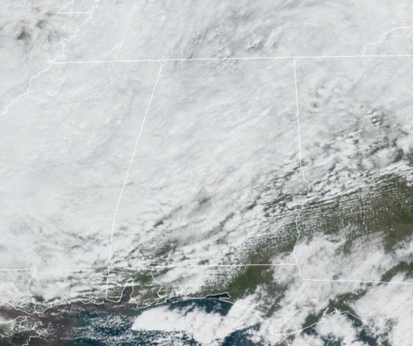
A deep, upper low is spinning just north of Alabama today and it is making it look and feel a lot like December verses October across Alabama. It remains cloudy and chilly, with air temperatures ranging from the upper 40s to lower 50s, which is more than 20 degrees below average for this time of year. Add in those breezy westerly winds of 10-20 mph, it feels even colder. We are also seeing areas of mist, drizzle, and light rain across the state today, making this a rather raw day for most of us.
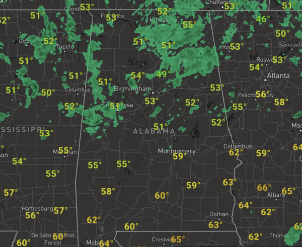
FRIDAY NIGHT LIGHTS: For the high school games tonight, the sky will be cloudy with some light rain possible; temperatures will hover around 50 degrees at most stadiums. Jackets and hot chocolate will be needed.
WORLD SERIES: For World Series game 3 tonight in Atlanta between the Braves and the Astros, the weather will be cloudy with occasional light rain or drizzle; temperatures will be in the low 50s. For game 4 tomorrow night, the sky will be mostly cloudy with only a small risk of a shower, temperatures will be in the 48-52 degree range. Then, for game 5 Sunday night, the sky will be clear with temperatures falling from the low 60s into the 50s during the game.
HALLOWEEN WEEKEND: Clouds and some light rain will linger into tomorrow, especially over the northern half of the state. Across South Alabama, we will forecast gradual clearing Saturday afternoon as the upper low begins to pull away. Saturday will stay cool with a highs holding in the 50s for much of North/Central Alabama, with 60s down towards the south. Sunday will be a much better day of weather as sunshine returns in full supply, we are forecasting temperatures to return to the upper 60s and lower 70s statewide
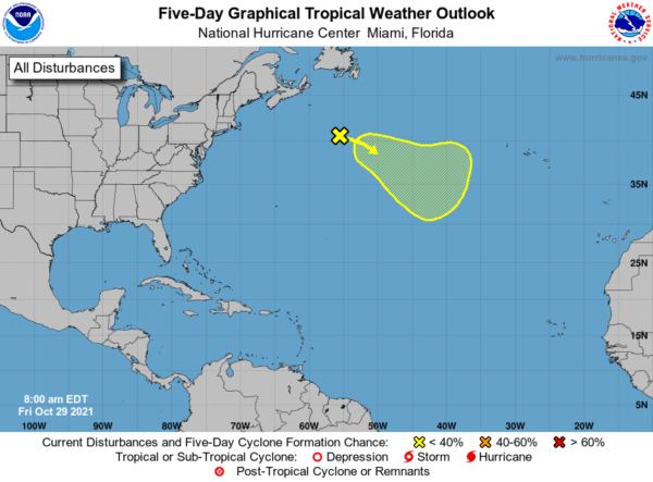
IN THE TROPICS: A strong low pressure system located several hundred miles south-southwest of Cape Race, Newfoundland is producing showers and a few thunderstorms. However, the low is still attached to a front and therefore remains nontropical. The low is expected to move eastward and then southeastward toward slightly warmer waters during the next few days, and it could lose its associated fronts and acquire some subtropical characteristics over the weekend or early next week while over the central Atlantic. Formation chance through 5 days…low…30 percent.
BEACH FORECAST CENTER: Get the latest weather and rip current forecasts for the beaches from Fort Morgan to Panama City on our Beach Forecast Center page. There, you can select the forecast of the region that you are interested in visiting.
WORLD TEMPERATURE EXTREMES: Over the last 24 hours, the highest observation outside the U.S. was 113.9F at Siteki, Swaziland. The lowest observation was -70.8F at Concordia, Antarctica.
CONTIGUOUS TEMPERATURE EXTREMES: Over the last 24 hours, the highest observation was 96F at Chino and Anaheim, CA. The lowest observation was 5F at Bridgeport, CA.
WEATHER ON THIS DATE IN 1956: A violent tornado, or series of tornadoes, moved along a path more than 100 miles in length from south of North Platte NE into Rock County NE. It was an unusually late occurrence so far north and west in the U.S. for such a storm.
Category: Alabama's Weather, ALL POSTS
About the Author (Author Profile)
Macon, Georgia Television Chief Meteorologist, Birmingham native, and long time Contributor on AlabamaWX. Stormchaser. I did not choose Weather, it chose Me. College Football Fanatic. @Ryan_StinnetSubscribe
If you enjoyed this article, subscribe to receive more just like it.


