Saturday Weather Xtreme — A Gray & Drizzly Saturday; Much Better on Sunday
THE CENTRAL ALABAMA WEEKEND: Skies will be mostly cloudy to cloudy across Central Alabama on this last Saturday of October, with light rain or drizzle possible over the northern portions, especially north of a line from Fayette to Columbiana to Alexander City. It will remain rather cool out there, with highs only reaching the upper 50s to the lower 60s. Sunday will be a much brighter and warmer day across the area, skies will become mainly sunny by the afternoon and highs in the upper 60s to the lower 70s. It will be cool for Trick-or-Treat time on Sunday evening, with clear skies and temperatures dropping into the mid to upper 50s by 7 pm.
NEXT WEEK: We’ll hang on to the cooler than normal temperatures on Monday, but skies will be bright and sunny. Highs will be in the mid-60s to the mid-70s. Same story for Tuesday, with highs in the lower 60s to the mid-70s.
A cold front will be working in our direction on Wednesday that will bring some clouds to the area and maybe a few showers during the late-night and overnight hours to the extreme northern parts of Central Alabama. We’ll stay dry throughout the daylight hours, with highs in the upper 50s to the lower 70s. Shower chances can be expected for Central Alabama through much of the day on Thursday as the front struggles to move through the area. Highs will be in the mid-50s to the lower 70s.
The front makes it through the area and on Friday we will have a mix of sun and clouds throughout the day. A stray shower is possible for the southern portions of Central Alabama, but nearly everyone in the area will be dry. Highs will be in the mid-50s to the mid-60s.
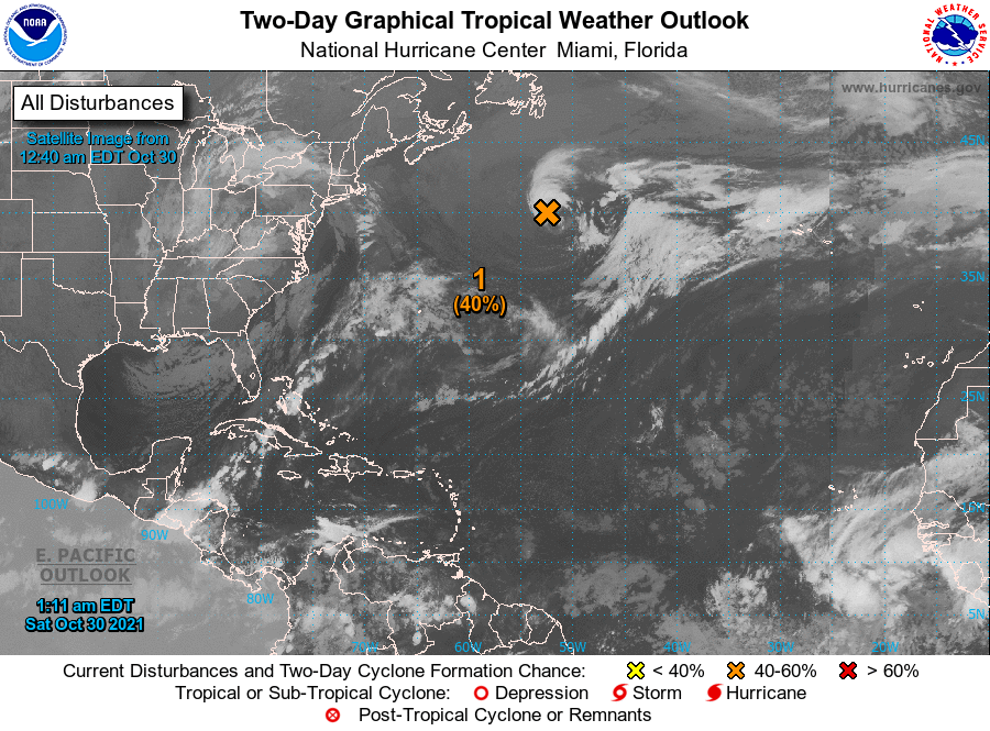
THE TROPICS: A strong low is located to the south of Newfoundland and is moving to the southeast into warmer waters in the Atlantic. Some subtropical development is possible over the weekend, and a subtropical storm may form by the start of the workweek. It is forecast to turn back northward by midweek. It is no threat to the US Mainland, and the rest of the Atlantic Tropical Basin is quiet.
Category: Alabama's Weather, ALL POSTS, Tropical, Weather Xtreme Videos
About the Author (Author Profile)
Scott Martin is an operational meteorologist, professional graphic artist, musician, husband, and father. Not only is Scott a member of the National Weather Association, but he is also the Central Alabama Chapter of the NWA president. Scott is also the co-founder of Racecast Weather, which provides forecasts for many racing series across the USA. He also supplies forecasts for the BassMaster Elite Series events including the BassMaster Classic.Subscribe
If you enjoyed this article, subscribe to receive more just like it.


