Midday Nowcast: Really Nice Fall Day
After the foggy start to the day, our Wednesday is featuring a generally sunny sky with highs in the low to mid 70s. Clouds increase tonight as a front approaches from the northwest and it will be warmer with lows in the mid 50s.
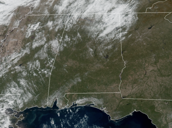
SOME SHOWERS TOMORROW: The cold front will move through the state tomorrow, and will produce some scattered showers across the state tomorrow, especially over the northern half of the state. Moisture will be very limited, and rain amounts should be under a quarter of an inch for most communities. Highs tomorrow will come earlier in the day with lows to mid 60s, then falling into the 50s through the afternoon.
FRIDAY AND THE WEEKEND: A much cooler air mass settles into the state Thursday night as lows fall well down into the 30s. Friday will be sunny and cool with highs in the 50s. Our coldest morning should be Saturday with widespread 30s, but we expect nice warm with abundant sunshine highs will return to the 60s. Sunday will remain dry with increasing clouds as some showers could return as early as Sunday evening. Highs Sunday will be in the 60s.
FRIDAY NIGHT LIGHTS: For the high school games Friday night, the sky will be clear with temperatures falling through the 40s, possibly reaching the upper 30s by the final whistle.
BEACH FORECAST CENTER: Get the latest weather and rip current forecasts for the beaches from Fort Morgan to Panama City on our Beach Forecast Center page. There, you can select the forecast of the region that you are interested in visiting.
WORLD TEMPERATURE EXTREMES: Over the last 24 hours, the highest observation outside the U.S. was 110.7F at Mariental, Namibia. The lowest observation was -60.3F at Concordia, Antarctica.
CONTIGUOUS TEMPERATURE EXTREMES: Over the last 24 hours, the highest observation was 93F at Rio Grande Village, TX. The lowest observation was -6F at Peter Sinks, UT.
WEATHER ON THIS DATE IN 1927: A tornado cut a seventeen mile path across Alexandria and southeastern Washington, DC, injuring 31 persons. The tornado struck the Naval Air Station where a wind gust of 93 mph was recorded. A waterspout was seen over the Potomac River ninety minutes later.
Category: Alabama's Weather, ALL POSTS
About the Author (Author Profile)
Macon, Georgia Television Chief Meteorologist, Birmingham native, and long time Contributor on AlabamaWX. Stormchaser. I did not choose Weather, it chose Me. College Football Fanatic. @Ryan_StinnetSubscribe
If you enjoyed this article, subscribe to receive more just like it.


