Sunday Forecast Update: Severe Weather Threat Overnight and Monday
Low clouds have been breaking up across all areas but Northeast Alabama late this morning. There are some high clouds streaming across the area from the southwest. I am kind of surprised at the amount of cumulus building the clear areas, showing ample moisture and warmth, and instability.
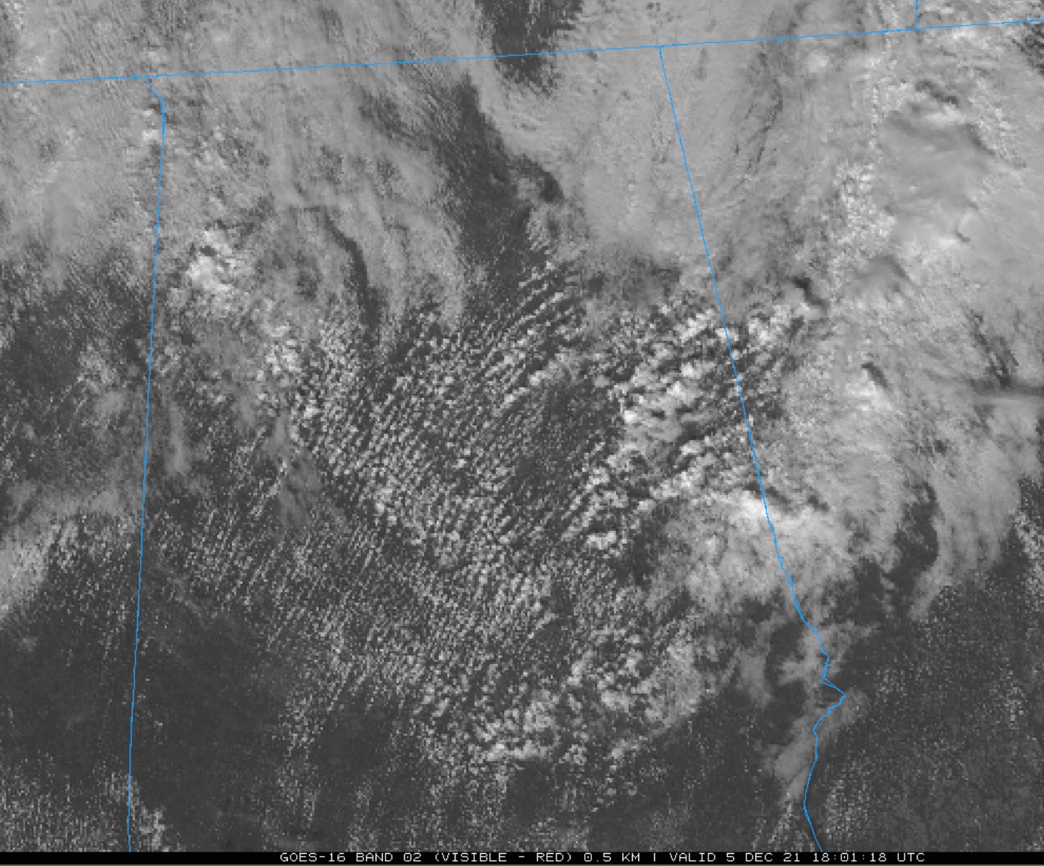
There could be a few isolated showers that show up from those showers this afternoon, but they shouldn’t be of much consequence.
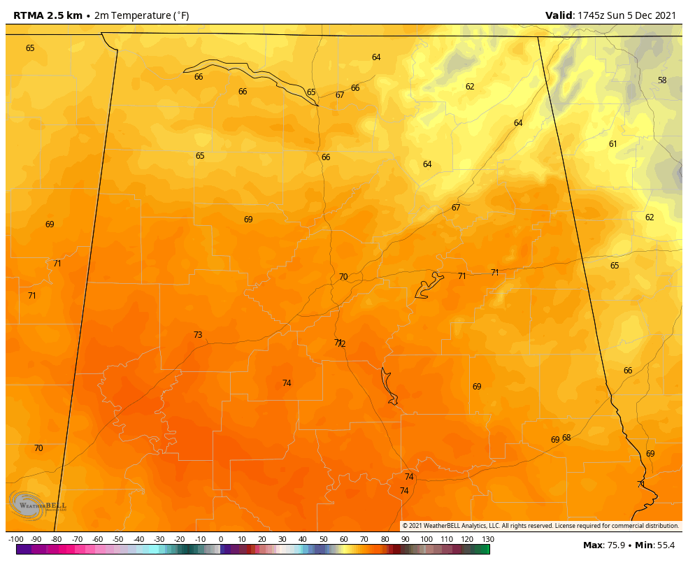
Temperatures are already above 70F in places where sunshine has been more abundant.
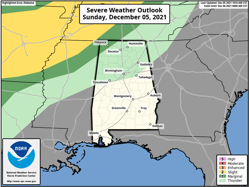
The SPC has a slight risk (2/5) severe weather risk for areas to our northwest. Instability and shear will be sufficient for severe storms late tonight across Arkansas, western Tennessee, and Kentucky. The storms should weaken before they get into Alabama, where the SPC has a marginal risk (1/5) overnight. There could be some damaging winds and QLCS tornadoes, especially over Arkansas.
So pay attention to tonight’s storm late. Check back for updates and make sure your WeatherRadio is plugged in, turned to alert mode, and has fresh batteries, just in case.
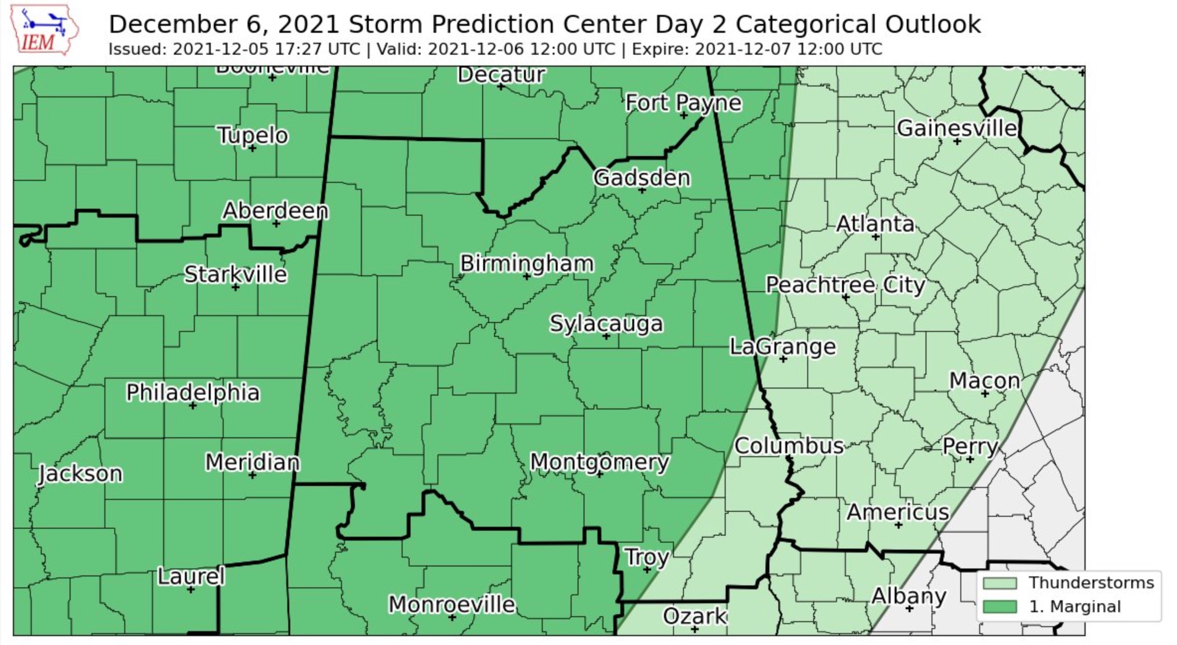
We might be underestimating tomorrow’s storms a bit. Perhaps their later arrival into Central Alabama will give them a little more oomph. This bears watching. Here is the SPC Day Two for Monday showing a marginal risk (1/5) over much of Central Alabama.
The rain and storms will rumble through during the morning. The band of rain and thunderstorms will spend the time from 5-10 a.m. covering the ground between Muscle Shoals and Birmingham. Rain should last between 2-3 hours and about 0.25-0.75 inches will fall. The rain should be south of Montgomery by 6 p.m. Skies should clear pretty quickly after 6 p.m. from the northwest, with most areas of North and Central Alabama clear by midnight. Much cooler and drier air will arrive through the afternoon and evening, and temperatures by Tuesday morning will be below freezing in most areas north of I-20. 30s will be common everywhere else. Winds will be brisk out of the northwest Monday night, gusting to nearly 20 mph at times.
Tuesday looks like it will be mostly cloudy with a few showers again. A band of rain moves in overnight, continuing into Wednesday morning. There could still be a few showers Thursday as it starts to warm back up, and Friday will be a warm, windy, and unsettled day with highs in the 70s. So will Saturday, with rain and strong storms Saturday night. Those storms could produce severe weather. We will be watching.
Have a great rest of your Sunday. We will keep an eye on the storms to our northwest tonihgt.
Category: Alabama's Weather, ALL POSTS
About the Author (Author Profile)
Bill Murray is the President of The Weather Factory. He is the site's official weather historian and a weekend forecaster. He also anchors the site's severe weather coverage. Bill Murray is the proud holder of National Weather Association Digital Seal #0001 @wxhistorianSubscribe
If you enjoyed this article, subscribe to receive more just like it.


