At Midday: Skies Clearing Out in the Northwest
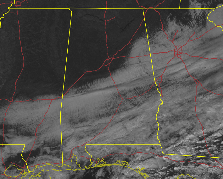
TODAY’S WEATHER: As of the 11 am roundup from the National Weather Service forecast office in Birmingham, temperatures have risen into the mid-40s to the upper 50s across Central Alabama as skies are clearing out. The latest satellite image shows that locations along and west of the I-59 corridor now have complete sunshine, with clouds over most of the areas east of I-59. Eufaula was the warm spot at 59 degrees, while the cool spot was Talladega at 46 degrees. Birmingham was at 49 degrees. The good news is that afternoon highs will make it up into the mid-50s to the mid-60s across the area this afternoon before the sun starts to set. Much of the area will have clear skies tonight except for the far southeastern locations as a few clouds may continue to linger around. Overnight lows will be in the mid-30s to the lower 40s.
THURSDAY’S WEATHER: Another wave of cloudiness and showers will begin to move into the western sections of Central Alabama late in the afternoon on Thursday, but skies will be partly to mostly clear before that. Afternoon highs will be up in the lower 60s in the northwest to the upper 60s to close to 70 degrees in the southeast.
SEVERE THREAT FOR THE START OF THE WEEKEND: We are still seeing decent agreement for the potential of strong to severe storms to move into the area during the very late night hours on Friday night and throughout much of the daylight hours on Saturday. For now, the main threats will be from damaging thunderstorm wind gusts up to 60 mph and a few tornadoes.
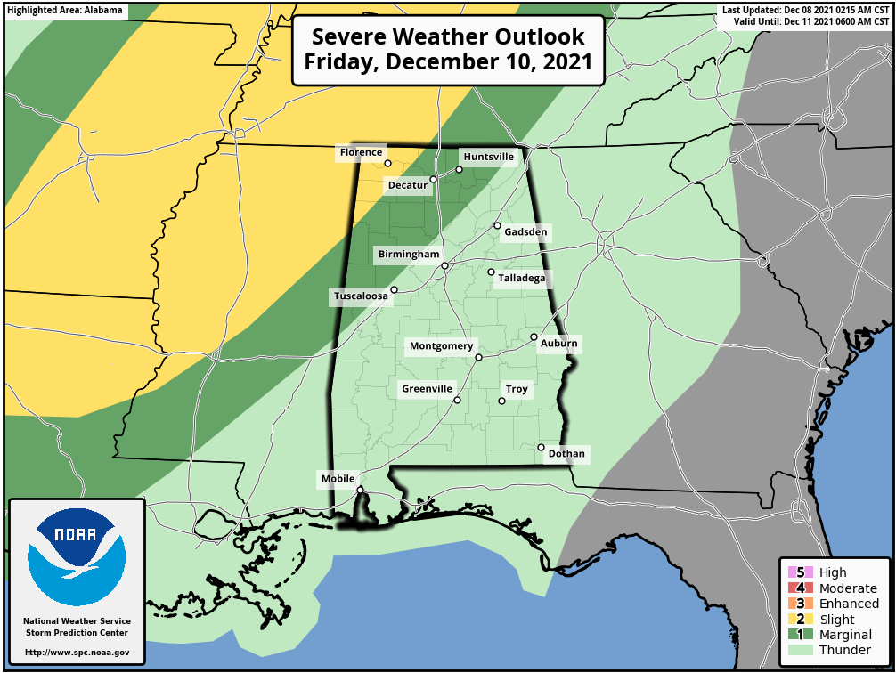
For now, the Storm Prediction Center does not have a defined risk for the day on Saturday, but they do have a Marginal Risk up for locations along and west of a line from Tuscaloosa to Scottsboro during the late-night hours on Friday and through the pre-dawn hours on Saturday. A Slight Risk is up for the extreme northwest corner of the state, especially for locations west of a line from Hamilton to Rogersville in Lauderdale Co. We’ll have a better idea on timing and what to expect as the high-resolution models come into view.
ON THIS DAY IN WEATHER HISTORY: 1989 – A winter storm spread snow and freezing rain across much of the Atlantic Coast Region, from Georgia to New Jersey. Snowfall totals ranged up to seven inches, at Stanton, VA and Tobacco, MD. Up to six inches of snow blanketed the mountains of northern Georgia. More than one hundred auto accidents were reported in Gwinnett County, GA.
Category: Alabama's Weather, ALL POSTS, Severe Weather
About the Author (Author Profile)
Scott Martin is an operational meteorologist, professional graphic artist, musician, husband, and father. Not only is Scott a member of the National Weather Association, but he is also the Central Alabama Chapter of the NWA president. Scott is also the co-founder of Racecast Weather, which provides forecasts for many racing series across the USA. He also supplies forecasts for the BassMaster Elite Series events including the BassMaster Classic.Subscribe
If you enjoyed this article, subscribe to receive more just like it.


