Warming Trend Ahead; Strong/Severe Storms Saturday Morning
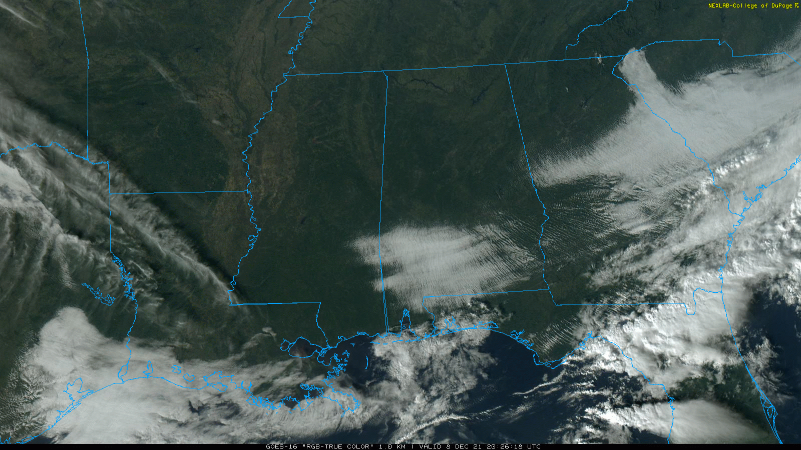
COOL, DRY AFTERNOON: As expected, the sky has cleared over much of Alabama this afternoon, and temperatures are mostly in the 55-60 degree range, right at seasonal averages for December 8. Tonight will be mostly fair and cold with a low in the 30s… colder spots will see a light freeze.
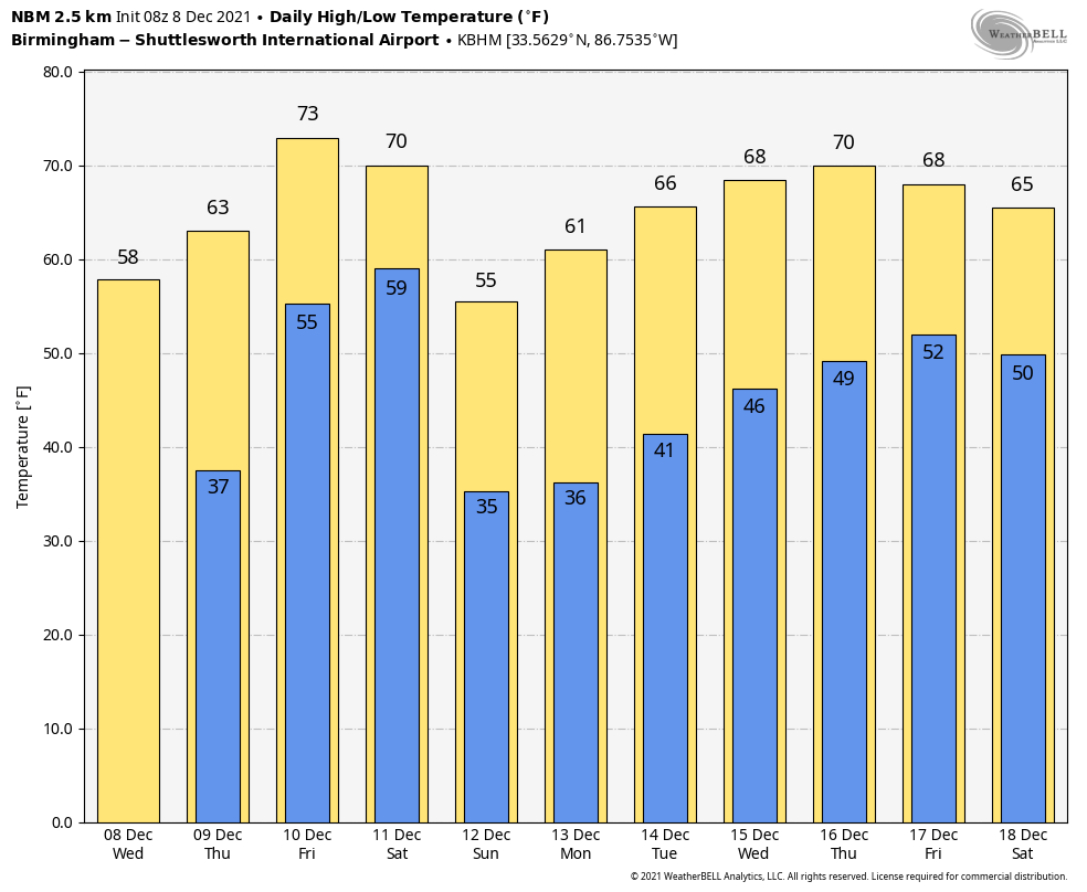
Look for a partly sunny sky tomorrow with a high in the 60s; we will mention just a small risk of an afternoon shower as moisture levels begin to rise. Then, on Friday, we hit the mid 70s, just below record levels. A few scattered showers or storms are possible Friday, but a decent part of the day will be dry with a good south breeze of 10-18 mph.
STRONG/SEVERE STORMS POSSIBLE AS THE WEEKEND BEGINS: A cold front will push an organized batch of rain and thunderstorms into Alabama after midnight Friday night into the daytime hours Saturday. SPC, in their “Day 3” severe weather outlook which runs through 6:00 a.m. Saturday, has a “slight risk” (level 2/5) defined for the northwest corner of the state, and a “marginal risk” (level 1/5) as far south as Scottsboro and Tuscaloosa.
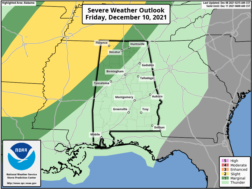
For now, SPC has not issued a formal severe weather outlook after 6:00 a.m. Saturday in their “Day 4” outlook, but it is likely they will issue at least a marginal risk in future outlooks for most of the rest of Alabama.
TIMING: The main window for strong to severe storms over the northern half of Alabama will come from 2:00 a.m. until 12:00 noon Saturday. During the afternoon hours the rain and storms will shift into the southern half of the state.
THREATS: The main threat will come from strong winds along an organized line of thunderstorms. A brief, isolated tornado or two within the line can’t be totally ruled out, however.
RAIN AMOUNTS: Most places will see rain amounts of around on inch with this system; flash flooding issues are not expected.
Temperatures will be mostly in the 60s Saturday… the sky will clear Saturday night as colder, drier air works into the state behind the front. Sunday will be a sunny day with a high between 55 and 60 degrees.
NEXT WEEK: A strong upper high will build over the Gulf Coast region next week, meaning dry conditions with pleasant afternoons. Highs will be mostly in the 60s through the week, but we could approach 70 by Thursday and Friday. And, the latest CPC outlook suggests temperatures will be above average here December 16-22. Still too early to call the weather for Christmas… See the Weather Xtreme video for maps, graphics, and more details.
ON THIS DATE IN 1935: From the Monthly Weather Review for December 1935, “The outstanding flood of December 1935 was the record-breaking overflow of Buffalo and White Oak Bayous at Houston, Texas on the 8 and 9th. This destructive flood was caused by excessive rainfall over Harris County, Texas during a 42 hour period on the 6th, 7th, 8th, with amounts ranging from 5.50 inches at Houston” to 16.49 inches at the Humble Oil Company in the northwestern part of Harris County.
ON THIS DATE IN 2017: Significant snow fell across a large portion of Central Alabama along a southwest-to-northeast axis. This snow fell from December 8th into December 9th. Within the main corridor of snow, totals of 4 to 8 inches were common, with a few swaths of 8 to 12 inches. A few reports exceeding 12 inches were received from Clay into Cleburne Counties: one 15 inch report in Delta (Clay Co.), and two 13 inch reports (Cleburne Co.). While public reports are considered unofficial, values were fairly consistent and tend to indicate this event was a top-tier ranking snowstorm for some locations in East Alabama. Birmingham officially recorded 4 inches of snow, making it the 3rd snowiest December on record.
BEACH FORECAST: Click here to see the AlabamaWx Beach Forecast Center page.
WEATHER BRAINS: Don’t forget you can listen to our weekly 90 minute show anytime on your favorite podcast app. This is the show all about weather featuring many familiar voices, including our meteorologists here at ABC 33/40.
CONNECT: You can find me on all of the major social networks…
Look for the next Weather Xtreme video here by 6:00 a.m. tomorrow.
Category: Alabama's Weather, ALL POSTS, Weather Xtreme Videos
About the Author (Author Profile)
James Spann is one of the most recognized and trusted television meteorologists in the industry. He holds the AMS CCM designation and television seals from the AMS and NWA. He is a past winner of the Broadcast Meteorologist of the Year from both professional organizations.Subscribe
If you enjoyed this article, subscribe to receive more just like it.


