Radar Check at 2 p.m. Plus Severe Weather over South Alabama
Severe weather threat area drawn in the pink
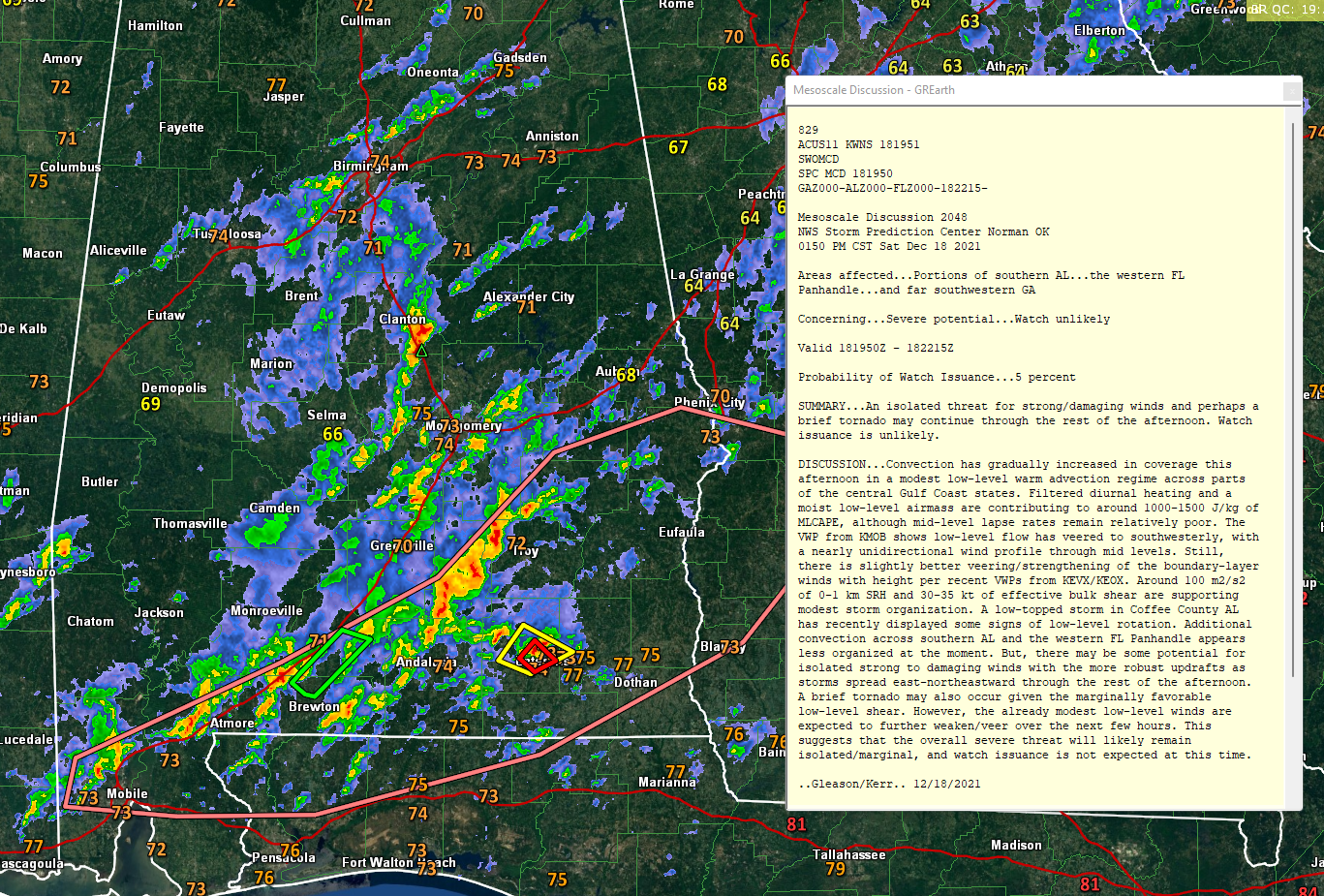
Thunderstorms are increasing at this hour across mainly Southeast Alabama.
There was a severe thunderstorm and even a tornado warning for the area just northwest of Enterprise in the past 30 minutes.
Storms are strongest over parts of Bullock, Pike, Montgomery, Crenshaw, and Covington Counties.
A Flash Flood Warning is in effect for areas just southeast of I-65 in parts of Escambia and Conecuh Counties.
Further north, in Central Alabama, a fairly strong storm is southwest of Rockford in Coosa County. It will move over Rockford and toward Alex City.
The SPC has weighed in saying there will be a marginal, isolated severe threat across southern Alabama over the next few hours, including damaging wind gusts and an isolated tornado or two. They do not anticipate having to issue a watch.
Category: Alabama's Weather, ALL POSTS
About the Author (Author Profile)
Bill Murray is the President of The Weather Factory. He is the site's official weather historian and a weekend forecaster. He also anchors the site's severe weather coverage. Bill Murray is the proud holder of National Weather Association Digital Seal #0001 @wxhistorianSubscribe
If you enjoyed this article, subscribe to receive more just like it.


