Areal Flood Advisory for Parts of Jefferson Co. Extended Until 9:45 am
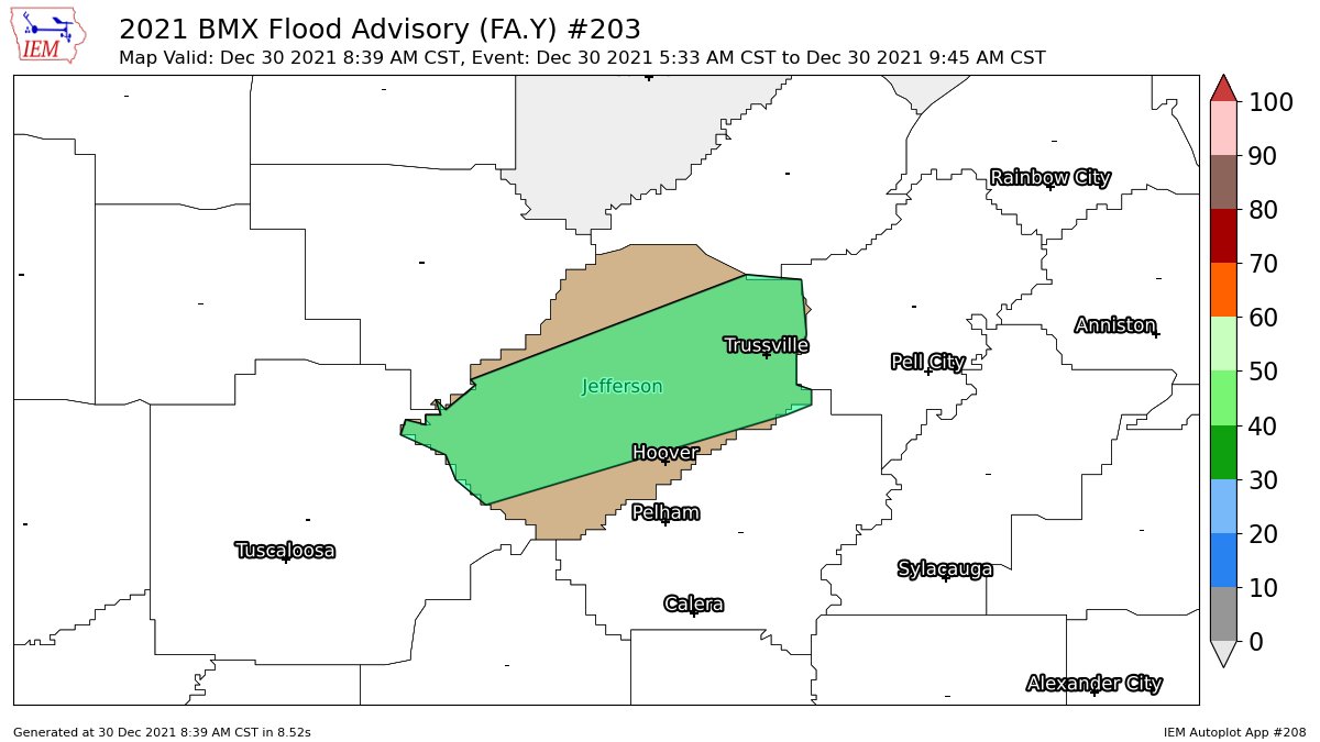
…FLOOD ADVISORY NOW IN EFFECT UNTIL 945 AM CST THIS MORNING…
* WHAT…Urban and small stream flooding caused by excessive
rainfall continues.
* WHERE…A portion of central Alabama, including the following
county, Jefferson.
* WHEN…Until 945 AM CST.
* IMPACTS…Minor flooding in low-lying and poor drainage areas.
Overflowing poor drainage areas. Ponding of water in urban or
other areas is occurring or is imminent.
* ADDITIONAL DETAILS…
– At 836 AM CST, Doppler radar and automated rain gauges
indicated heavy rain due to earlier thunderstorms has
produced rises in area streams. This will cause urban and
small stream flooding.
– Some additional rainfall will be possible over the next hour
although any accumulation amounts are expected to be light.
– Some locations that will experience flooding include…
Birmingham, Hoover, Vestavia Hills, Bessemer, Homewood,
Mountain Brook, Trussville, Hueytown, Gardendale, Irondale,
Leeds, Moody, Fairfield, Fultondale, Center Point, Pleasant
Grove, Clay, Pinson, Tarrant and Midfield.
PRECAUTIONARY/PREPAREDNESS ACTIONS…
Turn around, don’t drown when encountering flooded roads. Most flood
deaths occur in vehicles.
Be especially cautious at night when it is harder to recognize the
dangers of flooding.
Be aware of your surroundings and do not drive on flooded roads.
In hilly terrain there are hundreds of low water crossings which are
potentially dangerous in heavy rain. Do not attempt to cross flooded
roads. Find an alternate route.
Category: Alabama's Weather, ALL POSTS
About the Author (Author Profile)
Scott Martin is an operational meteorologist, professional graphic artist, musician, husband, and father. Not only is Scott a member of the National Weather Association, but he is also the Central Alabama Chapter of the NWA president. Scott is also the co-founder of Racecast Weather, which provides forecasts for many racing series across the USA. He also supplies forecasts for the BassMaster Elite Series events including the BassMaster Classic.Subscribe
If you enjoyed this article, subscribe to receive more just like it.


