A Brief Check on Our Weather Just After 6 pm
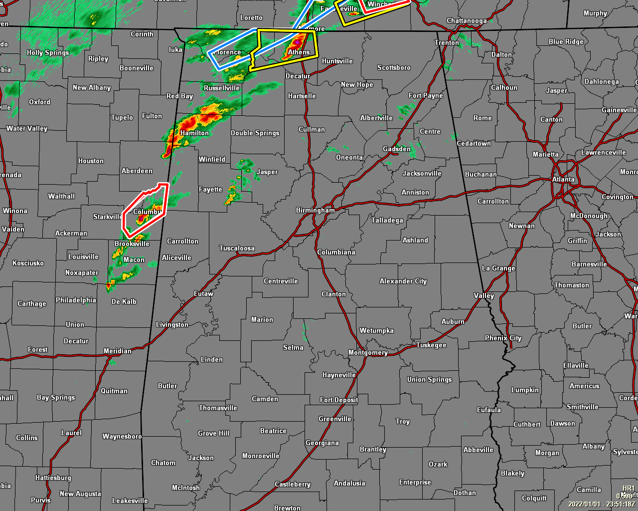
At 5:53 pm, if you are south of the I-20 corridor in the southern half of the area, or east of the I-65 corridor in the northern half of the area, your day has been relatively quiet so far. However, strong to severe storms continue to move northeastward out of Mississippi into and through the northwestern quarter of the area.
While a few of these storms have garnered severe thunderstorm warnings, no tornado warnings have been issued so far tonight. Thanks in part to the cap that has kept those storms from growing tall into the atmosphere. Unfortunately, the latest sounding from UAH now shows that the cap has been broken, and we’ll have to watch closely for rotating updrafts with any discrete cell out there or that forms over the next few hours ahead of the main squall line.
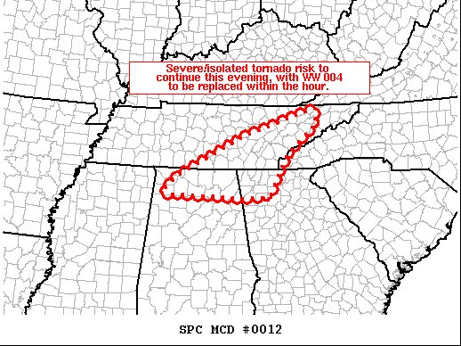
The latest Mesoscale Discussion just released from the SPC states that the severe thunderstorm and isolated tornado risk continues over the northern parts of North Alabama and up into eastern Tennessee and the northwestern corner of Georgia. A new watch will be issued soon, replacing the Tornado Watch that expires at 7 pm for Colbert, Franklin, Jackson, Lauderdale, Lawrence, Limestone, Madison, and Morgan counties.
Instability has climbed to as high as 1000-1500 J/kg, giving the storms enough fuel to build and thrive on. Wind shear is ranging from 60-80 knots from south to north across the area, and combine that with helicity values ranging from 250-350 m2/s2, we definitely have the ingredients in place for rotating updrafts. Significant tornado parameters are also ranging from 1-4 from east to west, showing the better probabilities of tornadoes being possible over the western parts of the area, with the potential of one of those becoming a significant tornado of ef-2 strength or greater.
The main timing for the threat of severe storms has started in the northwestern parts of the area and will end around midnight, from 8 pm tonight through 3 am Sunday morning for the locations along and just south of the I-59 corridor, and from 1 am through 8 am Sunday morning for the southern and southeastern parts of the area.
Bill Murray will be stepping in for me for a couple of hours to do coverage and to give me a little break. I’ll be back at 8 pm, unless it really gets active in the warning department.
Category: Alabama's Weather, ALL POSTS, Severe Weather
About the Author (Author Profile)
Scott Martin is an operational meteorologist, professional graphic artist, musician, husband, and father. Not only is Scott a member of the National Weather Association, but he is also the Central Alabama Chapter of the NWA president. Scott is also the co-founder of Racecast Weather, which provides forecasts for many racing series across the USA. He also supplies forecasts for the BassMaster Elite Series events including the BassMaster Classic.Subscribe
If you enjoyed this article, subscribe to receive more just like it.


