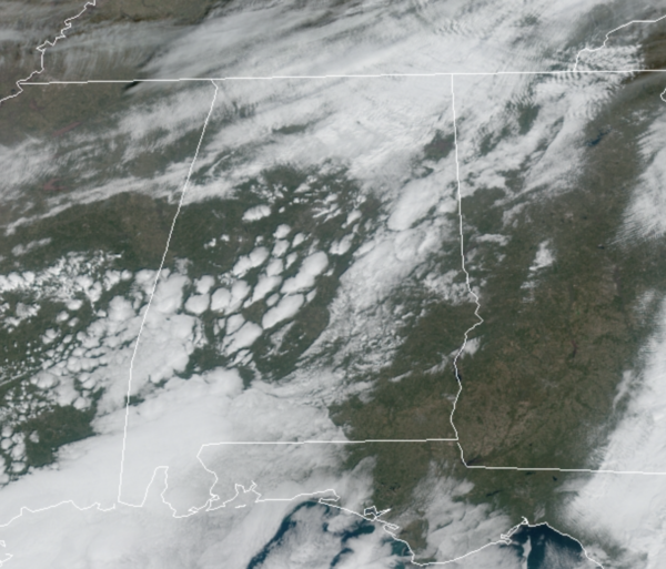
Midday Nowcast: Clouds Increase Through the Afternoon
We are seeing a mix of sun and clouds today, but clouds will be increasing as we head through the rest of today. Despite the clouds, we will remain dry with temperatures in the mid 50s.
WINTER WEATHER MISCHIEF: Another cold front will bring periods of light rain to the state tomorrow, and for Central Alabama it will only be a cold rain as temperatures hold in the 40s. As the precipitation begins, there will likely be an area of sleet and freezing rain across North Alabama. Through the day, it will transition to a cold rain as temperatures warm. However, as the cold air rushes in behind the front, we are likely to see another transition to wintry precip with sleet, freezing rain, and snow likely over North Alabama tomorrow evening.
The areas of main impact for now are along and north of the U.S. 278 corridor from Sulligent to Cullman to Attalla. The highest chance of travel impact (icy bridges) will be along and north of the Tennessee River, however. A few snow flurries are possible tomorrow evening as far south as I-20, but we expect no impact for places like Tuscaloosa/Birmingham/Anniston at this point. It will be a cold and blustery afternoon as temperatures will drop into the 30s by the afternoon.
FRIDAY: Very cold air flows into Alabama tomorrow night behind the front, and by Friday morning, we should see lows down
in the teen and 20s across the northern half of the state; wind chills could be closer to 10°. Friday will be sunny and cold with highs in the upper 30s and lower 40s.
THE ALABAMA WEEKEND: Saturday morning will be cold with lows back in the 20s, but the day will be sunny and warmer with highs back in the mid-50s. Clouds begin to increase Saturday night ahead of the next front that will bring rain and some storms back to Alabama on Sunday. Severe storms are not in the forecast and highs Sunday will be in the low 60s.
NEXT WEEK: Rain ends early in the morning Monday, with a slowly clearing sky, it stays cold with highs in the 40s. Most of the week looks dry, although rain looks to return late Thursday or Friday as another cold front approaches. Temperatures next week look fairly seasonal with highs most days in the 50s, and lows in the 30s.
BEACH FORECAST CENTER: Get the latest weather and rip current forecasts for the beaches from Fort Morgan to Panama City on our Beach Forecast Center page. There, you can select the forecast of the region that you are interested in visiting.
WORLD TEMPERATURE EXTREMES: Over the last 24 hours, the highest observation outside the U.S. was 114.1F at Rabbit Flat, Australia. The lowest observation was -68.1F at Ekychchyu, Russia.
CONTIGUOUS TEMPERATURE EXTREMES: Over the last 24 hours, the highest observation was 81F at Miles City, FL. The lowest observation was -23F at Hinsdale, MT.
WEATHER ON THIS DATE IN 1982: A three day rainstorm in the San Francisco area finally came to an end. Marin County and Cruz County were drenched with up to 25 inches of rain, and the Sierra Nevada Range was buried under four to eight feet of snow. The storm claimed at least 36 lives, and caused more than 300 million dollars damage.
Category: Alabama's Weather, ALL POSTS


