A Brief Midday Check on Our Weather Situation
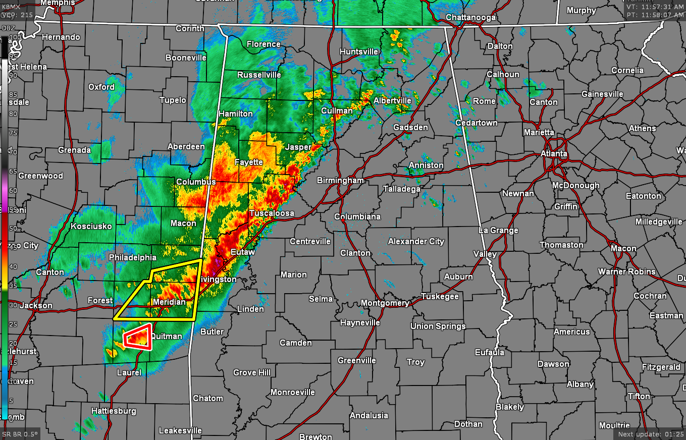
A line of rain with embedded thunderstorms currently stretches roughly from Arab to Tuscaloosa to Livingston. While gusty winds are being experienced in portions of Sumter and Greene counties, no severe weather is occurring in Central Alabama.
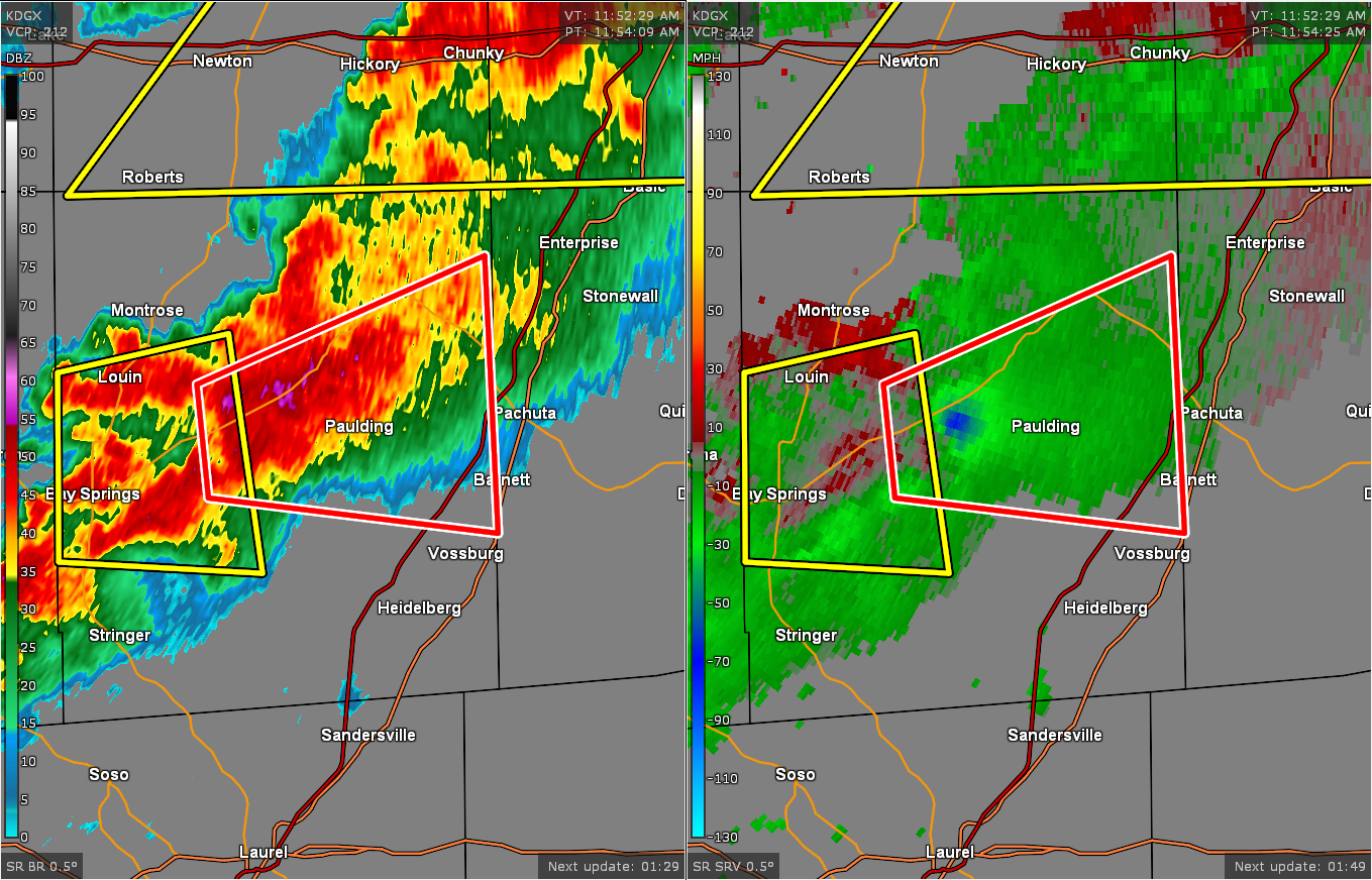
A tornado warning is in effect for portions of Jasper County in Mississippi until 12:30 pm for a cell showing a good bit of rotation. This cell is moving eastward in the direction of Paulding and Orange at 35 mph.
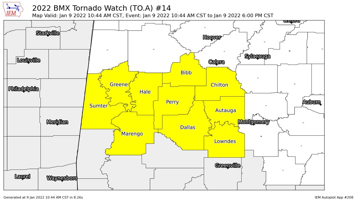
A Tornado Watch is in effect until 6 pm this evening for the following counties in Central Alabama: Autauga, Bibb, Chilton, Dallas, Greene, Hale, Lowndes, Marengo, Perry, and Sumter.
We will have to watch and see if the more moisture-rich air located over the southern parts of the state can move into the area before the line of storms make it. If that occurs, then we’ll have to watch for an increased risk of a few tornadoes. If it doesn’t occur, then the severe threat will mostly be damaging wind gusts.
Dewpoints are climbing in the southwestern parts of the area. Demopolis and Selma are both up to 63 degrees. Prattville is up to 60. Montgomery and Troy are up to 61 degrees. The good news for now is that the STP values remain below 1.0 for Central Alabama at this point.
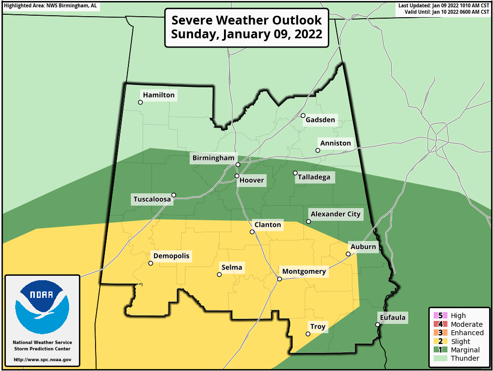
SPC continues a Slight Risk for severe storms roughly along and south of a line from Panola (Sumter Co.) to Jemison (Chilton Co.) to Opelika (Lee Co.) and along and west of a line from Opelika to Comer (Barbour Co.) to Spring Hill (Pike Co.). A Marginal Risk continues for locations along and south of a line from Fayette (Fayette Co.) to Fultondale (Jefferson Co.) to Woodland (Randolph Co.).
Timing for the threat of severe storms across the risk locations will be from now through 9 pm tonight from west to east.
Category: Alabama's Weather, ALL POSTS, Severe Weather
About the Author (Author Profile)
Scott Martin is an operational meteorologist, professional graphic artist, musician, husband, and father. Not only is Scott a member of the National Weather Association, but he is also the Central Alabama Chapter of the NWA president. Scott is also the co-founder of Racecast Weather, which provides forecasts for many racing series across the USA. He also supplies forecasts for the BassMaster Elite Series events including the BassMaster Classic.Subscribe
If you enjoyed this article, subscribe to receive more just like it.


