A Brief Check on Our Weather at 2:30 pm
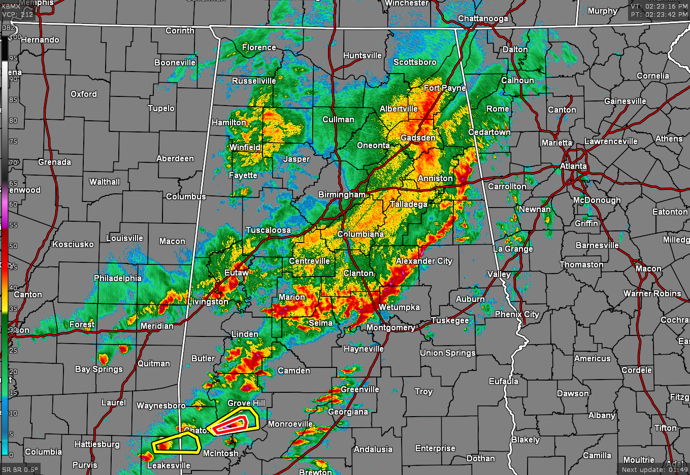
RADAR CHECK AT 2:23 PM: The main line of rain and thunderstorms stretches from Fruithurst back to the southwest through Alexander City to Autaugaville, before the activity become semi-discrete through the southern portions of Marengo County and into the extreme southwestern portions of the state. So far, the storms in Central Alabama have stayed below severe criteria, but the threat is still there for a brief tornado and damaging wind gusts up to 60 MPH along and ahead of that line of storms.
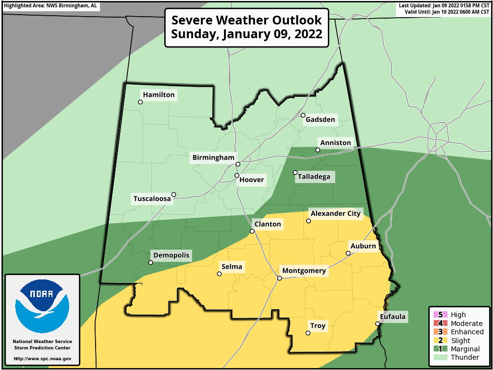
The Slight Risk has been shifted on this latest update to include the cities of Selma, Clanton, Alexander City, Montgomery, Troy, Auburn, Eufaula, and points in-between. A Marginal Risk has also been shifted and includes the cities of Demopolis, Talladega, and Anniston.
Dewpoints continue to rise in the south and southwestern parts of the area, with Selma having the highest at 66 degrees at this time.
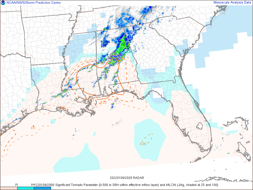
The good news is that the STP values remain around 1.0 and less for much of the southern half of the area, which means for now, the tornado threat remains low. However, the threat remains, along with damaging wind gusts up to 60 mph.
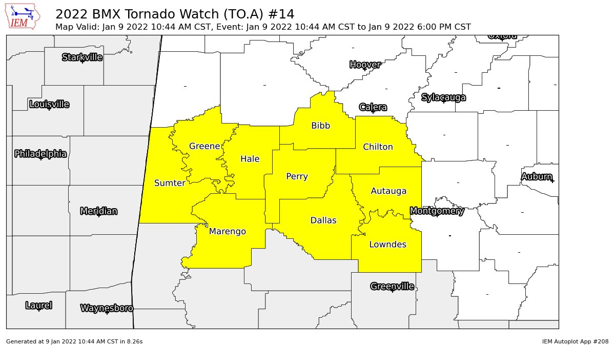
A Tornado Watch remains in effect until 6 pm for the following counties in Central Alabama: Autauga, Bibb, Chilton, Dallas, Greene, Hale, Lowndes, Marengo, Perry, and Sumter.
Category: Alabama's Weather, ALL POSTS, Severe Weather
About the Author (Author Profile)
Scott Martin is an operational meteorologist, professional graphic artist, musician, husband, and father. Not only is Scott a member of the National Weather Association, but he is also the Central Alabama Chapter of the NWA president. Scott is also the co-founder of Racecast Weather, which provides forecasts for many racing series across the USA. He also supplies forecasts for the BassMaster Elite Series events including the BassMaster Classic.Subscribe
If you enjoyed this article, subscribe to receive more just like it.


