SPC Mesoscale Discussion — A New Tornado Watch Not Likely
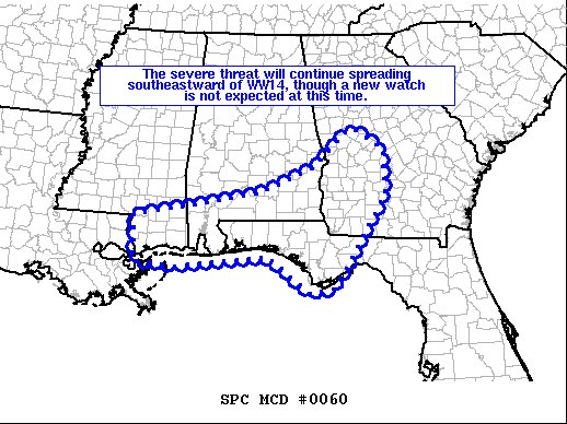
SUMMARY… The severe threat will continue spreading southeastward of the active Tornado Watch, though the localized and brief nature of the threat will likely preclude watch issuance.
DISCUSSION… Scattered thunderstorms will continue spreading southeastward into parts of southeastern MS, southern AL, the FL Panhandle, and southwest GA over the next few hours, where a moist boundary-layer (lower 70s dewpoints) and southerly surface winds are contributing to moderate surface-based instability. VWPs across the pre-convective warm sector indicate favorable low-level hodographs, with 0-1 km SRH of 150-200 m2/s2 and 0-6 km bulk shear of 50-60 knots. These factors may support a brief continuation of organized convection prior to being undercut, with a mix of supercell structures and linear segments possible. The primary risk will be isolated wind damage, though a brief tornado will also be possible with any discrete and longer-lived convection. At this time, a new watch is not anticipated owing to the localized and brief nature of the threat.
Category: Alabama's Weather, ALL POSTS, Severe Weather
About the Author (Author Profile)
Scott Martin is an operational meteorologist, professional graphic artist, musician, husband, and father. Not only is Scott a member of the National Weather Association, but he is also the Central Alabama Chapter of the NWA president. Scott is also the co-founder of Racecast Weather, which provides forecasts for many racing series across the USA. He also supplies forecasts for the BassMaster Elite Series events including the BassMaster Classic.Subscribe
If you enjoyed this article, subscribe to receive more just like it.


