

Updating the Alabama Weather Situation as of 4:45 p.m.
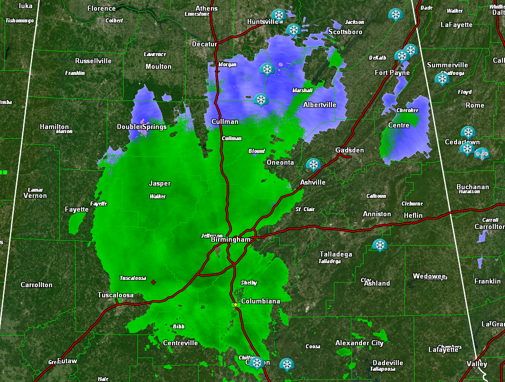
A mix of precipitation continues across parts of North, Northwest, and Central Alabama late this afternoon. North of a line from Double Springs, to Cullman, to Ashville to Heflin, it is snow. South of there it is rain.
The heaviest snow has been over Northeast Alabama, with 4 inches at Gurley in Madison County, 4 inches at Valley Head, and 4 inches at Mentone. There is 2 inches at Union Grove in Marshall County. This means the Winter Storm Warning has verified pretty well. There is 1 inch at Baileyton in Northeast Cullman County. Roads are slippery where they are snowcovered, and the situation will not improve overnight.
Elsewhere, north of I-59, the precipitation will change to snow if it is not already falling that way in some areas before ending.
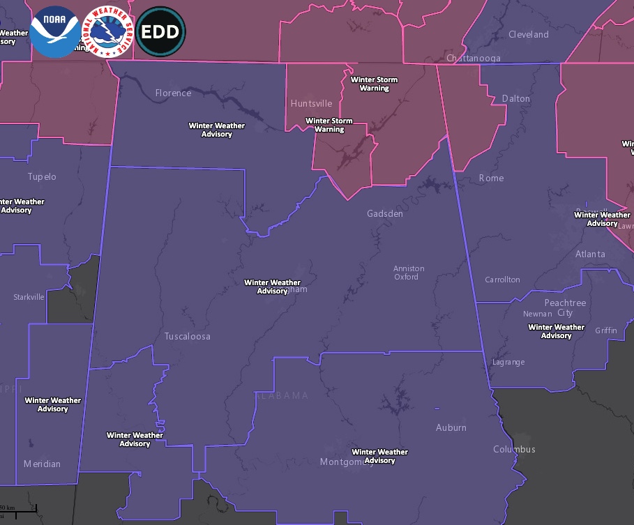
The Winter Storm Warning continues for Northeast Alabama’s Madison, Marshall, DeKalb, and Jackson Counties. Winter Weather Advisories drape the rest of North and parts of central Alabama. Driving could be hazardous in these counties overnight as precipitation freezes on roads.
Category: Alabama's Weather, ALL POSTS, Winter Weather
About the Author (Author Profile)
Bill Murray is the President of The Weather Factory. He is the site's official weather historian and a weekend forecaster. He also anchors the site's severe weather coverage. Bill Murray is the proud holder of National Weather Association Digital Seal #0001 @wxhistorianSubscribe
If you enjoyed this article, subscribe to receive more just like it.


