Midday Nowcast: Mild Wednesday; Big Changes Arrive Tonight
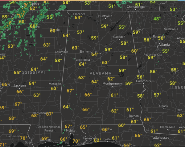
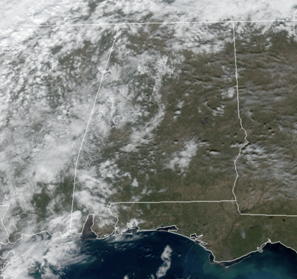
Temperatures this afternoon are heading into the upper 50s and lower 60s…enjoy these temps, because today will likely be the warmest day for the rest of the month. Clouds are on the increase today, and rain will arrive in Northwest Alabama late in the day with widespread rain statewide tonight.
Overnight, the front will push south and that will allow for a complex forecast tomorrow through Friday.
FOR TOMORROW: Much colder air spills into North Alabama overnight and continues to spill south through the morning hours. There could be enough lingering moisture for some light freezing rain or freezing drizzle over the northern third of the state. Not expecting widespread issues, but travelers need to be aware of that potential, especially on bridges over the northern part of the state. A cold rain will fall on the rest of the state, ending from north to south during the day. Temperatures will hold in the 30s, for much of North/Central Alabama, while lows 40s are expected to the south. Also, it will feel colder as winds will be gusty at times.
FOR FRIDAY: The front stalls to the south, and that will allow for a wave of low pressure to ride along the front, overspreading moisture back into the cold air mass in place late Thursday night and early Friday.
With the cold air in place, a period of freezing rain is likely Friday morning in a broad area of South and Southwest Alabama stretching from Mobile to Monroeville to Montgomery to Lafayette. This won’t be a crippling ice storm, but it could lead to some bridge icing in that part of the state, and if you area traveling over the southwest or central part of Alabama be aware of that potential during the morning hours. During the day, the precip should be all liquid as temperatures climb into the mid and upper 30s. However, as colder air flows into the state, we could see snow showers and flurries over North/Central Alabama, especially in eastern sections of the state. Major winter weather issues are expected east of Alabama across Georgia and Carolinas. Again, Friday will be cold with most locations remaining in the 30s all day.?
Of course, there remains model differences, and make sure you check back for updates over the coming days as the forecast will likely change some…
COLD WEEKEND WEATHER: Temperatures will remain below average for this weekend, but both days should be dry. Highs will be in the 40s and lows in the low and mid 20s both days, and for now will feature a mix of sun and clouds.
?BEACH FORECAST CENTER: Get the latest weather and rip current forecasts for the beaches from Fort Morgan to Panama City on our Beach Forecast Center page. There, you can select the forecast of the region that you are interested in visiting.
WORLD TEMPERATURE EXTREMES: Over the last 24 hours, the highest observation outside the U.S. was 109.8F at Geraldton Airport, Australia. The lowest observation was -58.4F at Delyankir, Russia.
CONTIGUOUS TEMPERATURE EXTREMES: Over the last 24 hours, the highest observation was 85F at Falcon Lake and Rio Grande Village, TX. The lowest observation was -20F at Clayton Lake, ME.
WEATHER ON THIS DATE IN 1977: Snowflakes were observed at Homestead and Miami Beach in extreme southern Florida.
Category: Alabama's Weather, ALL POSTS
About the Author (Author Profile)
Macon, Georgia Television Chief Meteorologist, Birmingham native, and long time Contributor on AlabamaWX. Stormchaser. I did not choose Weather, it chose Me. College Football Fanatic. @Ryan_StinnetSubscribe
If you enjoyed this article, subscribe to receive more just like it.


