Clouds in the Northwest & Southeast; We’re Stuck In the Middle with Sunshine
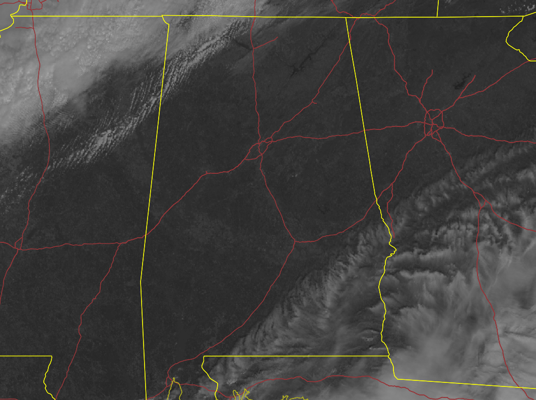
As of 11:07 am, skies across much of Central Alabama are bright and sunny, with the only clouds showing up on satellite across the extreme southeastern parts of the area south of I-85 and the extreme northwestern parts of the area. However, those clouds will move in from the west and northwest and will eventually block out most of that sunshine this afternoon and hide the stars as we move into the evening hours. We are continuing to see a dry trend for the remainder of the day, but could we squeeze out a few flurries or sprinkles late today and tonight? Just a small few of us in the extreme north and northwestern parts may see that happen. Highs today will range from the upper 40s in the northwest to the upper 60s in the southeast, while lows will drop into the lower 20s to the upper 30s.
A few clouds may linger around Central Alabama on Sunday morning, but we are expecting those to be out of here by midday, leaving us with cobalt blue skies. It will be a cool day across the area, but not too bad, reaching the mid 40s to the mid 50s.
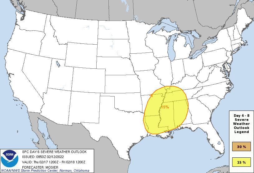
As I mentioned in this morning’s Weather Xtreme post and video, the SPC has the equivalent of a Slight Risk for severe storms up for all of North Alabama and much of Central Alabama on Thursday as a strong cold front will move through the area. Severe storms will be possible across the area, but the details on specific locations and timing remains uncertain at this time. We’ll have a much better idea over the next few days, especially when the high-res models start to come into play. Now is the time to be prepared. Stay tuned for further updates throughout the weekend and into next week.
Category: Alabama's Weather, ALL POSTS, Severe Weather
About the Author (Author Profile)
Scott Martin is an operational meteorologist, professional graphic artist, musician, husband, and father. Not only is Scott a member of the National Weather Association, but he is also the Central Alabama Chapter of the NWA president. Scott is also the co-founder of Racecast Weather, which provides forecasts for many racing series across the USA. He also supplies forecasts for the BassMaster Elite Series events including the BassMaster Classic.Subscribe
If you enjoyed this article, subscribe to receive more just like it.


