A Brief Cool Down for the Weekend; Severe Storms Possible on Thursday
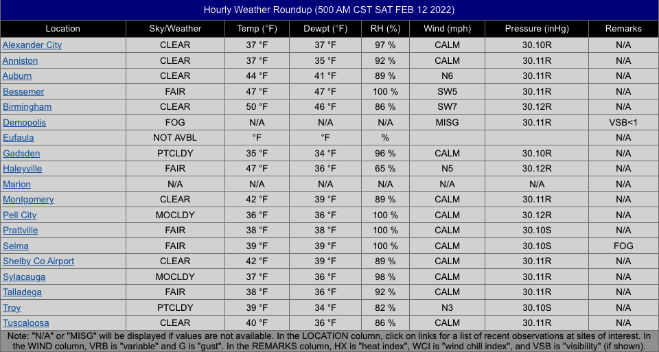
Temperatures as of the 5 am roundup were in the mid-30s to the lower 50s across Central Alabama. Birmingham was the warm spot at 50 degrees. Gadsden was the cold spot at 35 degrees. And as you can see, we have a mix of reports coming in with partly to mostly cloudy skies in Gadsden, Pell City, Sylacauga, and Troy, with the rest of the stations reporting clear or fair skies. Demopolis was reporting fog at this time.
TODAY: A cold front will move through Central Alabama today that will bring some mid to upper level clouds to the area, but any precipitation will be hard to find with this system. A few light sprinkles or very light showers may be possible over the far north and northwestern parts of the state. It is still possible that a few flurries could fall over those areas later this evening as temperatures drop, but no issues are expected at all. Afternoon temperatures will range from the upper 40s to the lower 70s from northwest to southeast.
SUNDAY: A deep trough will be over the area on Sunday, along with high pressure. Skies will clear out and winds will be out of the north, reinforcing that cooler air. Highs will be in the mid-40s to the lower 50s.
MONDAY-WEDNESDAY: The trough moves out and ridging starts to build over Central Alabama on Monday, that will lead to sunny skies and warmer temperatures. Highs will be in the mid to upper 50s. Much warmer temperatures on Tuesday can be expected underneath sunny skies, as highs will be in the lower to mid 60s. An ample southerly flow will set up over Central Alabama on Wednesday that will allow for moist and warm air to move into the area. Skies will be mostly sunny through the daylight hours, but clouds will really begin to move into the area by sunset. Showers will move into the area, becoming likely after midnight. Highs will be in the upper 60s to the lower 70s.
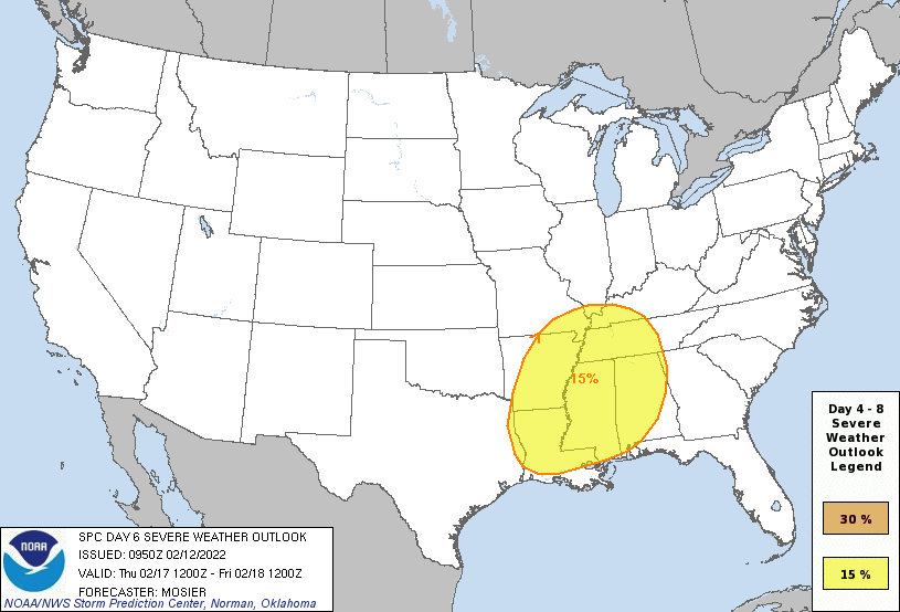
SEVERE STORMS POSSIBLE ON THURSDAY: A strong cold front will move into the area as a surface low will be pushing through the Ohio Valley region. That will bring rain and storms to the area, some of which could be strong to severe. The Storm Prediction Center has much of Alabama, along with all of Mississippi, a good part of Louisiana and Arkansas, and the western half of Tennessee in a 15% risk for severe weather, which equals a level 2/5 slight risk. While we are too far out to determine the exact timing and threats with this system, early signs are showing that damaging winds and a brief tornado or two will be possible. We’ll get that nailed down for you as we get a little closer to the event. Highs will top out in the upper 60s to the mid-70s.
FRIDAY: Friday will be a much cooler day for at least the northwestern half of the area, as the cold front will still remain close by off to our southeast. Skies will be partly sunny, with highs ranging from the upper 40s to the mid-60s from northwest to southeast.
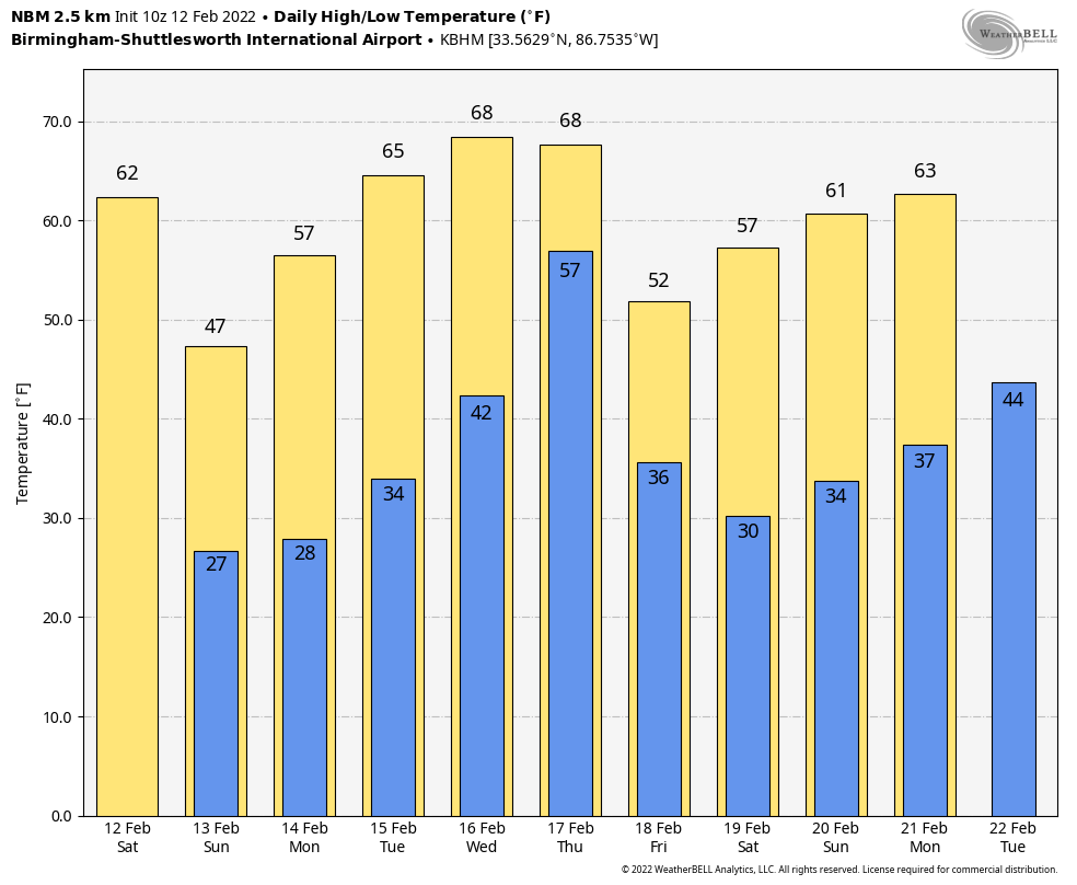
TEMPERATURE OUTLOOK: The good news is that we don’t stay cool for long, as high temperatures for the Birmingham area will rise back up into the upper 50s to the lower 60s after Friday. Lows will be in the 30s and 40s.
Category: Alabama's Weather, ALL POSTS, Severe Weather, Weather Xtreme Videos, Winter Weather
About the Author (Author Profile)
Scott Martin is an operational meteorologist, professional graphic artist, musician, husband, and father. Not only is Scott a member of the National Weather Association, but he is also the Central Alabama Chapter of the NWA president. Scott is also the co-founder of Racecast Weather, which provides forecasts for many racing series across the USA. He also supplies forecasts for the BassMaster Elite Series events including the BassMaster Classic.Subscribe
If you enjoyed this article, subscribe to receive more just like it.


