Storms Becoming Severe with Deteriorating Atmosphere Over Western Parts of the Area
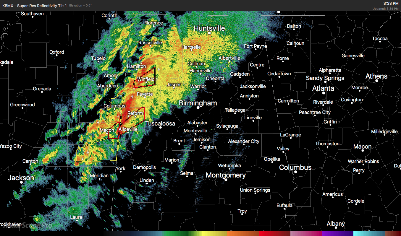
Conditions continue to deteriorate over the western parts of North/Central Alabama as storms are becoming severe with a couple of tornado warnings issued. Here is the latest update from NWS Birmingham:
The most intense convection starting to approach MS/AL state line. Best mesoscale instability parameters remain back in ms, although SBCAPE and MLCAPE have trended up the last couple hours in the western counties of Alabama. Wind and shear fields remain impressive, and any storms that can tap the limited instability and sustain an enhanced updraft will certainly be tornado-possible. Best overlap of instability and shear looks to from Pickens and Tuscaloosa counties southward. Will also be cautious to not get caught by the “loss of peak heating” fallacy in this situation — strong warm and moist advection should be more than sufficient to offset any lack of insolation as we transition to sunset.
Category: Alabama's Weather, ALL POSTS, Severe Weather
About the Author (Author Profile)
Scott Martin is an operational meteorologist, professional graphic artist, musician, husband, and father. Not only is Scott a member of the National Weather Association, but he is also the Central Alabama Chapter of the NWA president. Scott is also the co-founder of Racecast Weather, which provides forecasts for many racing series across the USA. He also supplies forecasts for the BassMaster Elite Series events including the BassMaster Classic.Subscribe
If you enjoyed this article, subscribe to receive more just like it.


