Brief Weather Update Just Before 8:30 pm
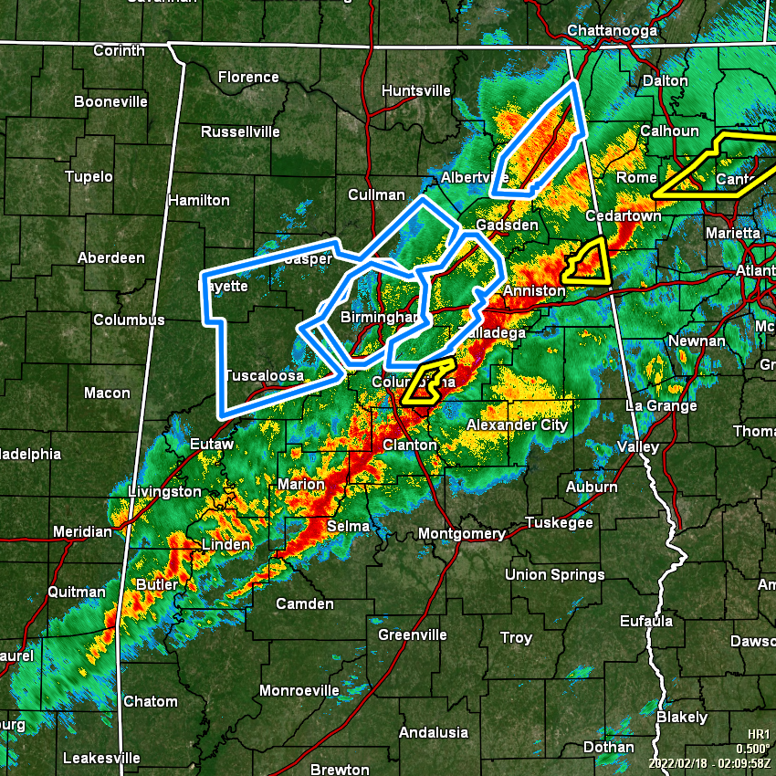
A line of strong to severe storms that is putting down copious amounts of rain is currently stretching from northeast of Anniston back to the southwest through Selma and back into the extreme southwestern parts of the state and into the extreme southeastern parts of Mississippi.
We have had several flooding issues with those heavier storms, with some training of cells occurring as well. The good news is that the tornado threat has dropped significantly, but we continue to have a threat of damaging wind gusts up to 60 mph along and east of the line of storms.
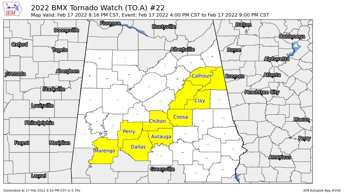
The first Tornado Watch was allowed to expire. The current Tornado Watch continues until the top of the hour for Autauga, Calhoun, Chilton, Clay, Cleburne, Coosa, Dallas, Marengo, Perry, and Talladega counties in Central Alabama.
We’ll continue to see this line of storms push eastward, with the overall threat coming to an end during the late-night hours tonight. I do not believe the threat is great enough for a new watch to be issued to the east of the current watch.
Category: Alabama's Weather, ALL POSTS, Severe Weather
About the Author (Author Profile)
Scott Martin is an operational meteorologist, professional graphic artist, musician, husband, and father. Not only is Scott a member of the National Weather Association, but he is also the Central Alabama Chapter of the NWA president. Scott is also the co-founder of Racecast Weather, which provides forecasts for many racing series across the USA. He also supplies forecasts for the BassMaster Elite Series events including the BassMaster Classic.Subscribe
If you enjoyed this article, subscribe to receive more just like it.


