Weather Xtreme — One Last Day of Nice Weather Before a Wet Work Week Starts
TODAY: High pressure will be set up just off of the Virginia Coast today that will start to pull warmer and more moist air up from the gulf. We’ll have plenty of sunshine throughout much of the day, but clouds will start to move into the western parts of the area before sunset. A few showers look to move into the west and southwestern parts of the area during the overnight hours. Highs will be in the mid to upper 60s.
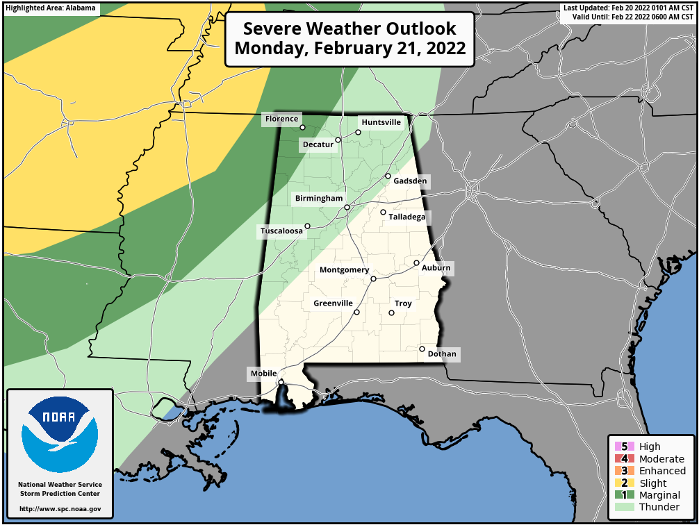
MONDAY: We’ll continue to have the southwesterly flow over the area on Monday, and we’ll see showers and a few thunderstorms start to form off to our west and expand into Central Alabama throughout the day as a warm front will be lifting northward. The better chance for thunderstorms will be along and west of the I-59 corridor. There is a Marginal Risk for severe storms up for the northwest corner of the state, as damaging wind gusts up to 60 mph will be possible. East of the I-59 corridor, much, if not all of the activity will be just general showers. Highs will be in the lower 60s to the lower 70s.
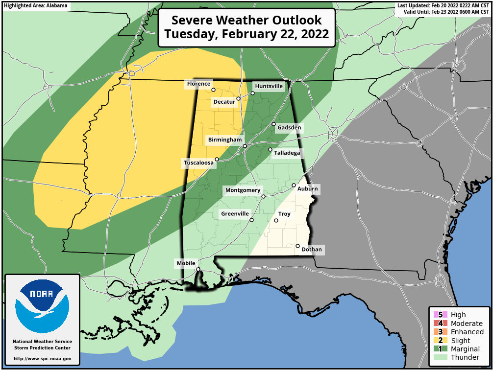
TUESDAY: We’ll continue to have clusters of showers and thunderstorms move across the area on Tuesday, especially during the late afternoon through the evening hours, ahead of an approaching cold front, with most of the activity taking place over the northwestern half of the area. Once again, we could see a couple of strong to severe storms with damaging winds as the main threat, with a small possibility of a brief tornado or two. The SPC has a Slight Risk up for locations mainly north of I-59 and west of I-65, with a Marginal Risk up for the rest of North Alabama and into the northeastern to southwestern parts of Central Alabama. Highs will be in the lower 70s to the lower 80s across the area.
WEDNESDAY-FRIDAY: That cold front creeps a little closer to the area on Wednesday, but ridging builds in before it arrives. This will actually allow for the shower activity to start dissipating through the morning hours, and only keeping a smaller chance of showers in the forecast through the afternoon. Highs will be in the lower 60s to the lower 80s from northwest to southeast. The front continues to hang out just to our west on Thursday that will keep much of the shower activity out of Central Alabama, but will keep those possible over the extreme northern parts of North Alabama. Skies will remain mostly cloudy and highs reaching the upper 60s to the lower 80s. Finally, the cold front gets the push and will move across Central Alabama on Friday. Rain will move across the area throughout the day, with conditions improving across the area from the northwest to the southeast starting by the early afternoon hours. Highs will range from the lower 50s to the lower 70s across the area from northwest to southeast.
NEXT WEEKEND: Skies will become partly sunny on Saturday and temperatures will be much cooler behind the cold front, but not too cold. Highs will be in the lower 50s to the mid 60s. Temperatures will start to rebound on next Sunday for much of the area, but cooler temperatures may hang around the extreme northern parts of Central Alabama. Skies will be partly cloudy, with highs in the lower 50s to the upper 60s.
Category: Alabama's Weather, ALL POSTS, Severe Weather, Weather Xtreme Videos
About the Author (Author Profile)
Scott Martin is an operational meteorologist, professional graphic artist, musician, husband, and father. Not only is Scott a member of the National Weather Association, but he is also the Central Alabama Chapter of the NWA president. Scott is also the co-founder of Racecast Weather, which provides forecasts for many racing series across the USA. He also supplies forecasts for the BassMaster Elite Series events including the BassMaster Classic.Subscribe
If you enjoyed this article, subscribe to receive more just like it.


