Midday Nowcast: Cloudy, Warmer Tuesday; Watching Storms to our Northwest
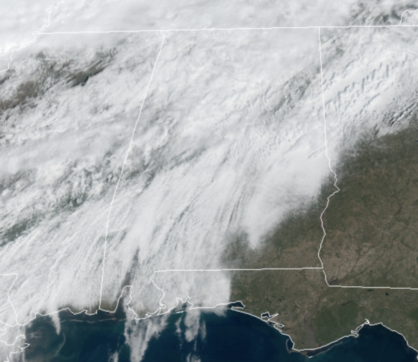
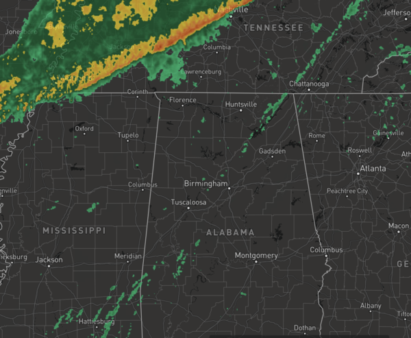
SOME STORMS LATER TODAY: The warm front is north of Alabama and all of Alabama is enjoying spring-like warmth today as temperatures are heading into the 70s and 80s across the state. We are seeing more clouds than sun today and a few scattered showers, but we are watching storms to our northwest ahead of cold front that will push into Alabama later today.
PLACEMENT: The SPC maintains a “slight risk” (level 2/5) for areas north and west of a line from Ft. Payne to Oneonta to Sumiton to Aliceville. A “marginal risk (level 1/5) extends as far east as Centre, Hoover, and Eutaw. South of that line, not much of a storm threat today as the front gets hung up over Northwest Alabama.
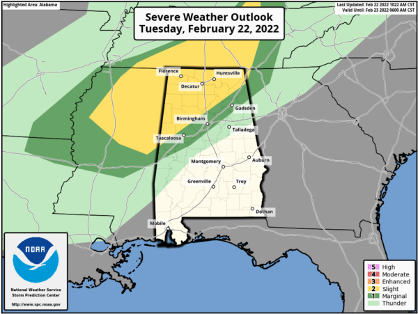
TIMING: The main window for strong to severe thunderstorms is from 3PM through midnight, after that, the storms will be weakening and will not be too much of a concern.
THREATS: Storms that form in the “slight risk” area will be capable of producing strong winds, hail, and a tornado or two. The main issue in the “marginal risk” will be gusty straight line winds, but the overall severe weather threat there is not especially high. As always, be sure you have a way of hearing severe weather warnings tonight if they are needed. Events like this are common in February; our tornado season runs from November through May.
RAINFALL: More soaking rains are possible today, especially across North and Northwest Alabama, where additional rain amounts will exceed one inch; a flood watch remains in effect for areas north of a line from Millport to Cullman to Fort Payne.
STAYING WARM: Tomorrow and Thursday, the front will hang over the northern half of the state so much of Alabama will remain in a very mild air mass with highs in the 70s for most locations. A few showers are possible both days, but the rain won’t be especially widespread or heavy.
Another front will push into Alabama Thursday night, bringing more rain and storms, and though there could be a few strong storms the severe weather looks low. The rain will end Friday, and cooler air returns to the state with highs in the low 50s, with lingering clouds.
THE ALABAMA WEEKEND: Saturday looks cool with highs remaining in the upper 40s and low 50s. We will see more clouds than sun, and a few showers are possible. However, a wave of energy will move through the state Saturday night and Sunday bring rain, but the rain ends early on Sunday with highs in the mid-50s.
NEXT WEEK: It looks like we will get a chance to dry out as much of next week looks rain-free. Temperatures look to be below average for early March across Alabama as a trough will be in place across the eastern half of the U.S.
BEACH FORECAST CENTER: Get the latest weather and rip current forecasts for the beaches from Fort Morgan to Panama City on our Beach Forecast Center page. There, you can select the forecast of the region that you are interested in visiting.
WORLD TEMPERATURE EXTREMES: Over the last 24 hours, the highest observation outside the U.S. was 109.4F at Mount Magnet, Australia. The lowest observation was -67.4F at Delyankir, Russia.
CONTIGUOUS TEMPERATURE EXTREMES: Over the last 24 hours, the highest observation was 96F at Del Rio, TX. The lowest observation was -27F at Crosby, ND.
Category: Alabama's Weather, ALL POSTS
About the Author (Author Profile)
Macon, Georgia Television Chief Meteorologist, Birmingham native, and long time Contributor on AlabamaWX. Stormchaser. I did not choose Weather, it chose Me. College Football Fanatic. @Ryan_StinnetSubscribe
If you enjoyed this article, subscribe to receive more just like it.


