Nice & Comfortable With a Little Breeze at Midday
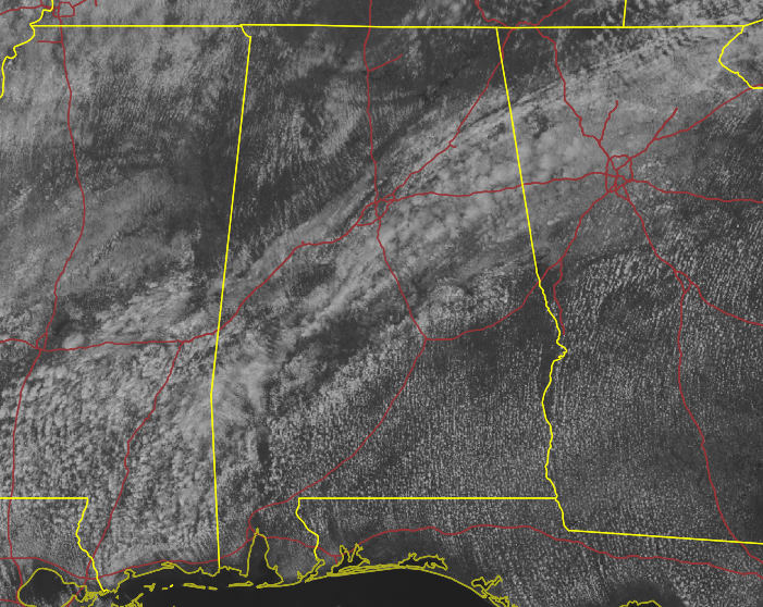
DECENT WEATHER TO END THE WEEKEND: While it is a very comfortable day out there across Central Alabama with a little bit of a breeze, we do have some rain on its way. For now, we are dry across the area, with a mix of sun and clouds. We do see some reflections of moisture on the radar approaching the I-20/59 corridor from the south, but this is evaporating before it reaches the ground. Temperatures as of the 11 am roundup were in the upper 60s to the upper 70s for the most part. Troy was the only reporting station in the 80s at 82º. Calera was the cool spot at 67º. Birmingham was sitting at 74º.
Today will be a decent day for the most part across Central Alabama, so get out there and enjoy the last day before rainy weather sets in for a few days. Skies will be partly to mostly cloudy across the area, with only a very small chance of a few showers for the extreme western portions by the late afternoon. We’ll reach the upper 70s to the mid 80s for the afternoon highs. More clouds and showers will move in late tonight and through the overnight hours west of I-65. Lows will be in the upper 50s to the mid 60s.
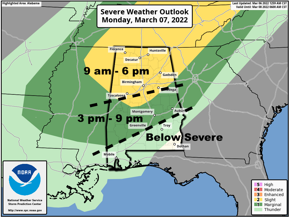
MONDAY’S SEVERE WEATHER THREAT: A cold front will be moving into and through the area on Monday that will bring rain and storms, some of which could be strong to severe. Once again, much of the activity looks to be associated with a squall line with light to moderate rain falling behind it.
A Slight Risk for severe storms is up for all of North Alabama and stretches into Central Alabama down to a line from Aliceville to Clanton to Heflin. A Marginal Risk is up for nearly the rest of Central Alabama, except for locations south of a line from Macedonia (Montgomery Co.) to Phenix City (Russell Co). All modes of severe weather will be possible, but the overall tornado threat looks to be low at this point.
The main window for the threat of severe storms will be from 9 am in the northwestern parts of the area and coming to an end in the southeastern parts by around 9 pm. Highs will be in the lower 70s to the mid 80s across the area.
Category: Alabama's Weather, ALL POSTS, Severe Weather
About the Author (Author Profile)
Scott Martin is an operational meteorologist, professional graphic artist, musician, husband, and father. Not only is Scott a member of the National Weather Association, but he is also the Central Alabama Chapter of the NWA president. Scott is also the co-founder of Racecast Weather, which provides forecasts for many racing series across the USA. He also supplies forecasts for the BassMaster Elite Series events including the BassMaster Classic.Subscribe
If you enjoyed this article, subscribe to receive more just like it.


