A Brief Weather Update as of 11 am; Slight Risk Area Reduced
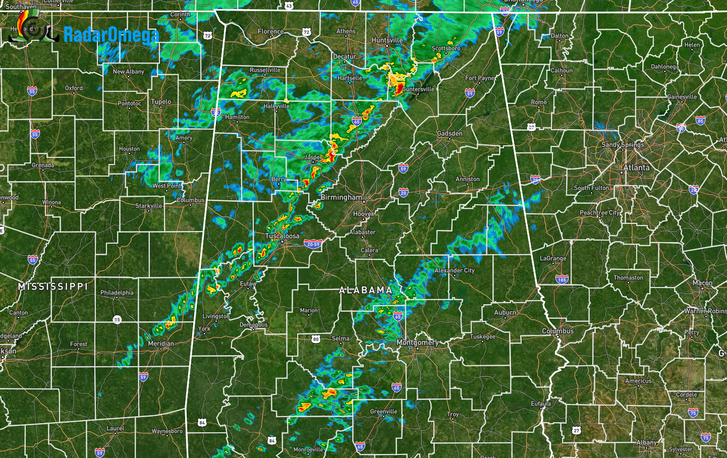
The line of storms has become more broken with individual cells, along with instability levels starting to rise. Updrafts have started to develop and a couple of cells have shown some minor rotation. The good news is that nothing is organized at this point, but there is definitely a risk for stronger to severe storms by the afternoon. The strongest cell at this point was located over central parts of Marshall County.
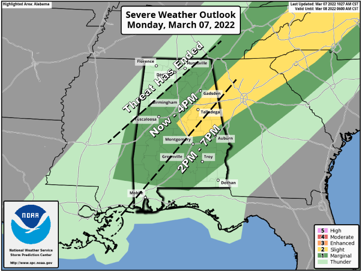
The SPC has adjusted the severe weather risks as the cold front continues to push further into the area. For locations along and west of a line from Fayette to Addison to Huntsville, the severe weather risk has ended for the day. A Marginal Risk for severe storms continues south and east of that line for the rest of North/Central Alabama, except for a small part of eastern and northeastern parts of Central Alabama, which is in a Slight Risk. The Slight Risk includes Calera, Clanton, Sylacauga, Alexander City, LaFayette, Roanoke, Anniston, Piedmont, Heflin, and Jacksonville.
The main window for the threat of severe storms is from now through 4 pm for the northeast, central, and southwestern parts of the area, and from 2 pm until 7 pm this evening for the south and southeastern parts of the area. Once again, the threat has ended for the north and northwestern parts of the area.
Category: Alabama's Weather, ALL POSTS, Severe Weather
About the Author (Author Profile)
Scott Martin is an operational meteorologist, professional graphic artist, musician, husband, and father. Not only is Scott a member of the National Weather Association, but he is also the Central Alabama Chapter of the NWA president. Scott is also the co-founder of Racecast Weather, which provides forecasts for many racing series across the USA. He also supplies forecasts for the BassMaster Elite Series events including the BassMaster Classic.Subscribe
If you enjoyed this article, subscribe to receive more just like it.


