Winter Weather Advisory Issued for the Northern Half of Alabama Starting Late Tomorrow Night
After seeing highs in the mid 60s to the lower 70s today, and expected afternoon highs reaching the upper 60s to the lower 70s on Friday, both NWS Birmingham and NWS Huntsville have issued winter weather advisories for their areas for the system that will move through the area late Friday through early Saturday. There is a little more confidence that a few travel issues may occur, as some areas could receive up to 2 inches of accumulating snow before the system exits the area on Saturday morning. Here are the details…
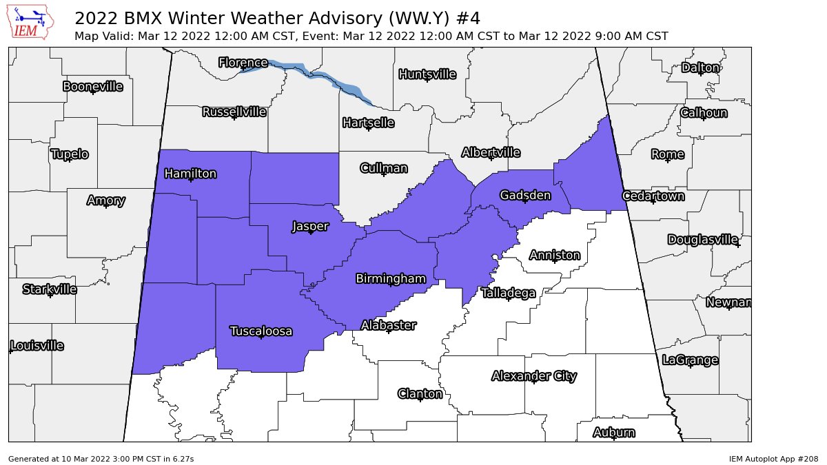
NWS Birmingham issues a WINTER WEATHER ADVISORY starting at midnight Friday night and is set to expire at 9 am Saturday morning for the following counties in Central Alabama: Blount, Cherokee, Etowah, Fayette, Jefferson, Lamar, Marion, Pickens, St. Clair, Tuscaloosa, Walker, and Winston.
WINTER WEATHER ADVISORY IN EFFECT FROM MIDNIGHT FRIDAY NIGHT TO 9 AM CST SATURDAY…
• WHAT… A changeover from rain to snow is expected Friday night. Total snow accumulations of one half inch are possible. Locally higher amounts, up to two inches, are possible in far northwest Central Alabama.
• WHERE… Portions of central Alabama.
• WHEN… From Midnight Friday night to 9 AM CST Saturday.
• IMPACTS… Plan on slippery road conditions.
PRECAUTIONARY/PREPAREDNESS ACTIONS…
Slow down and use caution while traveling.
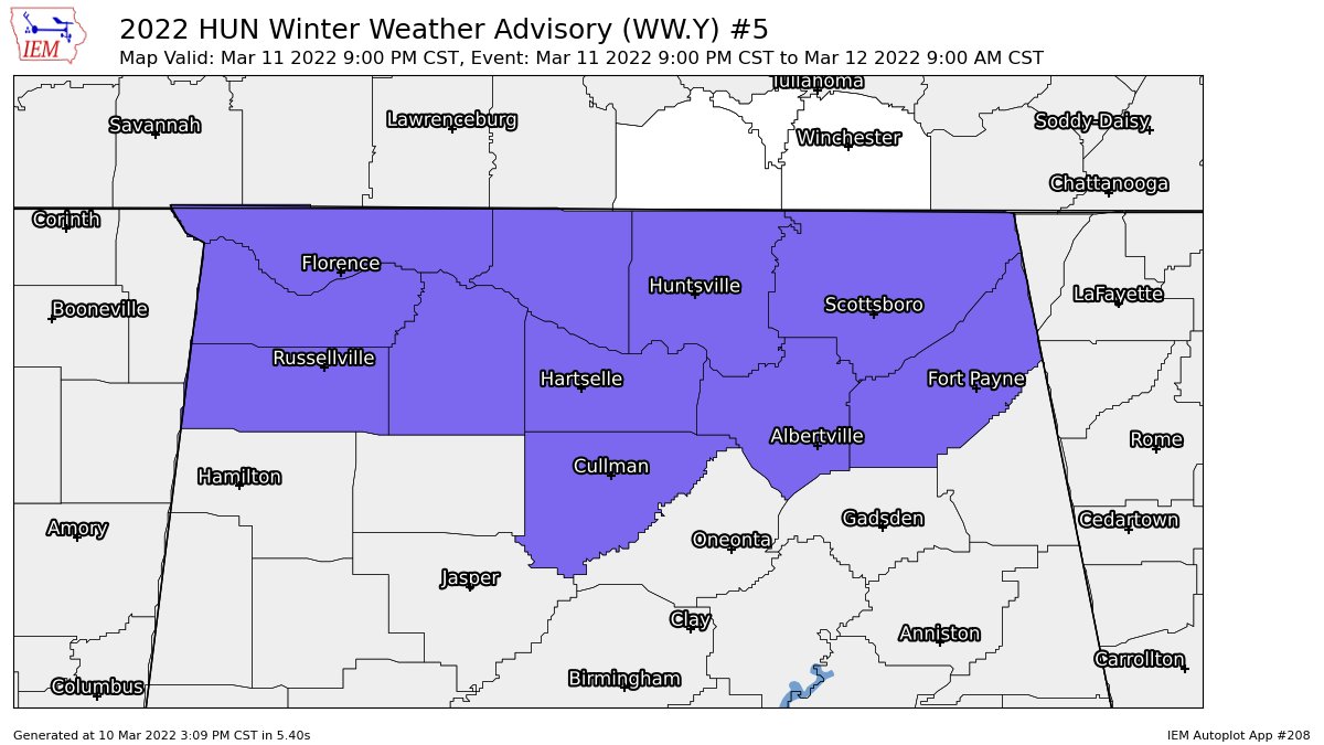
NWS Huntsville issues a WINTER WEATHER ADVISORY starting at 9 pm Friday night and is set to expire at 9 am Saturday morning for the following counties in North Alabama: Colbert, Cullman, DeKalb, Franklin, Jackson, Lauderdale, Lawrence, Limestone, Madison, Marshall, and Morgan.
WINTER WEATHER ADVISORY IN EFFECT FROM 9 PM FRIDAY TO 9 AM CST SATURDAY…
• WHAT… Rain late Friday evening is expected to change over to all snow quickly around midnight. Total snow accumulations of 1 to 2 inches are expected in most areas. Winds gusting as high as 40 mph are expected.
• WHERE… Portions of north central, northeast and northwest Alabama.
• WHEN… From 9 PM Friday to 9 AM CST Saturday.
• IMPACTS… Travel could be very difficult.
• ADDITIONAL DETAILS… Flash freezing of previously fallen rainfall or melted snow is possible and could add to the hazardous wintry conditions underneath snowfall accumulations.
Category: Alabama's Weather, ALL POSTS, Winter Weather
About the Author (Author Profile)
Scott Martin is an operational meteorologist, professional graphic artist, musician, husband, and father. Not only is Scott a member of the National Weather Association, but he is also the Central Alabama Chapter of the NWA president. Scott is also the co-founder of Racecast Weather, which provides forecasts for many racing series across the USA. He also supplies forecasts for the BassMaster Elite Series events including the BassMaster Classic.Subscribe
If you enjoyed this article, subscribe to receive more just like it.


