Weather Xtreme — A Chilly & Raw Start to the Weekend
TODAY’S WEATHER: With the snow mainly over with a few leftover flakes falling, both National Weather Service offices in Birmingham and Huntsville have canceled the Winter Storm Warnings and Winter Weather Advisories for this morning. However, travel issues may continue as black ice may create slick spots on some of the local roads, bridges, and overpasses. Use caution if driving today.
Once those flurries move out of the area this morning, skies will be clearing, but don’t expect a big warm-up as afternoon highs will only reach the mid 30s to the lower 40s across the area. It will be a raw day as well, with winds gusting up to 40 mph at times. A Wind Advisory is up for Central Alabama until 6 pm tonight, and for North Alabama until midday today.
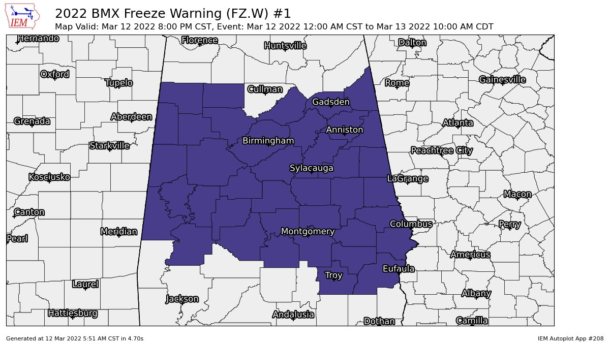
Skies will be clear tonight and a Freeze Warning is in effect for Central Alabama until late Sunday morning as lows will fall into the upper teens to the mid 20s. Don’t forget to move those clocks ahead one hour tonight before going to sleep.
SUNDAY’S WEATHER: We’re out of the freezer on Sunday as we’ll have sunny skies with highs reaching the mid to upper 50s across the area.
NEXT WEEK: Monday will be an even better day, as high pressure will be just off to our east, which will pull warmer air up into the area. Skies will be mostly sunny, with highs in the upper 50s to the upper 60s.
A shortwave will be moving through the area on Tuesday that will bring showers and thunderstorms back into the forecast, especially during the afternoon and evening hours. Strong storms will be possible across the Gulf Coast, but severe weather is not likely across Central Alabama at this time. Highs will be in the 60s.
With a surface low riding across the Florida Panhandle, it will keep skies partly cloudy with a small chance of showers on Wednesday. Highs will be in the upper 60s to the lower 70s.
Skies will be mostly sunny on Thursday, and it will be a really nice late winter’s day as highs will reach the 70s across the area.
A cold front will move through the area on Friday that will bring showers and thunderstorms back into Central Alabama during the daylight hours, with much of the activity pushing off into Georgia by the early evening. Severe weather doesn’t look likely at this point as well, but we’ll keep an eye on it as we are in our main severe weather season. Highs will be in the upper 60s to the upper 70s.
Category: Alabama's Weather, ALL POSTS, Weather Xtreme Videos, Winter Weather
About the Author (Author Profile)
Scott Martin is an operational meteorologist, professional graphic artist, musician, husband, and father. Not only is Scott a member of the National Weather Association, but he is also the Central Alabama Chapter of the NWA president. Scott is also the co-founder of Racecast Weather, which provides forecasts for many racing series across the USA. He also supplies forecasts for the BassMaster Elite Series events including the BassMaster Classic.Subscribe
If you enjoyed this article, subscribe to receive more just like it.


