Midday Nowcast: A Wet Tuesday Afternoon Ahead
An upper trough and low are moving slowly across the Deep South the next couple days, bringing the rain and a few storms today, tonight, and tomorrow.
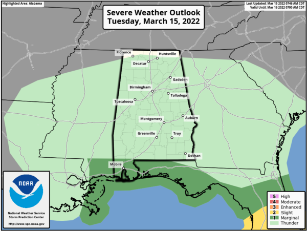
There could be a few strong storms near the Gulf Coast, and the SPC has defined a low end “marginal risk” (level 1/5) of severe thunderstorms for Mobile and Baldwin counties, where strong wind gusts are possible.
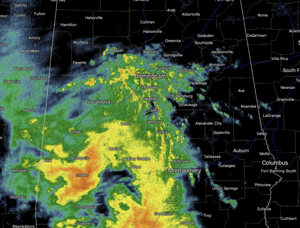
For the rest of the state, we will see a steady, soaking rain for many locations as the rain continue to increase in coverage into and through the afternoon hours. Temperatures today will mainly be in the low 60s.
Tomorrow, scattered showers and storms will remain in the forecast as the upper low rotates across the state. A “marginal risk” has been issued across South/Central Alabama, and this is due to the cold air aloft, as could allow for some storms to produce large hail tomorrow.
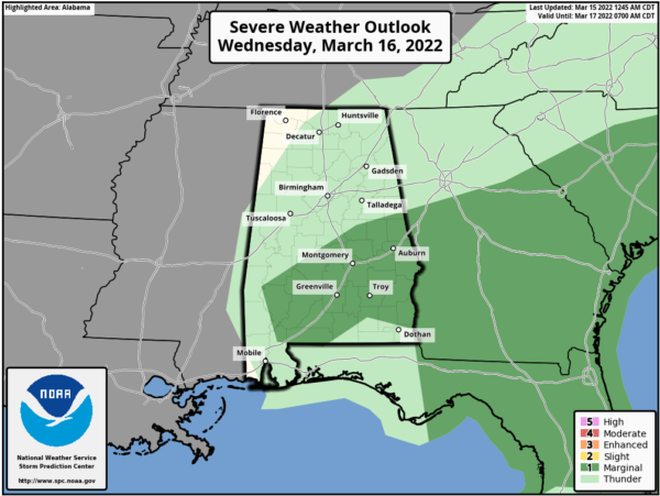
Rainfall totals of around half an inch to two inches are expected the next two days.
ST. PATRICK’S DAY: Thursday looks to be the best day of weather this week with abundant sunshine and highs in the mid 70s.
FRIDAY FRONT: A cold front will bring showers and thunderstorms back to to Alabama Friday. A strong thunderstorm can’t be ruled out, but for now the severe weather threat looks low with the main dynamic support far to the north, but we will continue to monitor trends the rest of this week in case things change.
WEEKEND WEATHER: Behind the front, a very nice weekend is ahead with sunny mild days and fair cool nights. Highs will be in the low to mid 70s for most communities.
NEXT WEEK: Monday will be dry and pleasant, but showers and storms return Tuesday and Tuesday night; and it looks like we will have to deal with some strong thunderstorms, and that does include the risk for some severe storms. Way too early to know the specifics on impacts and threats. Highs will remain mostly in the 70s.
BEACH FORECAST CENTER: Get the latest weather and rip current forecasts for the beaches from Fort Morgan to Panama City on our Beach Forecast Center page. There, you can select the forecast of the region that you are interested in visiting.
WORLD TEMPERATURE EXTREMES: Over the last 24 hours, the highest observation outside the U.S. was 120.0F at Chauk, Myanmar. The lowest observation was -78.2F at Concordia, Antarctica.
CONTIGUOUS TEMPERATURE EXTREMES: Over the last 24 hours, the highest observation was 90F at El Centro NAS, CA. The lowest observation was -15F at Seagull Lake, MN.
Category: Alabama's Weather, ALL POSTS
About the Author (Author Profile)
Macon, Georgia Television Chief Meteorologist, Birmingham native, and long time Contributor on AlabamaWX. Stormchaser. I did not choose Weather, it chose Me. College Football Fanatic. @Ryan_StinnetSubscribe
If you enjoyed this article, subscribe to receive more just like it.


