Areal Flood Watch and Wind Advisory Issued for Central Alabama For Tuesday Until Early Wednesday
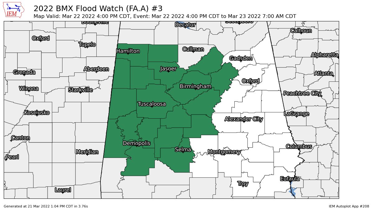
NWS Birmingham has issued an AREAL FLOOD WATCH starting at 4 pm Tuesday until 7 am Wednesday for the following counties in Central Alabama: Bibb, Blount, Chilton, Dallas, Fayette, Greene, Hale, Jefferson, Lamar, Marengo, Marion, Perry, Pickens, Shelby, St. Clair, Sumter, Tuscaloosa, Walker, and Winston.
Flash flooding caused by excessive rainfall is possible. Excessive runoff may result in flooding of rivers, creeks, streams, and other low-lying and flood-prone locations. Flooding may occur in poor drainage and urban areas.
Ground conditions are saturated from recent heavy rainfall, and streams and creeks are swollen. A strong storm system will impact the area Tuesday afternoon and Tuesday night, bringing the threat of heavy rainfall. Forecast rainfall totals are in the 1-3 inch range in the watch area, and any localized heavy rainfall could lead to flash flooding. You should monitor later forecasts and be prepared to take action should Flash Flood Warnings be issued.
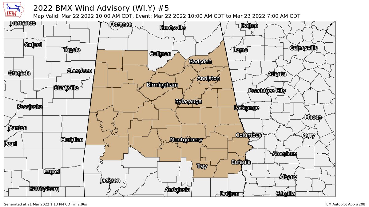
NWS Birmingham has also issued a WIND ADVISORY starting at 10 am Tuesday until 7 am Wednesday for the following counties in Central Alabama: Autauga, Barbour, Bibb, Blount, Bullock, Calhoun, Chambers, Cherokee, Chilton, Clay, Cleburne, Coosa, Dallas, Elmore, Etowah, Fayette, Greene, Hale, Jefferson, Lamar, Lee, Lowndes, Macon, Marengo, Marion, Montgomery, Perry, Pickens, Pike, Randolph, Russell, Shelby, St. Clair, Sumter, Talladega, Tallapoosa, Tuscaloosa, Walker, and Winston.
South winds 10 to 20 mph with gusts up to 40 mph expected. Gusty winds could blow around unsecured objects. Tree limbs could be blown down and a few power outages may result. Use extra caution when driving, especially if operating a high profile vehicle. Secure outdoor objects.
Category: Alabama's Weather, ALL POSTS
About the Author (Author Profile)
Scott Martin is an operational meteorologist, professional graphic artist, musician, husband, and father. Not only is Scott a member of the National Weather Association, but he is also the Central Alabama Chapter of the NWA president. Scott is also the co-founder of Racecast Weather, which provides forecasts for many racing series across the USA. He also supplies forecasts for the BassMaster Elite Series events including the BassMaster Classic.Subscribe
If you enjoyed this article, subscribe to receive more just like it.


