Midday Nowcast: Marvelous Monday; Severe Storms Tomorrow
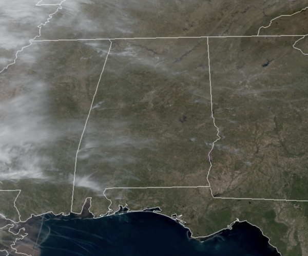
After the chilly start to the day, we are seeing afternoon temperatures warm into the mid 70s with a good supply of sunshine. To the west, a dynamic storm system will bring the threat of severe storms to the eastern half of Texas and some of the adjacent states later today and tonight.
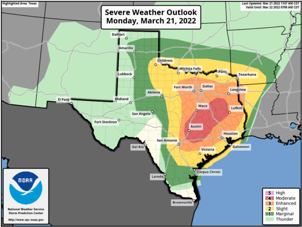
TUESDAY SEVERE WEATHER OUTBREAK: To the west of Alabama, an outbreak of severe storms will be developing and pushing towards Alabama through the day. The SPC has much of South Mississippi and Louisiana in the level 4 of 5 “moderate risk tomorrow, where large, violent, long-track tornadoes are likely.
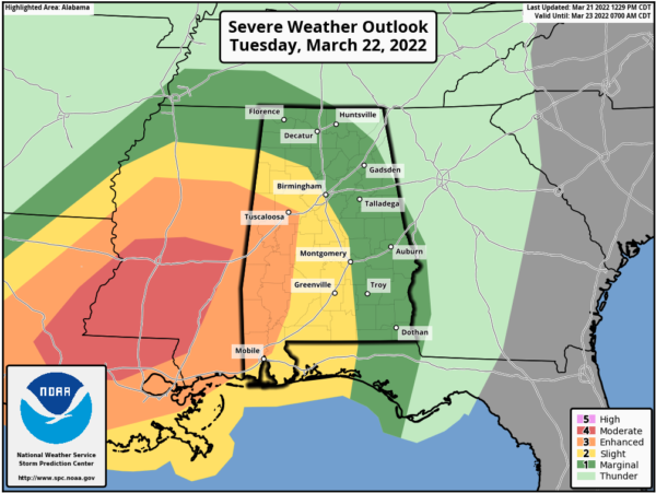
For Alabama, in the latest outlook just out,the SPC maintains an “enhanced risk” (level 3/5) of severe thunderstorms in the broad area from Tuscaloosa to Mobile, a “slight risk” as far east as Hamilton, Birmingham, Montgomery, and Luverne, and a “slight risk” (level 1/5) over to Huntsville, Anniston, and Ozark.
FOR TOMORROW: It will be warm and breezy day, gradient winds (not related to thunderstorms) could gust as high as 35/40 mph across the state tomorrow afternoon and tomorrow night. A wind advisory will be needed tomorrow. Temperatures will surge into the 70s and 80s across the state.
This is a very dynamic system, but there remains questions when it comes to the thermodynamics as we as mesoscale features. But, the overall pattern is certainly favorable for severe thunderstorms, especially over the western half of the state.
TIMING: Storms could develop is West Alabama as early as 2PM tomorrow afternoon, then pushing east towards the Interstate 65 corridor during the evening hours, around 5-6PM, and then over the eastern third of the state after 11:00PM. For Southeast Alabama, it will be during the early morning hours Wednesday.
THREATS: All modes of severe weather will be possible, including large hail, damaging winds up to 70 mph, and a few tornadoes. The highest tornado threat is across the “enhanced risk” over West and Southwest Alabama, where a strong tornado (EF-2 or higher) will be possible.
RAIN: Rain amounts of 2-4 are likely over the western half of the state, with 1-3″ for the eastern counties. A flash flood watch will likely be issued later today for parts of Alabama.
CALL TO ACTION: Be prepared and make sure you have all aspects of your severe weather safety plan ready for action. Be sure you have a way of hearing severe weather warnings, and an action plan if you are in a tornado warning polygon, take severe thunderstorm warnings seriously too. Have a NOAA Weather Radio in your home and business, properly programmed with a fresh battery in case of power failure. Be sure WEA (Wireless Emergency Alerts) enabled on your phone… this is not an app, but built into every phone sold in the U.S. Check settings, and notifications, and be sure emergency alerts are on. Have the free ABC 33/40 weather app on your phone as a secondary way of getting warnings. Search the App Store for “ABC 33/40 Weather” if you don’t have it already.
In a site built home, identify the safe place. Small room, lowest floor, near the center of the house, away from windows. And, in that safe place, have helmets for everyone in the family (including adults!), portable air horns, and hard sole shoes. You CANNOT stay in a mobile home if you are in a tornado warning polygon. Know the closest shelter, and how to get there quickly.
REMEMBER: Don’t be anxious or worried; events like this are very common in Alabama during our tornado season, especially March and April. Have a way of hearing warnings, have a plan, and you will be fine. Odds of any one spot being hit by a tornado are low, but we all have to be ready.
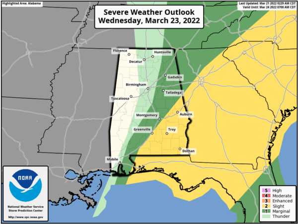
WEDNESDAY: Strong to severe storms could linger into Wednesday morning over the southeast part of Alabama, where SPC has a “slight risk” (level 2/5) defined.
The main concern for Southeast Alabama will be strong winds, although an isolated tornado can’t be ruled out. For the rest of the state, clouds will linger through much of the day with a high in the 67-70 degree range.
QUIET AND VERY NICE: For the rest of the week and through the weekend, expect dry days with more sun than clouds. It will bd cooler Thursday and Friday with highs in the low to mid 60s. For Saturday and Sunday, expect lots of sunshine with highs continuing to be in the low to mid 60s. Mornings will be chilly with 30s and 40s fairly common.
BEACH FORECAST CENTER: Get the latest weather and rip current forecasts for the beaches from Fort Morgan to Panama City on our Beach Forecast Center page. There, you can select the forecast of the region that you are interested in visiting.
WORLD TEMPERATURE EXTREMES: Over the last 24 hours, the highest observation outside the U.S. was 110.3F at Chauk, Myanmar. The lowest observation was -77.3F at Amundsen-Scott South Pole Station, Antarctica.
CONTIGUOUS TEMPERATURE EXTREMES: Over the last 24 hours, the highest observation was 92F at Rio Grande Village, TX. The lowest observation was -14F at Peter Sinks, UT.
WEATHER ON THIS DATE IN 1952: Severe thunderstorms spawned thirty-one tornadoes across Arkansas, Tennessee, Missouri, Mississippi, Alabama and Kentucky. The tornadoes killed 343 persons and caused 15 million dollars damage. Arkansas and Tennessee each reported thirteen tornadoes. The towns of Judsonia AR and Henderson TN were nearly wiped off the map in what proved to be the worst tornado outbreak of record for Arkansas. A tornado, one and a half miles wide at times, left a church the only undamaged building at Judsonia.
Category: Alabama's Weather, ALL POSTS, Severe Weather
About the Author (Author Profile)
Macon, Georgia Television Chief Meteorologist, Birmingham native, and long time Contributor on AlabamaWX. Stormchaser. I did not choose Weather, it chose Me. College Football Fanatic. @Ryan_StinnetSubscribe
If you enjoyed this article, subscribe to receive more just like it.


