AREAL FLOOD WARNING: Parts of Cullman Co. Until 4 am Wednesday
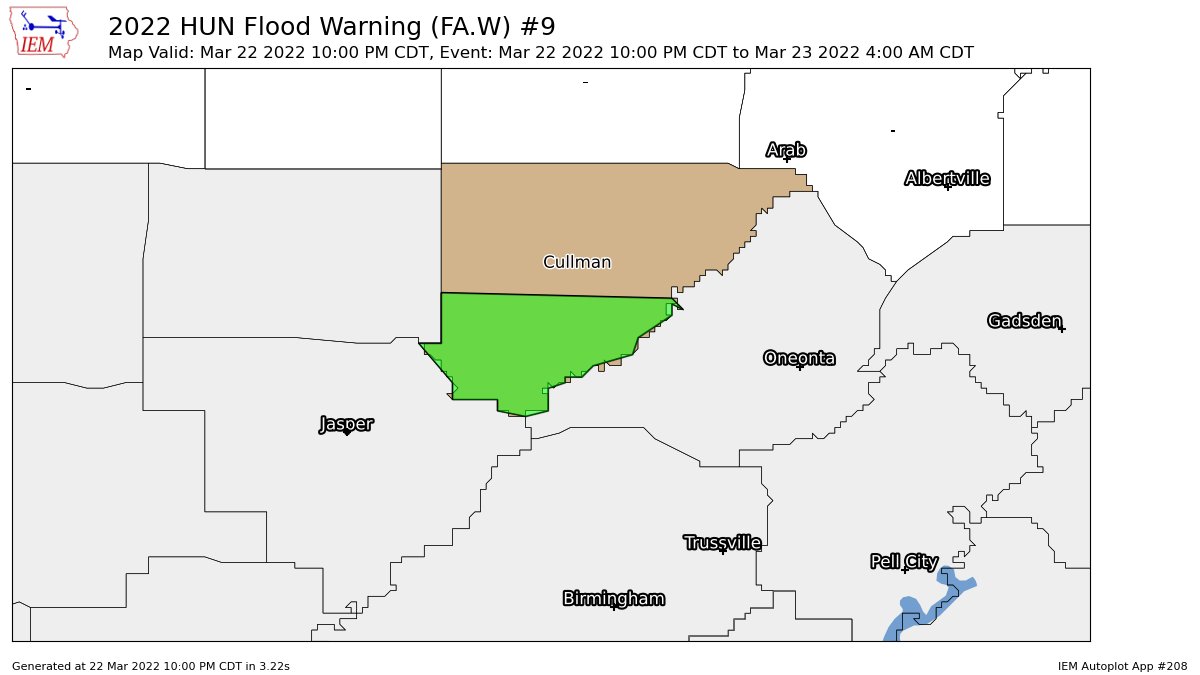
…FLOOD WARNING IN EFFECT UNTIL 4 AM CDT WEDNESDAY…
* WHAT…Flooding caused by excessive rainfall is expected.
* WHERE…A portion of north central Alabama, including the
following county, Cullman.
* WHEN…Until 400 AM CDT Wednesday.
* IMPACTS…Flooding of rivers, creeks, streams, and other low-lying
and flood-prone locations is imminent or occurring.
* ADDITIONAL DETAILS…
– At 956 PM CDT, Doppler radar continues to indicate widespread
moderate to locally heavy rain and embedded thunderstorms
across the warning area. Flooding is ongoing or expected to
begin shortly. Doppler radar estimates suggest that 3 and 4
inches of rain have already fallen across much of the warning
area.
– Rainfall rates between 0.5 and 1 inch per hour will continue
well into the early morning hours, with additional rainfall
amounts of 1 to 3 inches possible.
– Some locations that will experience flooding include…
Hanceville, Dodge City, Garden City, Colony, Bremen,
Arkadelphia, Smith Lake, Black Bottom and Wilburn.
– http://www.weather.gov/safety/flood
PRECAUTIONARY/PREPAREDNESS ACTIONS…
Turn around, don’t drown when encountering flooded roads. Most flood
deaths occur in vehicles.
Be especially cautious at night when it is harder to recognize the
dangers of flooding.
Category: Alabama's Weather, ALL POSTS
About the Author (Author Profile)
Scott Martin is an operational meteorologist, professional graphic artist, musician, husband, and father. Not only is Scott a member of the National Weather Association, but he is also the Central Alabama Chapter of the NWA president. Scott is also the co-founder of Racecast Weather, which provides forecasts for many racing series across the USA. He also supplies forecasts for the BassMaster Elite Series events including the BassMaster Classic.Subscribe
If you enjoyed this article, subscribe to receive more just like it.


