Midday Nowcast: Mainly Sunny First Day of April
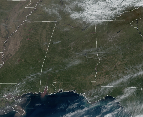
It was a chilly morning across the state, and it remains a bit cool today as temperates are running several degrees below average for the first day of April. The sky is mainly sunny, minus some upper-level clouds making for some filtered sunshine, temperatures this afternoon will top out in the low to mid 60s. Tonight, will be another chilly one with lows in the mid 30s to lower 40s by first thing tomorrow morning.
WONDERFUL WEEKEND WEATHER: The weather stays dry through the weekend. We will see more clouds at times tomorrow, as a feature works across the state, and it will be a milder day with highs in the low 70s. Tomorrow night, lows will be in the 40s. Sunday will feature sunshine in full supply allowing highs to return to the mid 70s for most North/Central Alabama communities.
NEXT WEEK: The weather will stay dry Monday, with highs in the mid to upper 70s. But, rain and storms will return to Alabama during the Tuesday/Wednesday timeframe, and unfortunately some severe storms make be in the forecast. This system will have strong wind fields and a pretty decent amount of surface based instability. The SPC has parts of Alabama in a severe weather threat in their “Day 5” outlook, mainly from Birmingham south and west… but this will likely be expanded to cover much of the state in future outlooks.
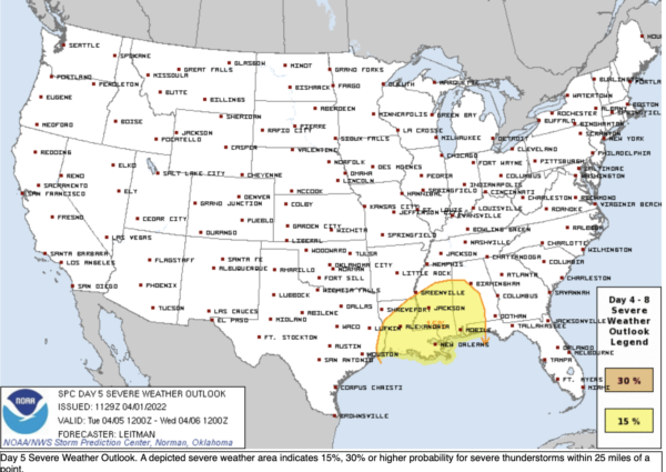
It looks like a situation where damaging winds and a few tornadoes will be possible, but it is still too early to be really specific on the magnitude of the threat, or the timing.
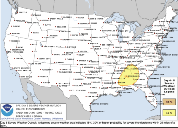
Then, on Wednesday, a cold front will sweep through the state, bringing the threat of a line of storms with strong gusty winds. SPC has much of the state in a severe weather threat in their (Day 6) outlook for this event.
Rain amounts will be in the 2-3 inch range for most of the state Tuesday and Wednesday, and some flooding problems could develop. Again, it is springtime in Alabama, and events like this are common, so we will watch trends through the weekend.
END OF WEEK: Dry and cooler air will return to Alabama Thursday and Friday, in fact temperates will likely be below average. There is also some evidence parts of North/Central Alabama could see a frost or freeze threat next weekend (April 8/9). Again, this is why we always say you should not plant until after Tax Day (April 15th).
BEACH FORECAST CENTER: Get the latest weather and rip current forecasts for the beaches from Fort Morgan to Panama City on our Beach Forecast Center page. There, you can select the forecast of the region that you are interested in visiting.
WORLD TEMPERATURE EXTREMES: Over the last 24 hours, the highest observation outside the U.S. was 110.5F at Chandrapur, India. The lowest observation was -83.7F at Amundsen-Scott South Pole Station, Antarctica.
CONTIGUOUS TEMPERATURE EXTREMES: Over the last 24 hours, the highest observation was 96F at Falcon Lake, TX. The lowest observation was -5F at Seagull Lake, MN.
Category: Alabama's Weather, ALL POSTS
About the Author (Author Profile)
Macon, Georgia Television Chief Meteorologist, Birmingham native, and long time Contributor on AlabamaWX. Stormchaser. I did not choose Weather, it chose Me. College Football Fanatic. @Ryan_StinnetSubscribe
If you enjoyed this article, subscribe to receive more just like it.


